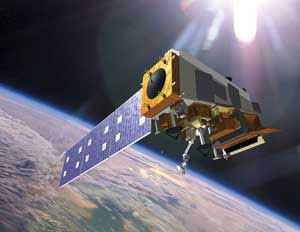
Seven months after launch, data is now flowing from a new generation of instruments onboard the Suomi NPP satellite, a joint NASA/NOAA mission being used in NOAA’s global numerical weather forecast system. NOAA is the US National Oceanic and Atmospheric Administration. The Suomi NPP polar-orbiting satellite circles the Earth every 102 minutes, flying 512 miles above the surface, capturing data from the land, oceans and atmosphere. It carries five instruments, including the Advanced Technology Microwave Sounder (ATMS), which captures atmospheric temperature and water vapor information used to assess the atmosphere and predict weather.
Kathryn Sullivan, Ph.D., NOAA deputy administrator stated: “This data stream from Suomi NPP ensures NOAA will continue to provide life-saving forecasts. This is welcome news after the devastating weather events of 2011, and as the United States comes closer to becoming a Weather Ready Nation.” ATMS also benefits NOAA’s hurricane forecasters. When ATMS looks into the eye of a hurricane, it will help provide a clearer picture of the hurricane's warm core and the intensity of its rainfall. Additionally, CrIS will provide more accurate data to the global observing system with the potential to improve prediction for hurricanes and other devastating weather events.