Global

country taxonomy block

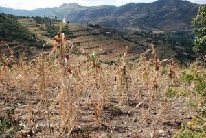
In recent years, droughts have been impacting several regions of the world on a more frequent and severe basis. The long-lasting effects of such droughts are taking a toll on farmers and their livelihoods, forcing some of them to seek alternate sources of income through migration to cities in their countries and in other countries in extreme cases. The World Meteorological Organization identifies droughts as the most damaging natural hazard due to their long-term socio-economic impact. According to the Food and Agriculture Organization of the United Nations (FAO), droughts are the “single greatest culprit of agricultural production loss”.

A drought generally refers to “an extended period of unusually...

more

Publishing date 22/03/2021

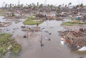
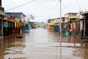
The world leading insurance and reinsurance provider Swiss Re recently partnered with the commercial synthetic aperture radar (SAR) satellite operator ICEYE to improve flood modelling and support disaster response efforts around the world.

A flood is a broad term that refers to “the overflow of water from a stream channel into normally dry land in the floodplain (riverine flooding), higher-than–normal levels along the coast and in lakes or reservoirs (coastal flooding) as well as ponding of water at or near the point where the rain fell (flash floods)“. Floods can pose a severe risk to natural environments, communities and their assets, agricultural areas, infrastructure and they are one of the most frequent and destructive natural hazards in...

more
Publishing date 15/03/2021

The European Space Agency (ESA) wants to further develop the understanding of our planet. For this purpose, ESA chose three concepts in 2018 to compete for the next Earth Explorer mission. The decision was made last week to move on to the next development stage with Harmony, one of the three concepts. Harmony would provide new and important information on the Earth’s systems for scientific research and disaster risk management.

The objective of Earth Explorer missions is to “focus on the atmosphere, biosphere, hydrosphere, cryosphere and Earth's interior with an overall emphasis on learning more about the interactions between these systems and the impact that human activity is having on Earth's...

more
Publishing date 05/03/2021

The European Space Agency (ESA) plans to improve its capabilities to track the effects of wildfires. For this purpose, ESA recently offered a contract to the IT and business consulting firm CGI in order to create a new mapping service for wildfires. This mapping service will blend Earth observation (EO) and Artificial intelligence (AI) data to improve wildfire risk management globally.

A wildfire refers to “any uncontrolled and non-prescribed combustion or burning of plants in a natural setting such as a forest, grassland, brush land or tundra, which consumes the natural fuels and spreads based on environmental conditions”. Wildfires can pose a risk to natural environments and human life in conditions of dry weather and strong winds. In this regard, EO data has the potential to provide important information on wildfires that can be used in all phases of the disaster management cycle. More information on wildfires...

more
Publishing date 26/02/2021

A new report outlines the availability of data in humanitarian settings around the world. The 2021 edition of “The State of Open Humanitarian Data”, recently published by the Centre for Humanitarian Data of the United Nations Office for the Coordination of Humanitarian Affairs (OCHA), explores the state of the humanitarian data ecosystem and identifies gaps in data availability.

Humanitarian data refers to “(1) data about the context in which a humanitarian crisis is occurring (e.g., baseline/development data, damage assessments, geospatial data); (2) data about the people affected by the crisis and their needs; and (3) data about the response by organisations and people seeking to help those who need assistance”. In “The State of Open Humanitarian Data” reports, humanitarian data is collected using the Humanitarian Data Exchange (...

more
Publishing date 24/02/2021

A new report outlines the impact of Global Human Settlement Layer (GHSL) data on various policy areas. The 2020 edition of the “Atlas of the Human Planet”, recently published and launched virtually by the Joint Research Centre (JRC) of the European Commission as a deliverable to the Group on Earth Observations (GEO) Human Planet Initiative, explores the impact of GHSL data on various policy areas, including disaster risk management.

GHSL data refers to “global spatial information, evidence-based analytics and knowledge describing the human presence on the planet”. This data relies on spatial information from Landsat 8, Sentinel-1 and Sentinel-2. It is mainly cost-free and...

more
Publishing date 18/02/2021

A knowledge platform for adaptation action on climate change recently updated the information, layout and logo of their website. With this step, adaptationcommunity.net aims to improve the user experience of the online platform and consequently facilitate the access to a wide variety of resources on climate change adaptation action, including tools working with Earth observation data.

Adaptation action in the context of climate change refers to “adjustments in ecological, social, or economic systems in response to actual or expected climatic stimuli and their effects or impacts. It refers to changes in processes, practices, and structures to moderate potential damages or to benefit from...

more
Publishing date 12/02/2021

The Disasters programme unit at the National Aeronautics and Space Administration (NASA) recently joined a newly launched online platform aimed at placing anticipatory action on the humanitarian agenda. NASA’s involvement in the Anticipation Hub and the subsequent incorporation of Earth observation (EO) tools, serves to improve the capabilities of anticipatory action globally and demonstrates the potential of utilizing satellite-driven data for anticipatory action in disaster management.

Anticipatory action in the humanitarian context describes disaster mitigation activities based on in-depth forecast information and risk analysis. This approach has gained traction amongst the humanitarian community in recent years as it is viewed as a more efficient and affordable alternative to...

more
Publishing date 02/02/2021

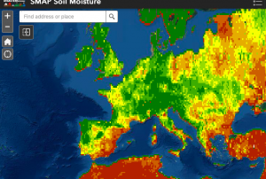
Officially launched in 2015 by the National Aeronautics and Space Administration (NASA), the SMAP mission is an orbiting satellite that measures the amount of wetness in the top layer of soil incrementally every 2-3 days. These Soil Moisture Active Passive (SMAP) measurements rely on radiation frequencies that point to different levels of moisture on the surface of  earth’s soil and are useful for scientists because it allows them to construct maps indicating the level of soil moisture globally. Acknowledging the relevance and usability of this data for the field of disaster management, NASA recently integrated the SMAP data into its Disasters Mapping Portal

The Disasters Mapping Portal has been developed by the Geographic Informations Systems (GIS) Team at NASA in an effort to make their satellite data...

more
Publishing date 25/11/2020

Officially launched in 2015 by the National Aeronautics and Space Administration (NASA), the SMAP mission is an orbiting satellite that measures the amount of wetness in the top layer of soil incrementally every 2-3 days. These Soil Moisture Active Passive (SMAP) measurements rely on radiation frequencies that point to different levels of moisture on the surface of  earth’s soil and are useful for scientists because it allows them to construct maps indicating the level of soil moisture globally. Acknowledging the relevance and usability of this data for the field of disaster management, NASA recently integrated the SMAP data into its Disasters Mapping Portal

The Disasters Mapping Portal has been developed by the Geographic Informations Systems (GIS) Team at NASA in an effort to make their satellite...

more
Publishing date 25/11/2020

Most of the volcanic activities are rapidly evolving phenomena, and thus, hard for volcanologists and disaster management agencies to monitor and predict. In the last four decades, however, due to the proliferation of new and innovative instruments and techniques, scientists have made progress in forecasting the timing of many volcanic eruptions. New studies have shown that combining ground-based information, satellite data, and AI technologies facilitates consistent and long-term monitoring of volcanoes, allowing researchers to have a comprehensive overview of volcanic systems. Understanding volcanic behavior can help to track unrest-warning signs, to forecast volcano eruptions and possible related landslides and tsunamis, and consequently to activate emergency plans in a timely manner.

Volcanologists are now using...

more
Publishing date 02/06/2020

The United Nations Office for Outer Space Affairs (UNOOSA) and the Space Generation Advisory Council (SGAC) have launched the second edition of their Space4Youth competition. Under the title Space4Climate, this year's focus is on SDG 13, Climate Action. In order to participate, students and young professionals from any Member State of the United Nations are invited to submit an essay on the topic "Space as a tool to address climate challenges: examples from local communities" by 21 June 2020.

Climate change is the defining issue of our time. From shifting weather patterns to rising sea levels, the impact of climate change is global in scope and unprecedented in scale. Action is needed and young people play a key role. With this competition, UNOOSA and SGAC want to give a voice to and promote youth's ideas on how space, in all its...

more
Publishing date 26/05/2020

A recent study has produced a 20-year time series of primary production by marine phytoplankton, one of the largest fluxes of carbon on our planet. Studying phytoplankton primary production is important because it provides useful information about ocean biology, climate, and global carbon cycle. Observing primary production over long-time scales or quantifying its small variations can help the scientific community to determine carbon dioxide concentrations, as well as the effect of climate variability on these processes. The study uses in -situ measurements and satellite data from the European Space Agency’s (ESA) Climate Change Initiative,

The study assesses global annual phytoplankton primary productivity between 1998 and 2018 and aims at identifying its long-term patterns and its variability with seasons and...

more
Publishing date 11/05/2020

On 14 May, the United Nations Office for Outer Space Affairs (UNOOSA) hosted two sessions of a webinar on space applications to support global health, including to fight coronavirus. 

During the 90-minute sessions, experts from UNOOSA, as well as from other international organisations, governments and private sector companies operating in the space sector discussed how space applications can strengthen the capacity of all countries, in particular developing countries, for early warning, risk reduction and management of epidemics and other health risks. Particular attention was paid to the current coronavirus pandemic.

To find out more about space applications to fight the coronavirus, please visit the COVID-19 overview page here on the Knowledge Portal.

Presentations from the webinar are available on the...

more
Publishing date 08/05/2020
Regional Support Offices mentioned:

The Group of Earth Observations (GEO) and the United Nations Human Settlement Programme (UN-Habitat) have opened a call for expression of interest for the “Earth Observation Toolkit for Sustainable Cities and Communities” programme. This programme aims to support UN Member States in sustainable urban development by creating a customizable and continually updated toolkit that will integrate Earth observation and geospatial data with national statistics, socioeconomic information and other data. Through this project, GEO and UN-Habitat are looking to define needs and data, and provide practical guidance to support urban monitoring, reporting and development at the city, national, regional, and global levels.

The programme will complement the efforts of countries to monitor, report and drive progress on the...

more
Publishing date 22/04/2020

On 1 April 1960, NASA sent the Television Infrared Observation Satellite (TIROS-1) into space. TIROS-1 was developed during the 1950s and, after years of experimental programmes and attempts, became the world’s first weather satellite. Since weather satellites were a new technology at that time, the mission also tested various design issues for spacecraft, such as instruments, data, and operational parameters, in order to improve satellite applications for Earth-bound decisions. TIROS-1 thus paved the way for further weather satellite development and research. Today, weather satellites provide highly accurate and near-real-time measurements that can efficiently monitor and forecast extreme weather events, such as floods and droughts, as well as enhance the understanding of the climate and of the Earth as a whole.

...

more
Publishing date 16/04/2020

The European Space Agency (ESA), in coordination with the European Commission, is launching a special edition of the Custom Script Contest, focused on the support of space assets during the COVID-19 crisis, managed by Euro Data Cube group. The contest is looking for remote sensing experts, machine learning scientists and interested public to make proposals on how satellite data can help with observation of changes in economic operators, changes in human activity distribution and changes in agriculture activity, among other applications. The aim of the contest is to help mitigate the COVID-19 situation in the upcoming months.

Participants can produce scripts using data from various sources, such as the European Sentinel satellites, Airbus and Planet data, as well as data from Pleiades and PlanetScope. Different tools...

more
Publishing date 03/04/2020

The National Aeronautics and Space Administration (NASA), the European Space Agency (ESA) and the Republic of Korea are working together on a global satellite constellation of three space-based instruments that could track global pollution on an hourly basis. These air quality satellites will measure pollutants, including ozone, nitrogen dioxide, formaldehyde and tiny atmospheric particles called aerosols in order to enhance our understanding of air quality and air pollution. To date, air quality satellites have collected data only once a day. These three new instruments will provide hourly, highly detailed and near-real-time data that will improve air quality science and forecasting around the world, in particular around the most densely populated areas of the Northern Hemisphere. 

Collecting data hourly will...

more
Publishing date 30/03/2020

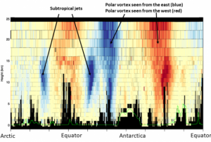
The European Centre for Medium-Range Weather Forecasts (ECMWF), after months of careful testing, has started to operationally assimilate data from the European Space Agency's Aeolus satellite in its daily weather forecasts. Aeolus measurements have been considered ready for operational use as early as 14 months after the satellite launch, which is unusual for data collected from a new type of satellite. Aelous provides accurate and near-real time measurements that can improve weather forecasting and contribute to better preparedness for possible hazards.

The Aeolus satellite is the first of its kind as it is able to calculate atmospheric winds in cloud-free areas or winds throughout vertical wind columns. To date, satellites could estimate winds only from the movements of...

more
Publishing date 23/03/2020

A new report lists extreme weather events and major natural disasters among the top five risks in terms of likelihood over the next decade. The Global Risks Report 2020, published by the World Economic Forum, is based on a survey of 750 global experts and decision-makers who ranked their concerns in terms of likelihood and impact. Climate action failure, biodiversity loss and human-made environmental disasters are also among the most prevalent risks, making it the first time that the report's top five risks in terms of likelihood are all environmental.

Failure of climate change mitigation and adaptation, and extreme weather events, such as floods and storms, are also among the top five risks by severity of impact. These are the most strongly connected global risks, according to respondents.

The report underlines that growing climate emergency is "striking harder and more rapidly...

more
Publishing date 16/01/2020

Sentinel Hub’s Earth Observation (EO) browser is hosting its second round of contests for custom scripts to better visualize and analyze the Earth’s surface. EO Browser, developed by Sinergise in close cooperation with the European Space Agency (ESA), brings together petabytes of data from many satellite platforms - from ESA’s Copernicus programme to NASA’s Landsat missions.

The competition is open from 15 October 2019 to 15 January 2020, and calls for submissions of JavaScript scripts, which can be input into EO Browser's “create custom rendering” visualization tool. This script must be designed to work with one of the eight satellite platforms available on EO browser.

The last Sentinel Hub Custom Script Contest was won by a script for best visualizing deep moist convection, an atmospheric condition associated with tornadoes, hurricanes,...

more
Publishing date 19/11/2019

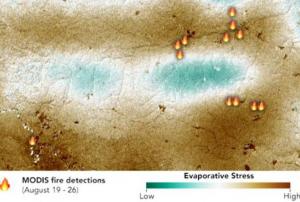
Major disasters such as droughts and wildfires are driven by the dryness of vegetation. To enhance the monitoring of plant water stress, NASA launched and installed a new sensor on the International Space Station. ECOSTRESS (ECOsystem Spaceborne Thermal Radiometer Experiment on Space Station) allows identifying loss of water in leaves- even before they show visible signs of trouble.

The image to the left shows a product derived from ECOSTRESS data, indicating that the forest fires during the 2019 Amazon dry season were concentrated in water-stressed areas, which are not visible on optical imagery. “To the naked eye, the fires appear randomly distributed throughout the forest,...

more
Publishing date 14/11/2019

The International Federation of Red Cross and Red Crescent Societies (IFRC) - the world's largest humanitarian organization - released a report estimating the growth of humanitarian need if current human activities continue. Published this month, "The Cost of Doing Nothing" paints a bleak picture of global need for humanitarian assistance doubling to 200 million. The price tag, the report projects, could come to $20 billion annually. 

The report is a collaboration between IFRC and leading environmental scientists and economists and takes into account global growth rates, inequality, demographics and climate. The IFRC cautions that inaction now will result in the need for a massive increase in humanitarian aid to combat climate-related disasters and their socioeconomic impact. Key findings of the report show that current human activities will lead to escalating suffering and ballooning costs. The report also warns that its dire findings...

more
Publishing date 24/09/2019

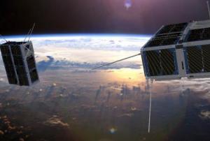
The European Space Agency (ESA) has announced the launch of a new satellite that will use artificial intelligence to filter images unsuitable for future use. The Phi Satellite (ɸ-Sat-1), presented at the ESA Phi-week from 9 to 12 September, will make data delivery more efficient by not sending back to Earth acquisitions with high cloud cover. Currently, the process of filtering images for cloud cover is done after the images are received on the ground, meaning that a number of images sent to Earth are not useful.

In 2017, the federated satellite system 6U tandem mission for sea ice and soil moisture monitoring (FSSCat) idea, which was proposed by the Universitat Politecnica de Catalunya from Barcelona, Spain, won the Copernicus Masters. This annual international competition awards prizes to innovative solutions, developments and ideas for business and society based on Earth observation data...

more
Publishing date 23/09/2019

Facebook has published new population density maps covering most of the African continent and countries of the Asia-Pacific region in June 2019. Using artificial intelligence (AI), these maps help organizations to respond to natural disasters, and scientists to assess the impact of climate change and urbanization on people’s lives. As soon as almost the entire world population is covered by the project, population distribution in remote areas will be better determinable by humanitarian agencies. In that way, health workers will be able to better reach households and relief workers to better distribute aid. 

For its population density maps, Facebook used a combination of machine learning techniques, high resolution satellite imagery and population data; no Facebook data was used nor did the census and satellite data used contain any personal data. The satellite maps used were created using DigitalGlobe'...

more
Publishing date 16/07/2019