Space-based information
Launched in 2010, the Global Humanitarian Technology Conference (GHTC) is the flagship conference of the Institute of Electrical and Electronics Engineers (IEEE), which focuses on innovation, deployment, and adaptation of Technology for Humanitarian Goals and Sustainable Development. The proceedings of the 7th edition of the conference, which took place in October 2017 in San Jose, United States of America, have recently been published and contain various contributions made by researchers and participants at the conference including on the topics of satellite data and communications and disaster resilience.
Among the published proceedings, a paper “Top-down and bottom-up – A global approach to strengthen local disaster resilience” discusses the importance of proactive disaster risk management and provides insights into how space-based information can support humanitarian action.
The authors, affiliated to the German Aerospace Center (DLR), Columbia University’s International Research Institute for Climate and Society and SOS Children’s Villages International (SOS-CVI), present a new SOS-CVI strategy that aims to increase disaster preparedness through in-depth risk and vulnerability assessments, transform early warning efforts into early action, and establish a reciprocal local to global emergency communication strategy. A key element on which the strategy is based is the adapted Resilience360 (R360), a dedicated online near real-time disaster risk management platform. The platform is a result of a collaboration between DLR, Deutsche Post DHL and SOS-CVI and its main objective is to centralize information that covers all phases of natural and manmade disasters. Another key element the SOS-CVI strategy relies on is collaboration with academia and private industry that can provide useful satellite-derived information in data-sparse regions as well as weather and climate forecasts. As a central argument of this article, the authors emphasize the need for a paradigm shift from already existing solutions that are more widely used to confirm conditions rather than to inform preparedness activities, to solutions that can translate early warnings into early action.
The role of satellite-derived information for humanitarian action
With regards to satellite-based analysis for disaster situations, the time taken from activation to the acquisition of the first satellite image and subsequently to the production of the first map is constantly decreasing. To SOS-CVI, this is proof that rapid satellite-based situation analysis brings high operational and communication value. In order to have access to early satellite analysis products in a systematic manner SOS-CVI has decided to develop a dedicated satellite emergency mapping (EMMA) strategy. However, the authors argue that when it comes to the added value brought by satellite data to decision-making support, the user needs to clearly understand the strengths and limitations of this type of data.
In terms of strengths, satellite-derived information can improve the tracking of agricultural seasons, help predict vegetation health, and assess the risk of epidemics such as malaria. Platforms such as the Copernicus Emergency Management System or the International Charter Space and Major Disasters provide free of charge products for disaster mapping which can play a beneficial role for the humanitarian community. Regarding limitations, for example, the unclear basic disaster definitions and critical thresholds for anomalies inhibit the translation of early warnings into early action, particularly with regards to slow-onset disasters such as droughts. Furthermore, the lack of internal capacity-building and of a clear commitment and sound long-term strategy of many global aid organizations hinder the proper use of satellite-data for humanitarian actions.
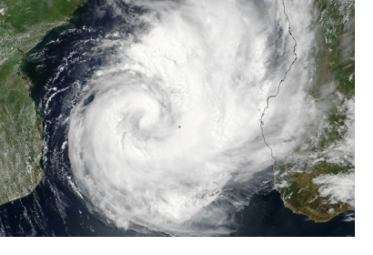
In addition, the article also presents a case study of cyclone Dineo which took place in Mozambique in February 2017. Through this example the authors showcase how the integration of satellite-based damage assessments into R360 and early warnings improved the decision-support of SOS-CVI and its partners.

