![]()
United
Nations
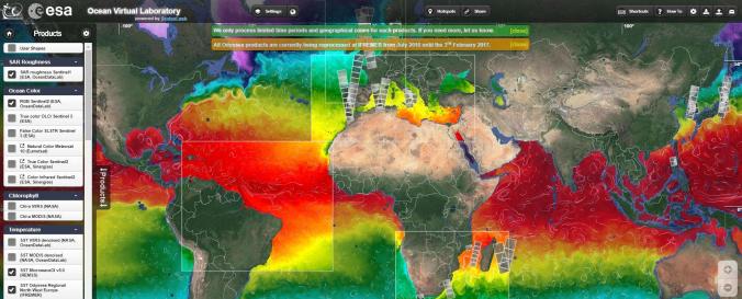
Ocean Virtual Laboratory (OVL - OceanDataLab, ESA)
| Data provided by: | OceanDataLab, European Space Agency (ESA) |
| Data accessibility: | export data, export map, visualization of data (e.g. web GIS or real time monitoring), web processing/cloud computing |
| Link to the data: | |
| Data type: | baseline data, hazard specific data, satellite data or aerial image |
| Disaster cycle phase: | Disaster Risk Management, Response, Recovery |
| Space-based Information: | The Ocean Virtual Laboratory is a web platform making satellite and in-situ data for ocean monitoring accessible. It presents one of multiple Syntool Web portals that promote the synergistic use of Ocean Remote Sensing data in a wider context of Oceanic and Atmospheric models or in-situ data. , ESA/SEOM Ocean Virtual Laboratory portal: SAR roughness Sentinel 1: Ocean Color: From Sentinel-2, Sentinel-3 and Meteosat. Chlorophyll: From VIIRS and MODIS Sea Surface Temperature, Sea level, Salinity, Wind, Current, Rain, Mean Square Slope, Sea ice concentration , ESA/DUE GlobCurrent portal: SAR roughness, Ocean Color, Chlorophyll, Sea surface temperature, Sea level, Salinity, Wind, Wave, Current, Rain, ESA SMOS Storm portal: Significant Wave height (SWH) Jason 2 and ALTIKA, SAR roughness Sentinel-1, Wind speed SMOS, SMAP, AMSR2 and ASCAT, wind barbs ASCAT, CNES Aviso'VIZ altimetry portal: Sea Surface Height Anomaly (SSHA) Jason-2 and SARAL, Sea Level Anomaly (SLA) Jason-2 and SARAL, Absolute Dynamic Anomaly (ADT) Jason-2 and SARAL, Mean Sea Level RIse, Sea Level Anomaly, Geostrophic current vectors and streamlines., ESA Sentinel3 Viewer: products from OLCI, SLSTR and SRAL sensors., CNES PEPS Sentinel-1 Ocean Viewer: SAR roughness Sentinel-1, ESA Sea Surface Salinity portal: SMOS salinity, SMAP salinity |
| Satellites and Sensors: | Aqua, GCOM-W1 (AMSR2), Jason-2 (Poseidon-3), MetOp (ASCAT), SARAL (AltiKa), Sentinel-1A, Sentinel-2A, Sentinel-3A, SMAP, SMOS |
| Spatial coverage: | Global |
| Temporal coverage: | Archive, Near-real time |
| Costs: | free |
| Tutorials on the use of data: | Explore the synergy of remote sensing and in-situ using Syntool, Explore the synergy of the Sentinels using SEAScope, OceanDataLab Youtube |
Provider
![]()