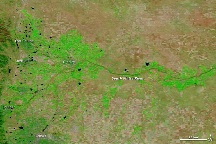
NASA's Aqua satellite was able to acquire imagery of the Colorado floods on 14 September 2013 during a break in precipitation with its Moderate Resolution Imaging Spectroradiometer (MODIS). Intense rainfall in northern and eastern Colorado had led to widespread floods caused by as much as 46 centimeters of rain between 9 to 15 September 2013.
NASA explains: "The images were made from infrared light to increase the contrast between water and land. Water is typically black or dark blue in these images, but here the sediment-laden water and muddy ground are light blue. (In the true-color version, the muddy river blends with the brown landscape that surrounds it.) Irrigated farmland is bright green, while natural vegetation and bare ground are pale green and tan, respectively. Bright blue and white clouds still cover cities along the front of the Rocky Mountains, including Denver, Boulder, Loveland, and Fort Collins."