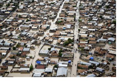
A real-time demonstration led by the Network Centric Operations Industry Consortium for the US National Geospatial-Intelligence Agency (NGA) has demonstrated the advantages of cloud-based disaster response infrastructure, as the website GCN reported. Via such a cloud-based infrastructure geospatial data can be shared and accessed despite having different IT systems.
GCN reported: "In an effort to improve communication in disaster response, NGA wanted to see how industry can deliver open standards-based geospatial data to first responders via multiple, interoperable cloud infrastructures that would let NGA share nonclassified information with mission partners but protect access to its sensitive information, said David Bottom, director of NGA Information Technology Services. (...) NGA wanted the OpenStack cloud to ensure all geospatial data would be stored in the object-based environment and consumed as a standard Open Geospatial Consortium service, said Todd Myers, NGA’s lead global computer architect."

