Sentinel-1 is a two satellite constellation with the prime objectives of land and ocean monitoring. The goal of the mission is to provide C-Band Synthetic Aperture Radar (SAR) data continuity following the retirement of ERS-2 and the end of the Envisat mission. To accomplish this the satellites carry a C-SAR sensor, which offers medium and high resolution imaging in all weather conditiions. The C-SAR is capable of obtaining night imagery and detecting small movement on the ground, which makes it useful for land and sea monitoring. Sentinel-1 will work in a pre-programmed operation mode to avoid conflicts and to produce a consistent long-term data archive built for applications based on long time series. The mission benefits numerous services. For example, services that relate to the monitoring of Arctic sea-ice extent, routine sea-ice mapping, surveillance of the marine environment, including oil-spill monitoring and ship detection for maritime security, monitoring land-surface for motion risks, mapping for forest, water and soil management and mapping to support humanitarian aid and crisis situations. The design of Sentinel-1 with its focus on reliability, operational stability, global coverage and quick data delivery is expected to enable the development of new applications and meet the evolving needs of Copernicus.
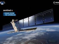
Sentinel-1A was launched on 3 April 2014, taken into orbit by a Soyuz rocket from Europe's Spaceport in French Guiana.
- active phased array antenna providing fast scanning in elevation and in azimuth - dual channel transmit and receive modules and H/V-polarised pairs of slotted waveguides - incident angle range: 20°- 46° - swath width: 80-400km swath in four different modes
Monitoring sea ice, oil spills, marine winds, waves & currents, land-use change, land deformation among others, and to respond to emergencies such as floods and earthquakes