Ecuador - Technical Advisory Mission
Ecuador - Technical Advisory Mission
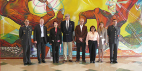
The mission was led by two experts from UN-SPIDER who were accompanied by one expert from the National Institute for Space Research of Brazil (INPE) and one expert from the National Commission for Space Activities of Argentina (CONAE).
The mission included visits to 12 Government agencies and representatives of agencies of the United Nations in Ecuador. It benefited from the fact that UN-SPIDER conducted its regional workshop for Latin America and the Caribbean a week before the mission took place, which allowed Ecuadorian agencies to showcase how they were using space-based information for a variety of purposes targeting all phases of the disaster cycle.
Ecuador is fairly well advanced in the use of information for a variety of purposes. In addition, the government has recognized the need to target disaster-risk management at the highest political level.
The Government has also recognized the need to highlight the profile of risk management by transforming the Technical Secretariat for Risk Management into the National Secretariat for Risk Management, hierarchically at the level of a Ministry;
Synergies among many international agencies under the umbrella of the National Secretariat for Risk Management are allowing for a more efficient coordination of activities targeting all phases of the disaster management cycle.
The National Secretariat for Planning (SENPLADES) has established the National System for Territorial Information, which is promoting the establishment of standardized Spatial Database Infrastructures to ensure compatibility and easy exchange of information among agencies. In this context, SENPLADES has established the National Geo-informatics Council (CONAGE) as an inter-institutional body to administer the National Geospatial Database Infrastructure. SENPLADES is also channeling financial resources to many agencies to assist them in upgrading quality standards in the acquisition, processing, and dissemination of information.
For more than 30 years the Armed Forces of Ecuador have operated both the Military Geographical Institute and the Centre for Integrated Remote Sensing Applications for Natural Resources (CLIRSEN). CLIRSEN is recognized by many government agencies for its contributions to promote the use of space-based information for a variety of purposes.
The Government is establishing the Ecuadorian National Space Commission as a vehicle to thrust activities in this area and to take advantage of the benefits that space applications offer in many sectors of development.
Taking note of the fact that many government agencies in Ecuador are fairly well advanced in the use of information for a variety of purposes, the mission recommended the Ecuadorian Space Commission (CEE) to institutionalize of the use of space-based information.
The mission recommended CEE, the National Secretariat for Risk Management (SNGR) and CLIRSEN to design a strategy to facilitate access to and use of space-based information, particularly in the context of land-use planning as a way to reduce the exposition of communities to natural hazards and in the context of vulnerability assessment.
SNGR and CLIRSEN should improve their links with international mechanisms such as the International Charter: Space and Major Disasters and with UN-SPIDER in case of emergency response. In particular, the incorporation of a task within the Manual of Emergency Operations of the National Emergency Operations Centers targeting this issue explicitly is recommended.
CLIRSEN and CEE could benefit from the design of an architecture for the catalogue of archived and recent space-based imagery and information. CONAGE could design strategies to facilitate the compatibility among databases generated by government agencies through a policy that targets the generation of metadata. SNGR, CLIRSEN and CEE should design strategies to enhance the skills of staff in government agencies on the generation and use of space-based information with particular emphasis on disaster-risk management and emergency response.
Finally, CEE, SNGR and CLIRSEN could benefit from the bridge function provided by UN-SPIDER as a way to establish contact with space agencies from countries in the region and around the world.
