We're glad to share with you the February 2019 UN-SPIDER Monthly Updates and would like to make you aware of an upcoming event and two opportunities organized by the United Nations Office for Outer Space Affairs (UNOOSA) that might be of interest to you.
From 24 to 27 April, UNOOSA and the China National Space Administration (CNSA) are organizing the United Nations/China Forum on Space Solutions in Changsha, China. Applications for self-funded participants are open until 14 April 2019. Details are available on the UNOOSA website.
The United Nations Office for Outer Space Affairs (UNOOSA) has teamed up with the Space Generation Advisory Council to launch the Space for Youth Competition. If you're under 35 and passionate about space, make to submit your contribution to the competition until 22 March 2019. Details are available on the UNOOSA website.
The Drop Tower Experiment Series is a fellowship programme of the United Nations Office for Outer Space Affairs (UNOOSA), the Center of Applied Space Technology and Microgravity (ZARM) and the German Aerospace Center (DLR) in which students can learn and study microgravity science by performing experiments in a drop tower. Applications for the 6th cycle close on 31 March 2019. Details are available on the UNOOSA website.
Below the updates, you'll also find an events calendar with upcoming conferences, workshops and seminars organized by the community.
Enjoy the read!
UN-SPIDER at a glance
- 11/02/2019
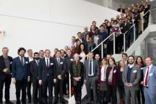
The United Nations Office for Outer Space Affairs (UNOOSA), through its UN-SPIDER programme, attended the DLR (German Aerospace Center) Humanitarian Technology Days on 6 and 7 February at the DLR Earth Observation Centre in Oberpfaffenhofen, Germany.
News from our Regional Support Offices
- 22/02/2019Regional Support Offices involved: International Centre for Integrated Mountain Development (ICIMOD)
The Hindu Kush Himalayan Monitoring and Assessment Programme (HIMAP), under the coordination of the International Centre for Integrated Mountain Development (ICIMOD), has recently brought… Read more
News from the community
- 27/02/2019Regional Support Offices involved: Nigeria Regional Support Office
The Edo State Polytechnic, Usen, has concluded preparations to unveil the Centre for Geospatial Information Science (CGIS), a research and teaching unit that will utilize computer software and tools such as geographic information systems among others, to gather information for use in mining, agriculture, urban planning and health care.
CGIS will provide training and… Read more
- 26/02/2019
The Global Facility for Disaster Reduction and Recovery (GFDRR), a grant-funding mechanism managed by the World Bank, has released a new report that analyzes how machine learning (ML) can be applied in disaster risk management (DRM) projects. The publication provides a concise, demystifying reference that readers - from project managers to data scientists - can easily use. It… Read more
- 20/02/2019
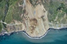
While several studies have already highlighted how global warming and its consequences are predicted to increase the frequency and magnitude of geohazards such as landslides, the relation between ongoing climate shifts and landslide behaviour is still difficult to assess, especially due to uncertainties in both models. In a new research paper, researchers at NASA's Jet Propulsion… Read more
- 18/02/2019
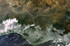
Using imagery of the Copernicus Sentinel-2 satellite, researchers from Spain, the United Kingdom and Germany have discovered that more areas in Sub-Saharan Africa are affected by wildfire than previously estimated. In their open-access paper, published in the journal… Read more
Satellite(s) and sensor(s) used: - 18/02/2019Regional Support Offices involved: Nigeria Regional Support Office
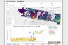
An integrated data platform has been created to bring together a wide variety of in situ and remotely-sensed soil moisture data sets to better inform disaster response planners, climate scientists and meteorologists, farmers, and others. The Soil Moisture Visualizer (SMV) is provided as an open and free data access tool from the NASA… Read more
| Title | Organized by | City | Country | Date |
|---|---|---|---|---|
| UN/Costa Rica/PSIPW Sixth conference on the use of space technology for water management | United Nations Office for Outer Space Affairs (UNOOSA) Government of Costa Rica Prince Sultan Bin Abdulaziz International Prize for Water (PSIPW) |
San José | Costa Rica | 05/07/2024 to 05/10/2024 |
| 3rd International Conference Natural Hazards and Risks in a Changing World | Amsterdam | Netherlands | 06/12/2024 to 06/13/2024 | |
| 43rd EARSeL Symposium | European Association of Remote Sensing Laboratories (EARSeL) |
Manchester | United Kingdom of Great Britain and Northern Ireland | 06/17/2024 to 06/20/2024 |
| 67th Session of the Committee on the Peaceful Uses of Outer Space (COPUOS) | Vienna | Austria | 06/19/2024 to 06/28/2024 | |
| Global Flood Partnership Annual Conference 2024 | Nairobi | Kenya | 07/24/2024 to 07/26/2024 | |
| EUMETSAT Meteorological Satellite Conference 2024 | European Organisation for the Exploitation of Meteorological Satellites (EUMETSAT), Deutscher Wetterdienst (DWD) |
Würzburg | Germany | 09/30/2024 to 10/04/2024 |
| 2nd UNESCO IOC Global Tsunami Symposium | United Nations Educational, Scientific and Cultural Organization (UNESCO); Meteorological, Climatological and Geophysical Agency (Indonesian: Badan Meteorologi, Klimatologi, dan Geofisika, abbreviated BMKG) |
Banda Aceh | Indonesia | 11/09/2024 to 11/14/2024 |
