Dear readers,
We're glad to share with you the January 2020 UN-SPIDER Monthly Updates, and would like to make you aware of our latest Recommended Practice, which explains how to map floods and assess related damage using Sentinel-1 data and Google Earth Engine. This step-by-step procedure provides a useful outline of floods, while overlaying the flood extent with land use and population information to instantly output statistics such as area of cropland and number of population within the damaged areas. It aims to be a simple and quick tool for users of any experience level to obtain an overview of a flood event.
The Recommended Practice can be accessed on the UN-SPIDER Knowledge Portal: www.un-spider.org/advisory-support/recommended-practices/recommended-practice-google-earth-engine-flood-mapping
Below the updates, you'll also find an events calendar with upcoming conferences, workshops and seminars organized by the community.
Enjoy the read!
UN-SPIDER at a glance
- 24/02/2020Regional Support Offices involved: Islamic Republic of Iran Regional Support Office
UN-SPIDER conducted a training programme on Combatting Disaster in Arid Regions Using Space-Based and Geospatial Technologies from 18 to 20 February 2020 in Istanbul, Turkey. The event was the first attempt of broadening UN-SPIDER efforts to include countries in a vast swath of arid regions in Asia and North Africa, and to increase awareness of the need for space technology to combat disasters… Read more
Country/Region mentioned:
News from the community
- 20/02/2020
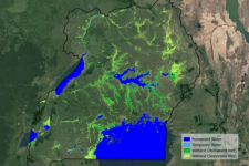
The European Space Agency’s (ESA) GlobWetland Africa project has produced maps that demonstrate how satellite observations can be used for the effective use and management of wetlands in Africa. The project, created in collaboration with the African Team of the Ramsar Convention on Wetlands, provides national… Read more
Satellite(s) and sensor(s) used:Country/Region mentioned: - 19/02/2020
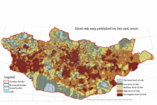
The Mongolian National Agency for Meteorology and Environmental Monitoring (NAMEM) has developed a extreme winter (dzud) risk map for the country using MODIS satellite data, among other resources. The map shows that over 50 per cent of the country are at risk of a severe winter. Following the analysis, the… Read more
Satellite(s) and sensor(s) used:Country/Region mentioned: - 03/02/2020
Scientists from 50 scientific institutions, led by the National Aeronautics and Space Administration (NASA) and the European Space Agency (ESA) combined 26 independent satellite datasets to show that the Greenland Ice Sheet melt is increasing. The group studied data from 1992 to 2018, taking direct measurements of the… Read more
Satellite(s) and sensor(s) used:Country/Region mentioned: - 03/02/2020
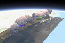
When analysing wildfires and their impacts, remote sensing instruments provide frequent, broad coverage at minimal incremental cost and at no risk, compared with traditional in situ monitoring. Over the past 20 years, the research community has developed tools and techniques to capture key aspects of fire behavior and… Read more
Country/Region mentioned:
| Title | Organized by | City | Country | Date |
|---|---|---|---|---|
| UN/Costa Rica/PSIPW Sixth conference on the use of space technology for water management | United Nations Office for Outer Space Affairs (UNOOSA) Government of Costa Rica Prince Sultan Bin Abdulaziz International Prize for Water (PSIPW) |
San José | Costa Rica | 05/07/2024 to 05/10/2024 |
| 3rd International Conference Natural Hazards and Risks in a Changing World | Amsterdam | Netherlands | 06/12/2024 to 06/13/2024 | |
| 43rd EARSeL Symposium | European Association of Remote Sensing Laboratories (EARSeL) |
Manchester | United Kingdom of Great Britain and Northern Ireland | 06/17/2024 to 06/20/2024 |
| 67th Session of the Committee on the Peaceful Uses of Outer Space (COPUOS) | Vienna | Austria | 06/19/2024 to 06/28/2024 | |
| EUMETSAT Meteorological Satellite Conference 2024 | European Organisation for the Exploitation of Meteorological Satellites (EUMETSAT), Deutscher Wetterdienst (DWD) |
Würzburg | Germany | 09/30/2024 to 10/04/2024 |
| 2nd UNESCO IOC Global Tsunami Symposium | United Nations Educational, Scientific and Cultural Organization (UNESCO); Meteorological, Climatological and Geophysical Agency (Indonesian: Badan Meteorologi, Klimatologi, dan Geofisika, abbreviated BMKG) |
Banda Aceh | Indonesia | 11/09/2024 to 11/14/2024 |


