UN-SPIDER at a glance
- 31/10/2018
- 31/10/2018
The United States Geospatial Intelligence Foundation (USGIF) has recently released a new report on “Building Resilient Communities Through Geospatial Intelligence”. The report highlights the importance of raising awareness about the value of space-based information for early warning systems and risk and disaster management. Moreover, it suggests the need for a better definition of GEOINT… Read more
- 24/10/2018
The United Nations Office for Outer Space Affairs (UNOOSA), through the United Nations Platform for Spaced-Based Information for Disaster Management and Emergency Response (UN-SPIDER), is conducting the eighth edition of the United Nations International Conference on Space-based Technologies for Disaster Risk Reduction from 24 to 26 October in Beijing, China. The event is organized together… Read more
- 15/10/2018
The United Nations Platform for Space-based Information for Disaster Management and Emergency Response (UN-SPIDER) is conducting an institutional Strengthening Mission (ISM) to Ghana from 15 to 19 October. The mission is carried out in cooperation with the Ghana National Disaster Management Organization (NADMO) and upon the invitation of the Government of Ghana. Thirty participants from more… Read more
- 13/10/2018
Disasters cause tremendous loss of lives and assets around the world. Over the last twenty years, more than 1.35 million people have died, while over 4 billion have been displaced, left homeless, injured or in need of emergency assistance as a result of disasters according to a new report by the United Nations Office for… Read more
News from the community
- 31/10/2018
A declaration adopted by a wide range of stakeholders at the second United Nations World Data, calls for an increase in financing for better data and statistics for sustainable development. The Dubai Declaration aims to establish a funding mechanism under the mandate of the United Nations Statistics Commission to raise resources to address the data needs for the full implementation of the 2030… Read more
- 29/10/2018
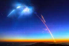
The United Arab Emirates (UAE) launched a new satellite on 29 October which aims to assist with a range of tasks including aiding relief efforts after disasters.
KhalifaSat, a remote sensing Earth observation satellite, was put into orbit via a H-2A rocket which lifted off from the the Tanegashima Space Centre in Japan.
The satellite will… Read more
- 23/10/2018
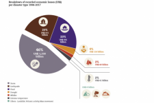
The United Nations Office for Disaster Risk Reduction (UNISDR) and the Centre for Research on the Epidemiology of Disasters (CRED) have released a new report that highlights the global trends in disaster losses in the period between 1998 and 2017.
“Economic Losses, Poverty & Disasters1998-2017” shows the significant increase of… Read more
- 09/10/2018
The German Aerospace Center (DLR) has released a 90-metre resolution global elevation… Read more
- 02/10/2018
A drought/dzud monitoring system known as “DroughtWatch-Mongolia” has been officially handed over to Mongolia on 17 September by the United Nations Economic and Social Commission for Asia and the Pacific (UNESCAP) and the Institute of Remote Sensing and Digital Earth (… Read more
- 01/10/2018Regional Support Offices involved: Asian Disaster Reduction Center (ADRC), Indonesia Regional Support Office
The International Charter “Space and Major Disasters” and the Copernicus Emergency Management Service Mapping have been activated on 29 September after a 7.5 magnitude earthquake in the central Indonesian Island of Sulawesi.
At least 844 people have been killed and 64,000 displaced… Read more
- 01/10/2018
The United Nations, the World Bank, the International Committee of the Red Cross and prominent technology companies have jointly launched the new Famine Action Mechanism (FAM). The Mechanism uses a range of data including satellite imagery to predict famines, ultimately aiming to prevent them.
Launched on 23 September, the FAM is a still-evolving algorithm that will use analytics to… Read more
News from our Regional Support Offices
- 23/10/2018
Delta State University became the 23rd member of the network of UN-SPIDER Regional Support Offices (RSO) on 1 October. As an RSO, Delta State University will communicate and coordinate with UN-SPIDER on a regular basis, engage in outreach and capacity-building efforts, and contribute to the programme’s technical advisory support activities.
Through its… Read more
- 09/10/2018Regional Support Offices involved: Argentina Regional Support Office
The Argentina National Space Activities Commission (CONAE) launched a new Earth observation satellite that will support disaster management efforts. SAOCOM 1A is the first of a constellation of two radar satellites. The remote sensing mission aims to provide timely information for disaster management as well as monitoring services for agriculture, mining and ocean applications.
The… Read more
| Title | Organized by | City | Country | Date |
|---|---|---|---|---|
| UN/Costa Rica/PSIPW Sixth conference on the use of space technology for water management | United Nations Office for Outer Space Affairs (UNOOSA) Government of Costa Rica Prince Sultan Bin Abdulaziz International Prize for Water (PSIPW) |
San José | Costa Rica | 05/07/2024 to 05/10/2024 |
| 3rd International Conference Natural Hazards and Risks in a Changing World | Amsterdam | Netherlands | 06/12/2024 to 06/13/2024 | |
| 43rd EARSeL Symposium | European Association of Remote Sensing Laboratories (EARSeL) |
Manchester | United Kingdom of Great Britain and Northern Ireland | 06/17/2024 to 06/20/2024 |
| 67th Session of the Committee on the Peaceful Uses of Outer Space (COPUOS) | Vienna | Austria | 06/19/2024 to 06/28/2024 | |
| EUMETSAT Meteorological Satellite Conference 2024 | European Organisation for the Exploitation of Meteorological Satellites (EUMETSAT), Deutscher Wetterdienst (DWD) |
Würzburg | Germany | 09/30/2024 to 10/04/2024 |
| 2nd UNESCO IOC Global Tsunami Symposium | United Nations Educational, Scientific and Cultural Organization (UNESCO); Meteorological, Climatological and Geophysical Agency (Indonesian: Badan Meteorologi, Klimatologi, dan Geofisika, abbreviated BMKG) |
Banda Aceh | Indonesia | 11/09/2024 to 11/14/2024 |
![Copernicus Emergency Management Service (© 2018 European Union), [EMSR317] Palu - Indonesia, Grading Map. Copernicus Emergency Management Service (© 2018 European Union), [EMSR317] Palu - Indonesia, Grading Map.](/sites/default/files/styles/cropped_225x150/public/Copernicus_EMSR317_07PALU_02GRADING_MAP_v2_100dpi.png?itok=qi3KT1Td)
