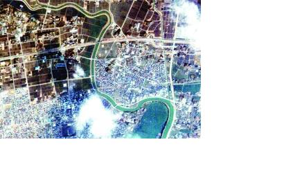
The Emirates Institution for Advanced Science & Technology (EIAST), the UAE’s premier scientific and technology organisation, has provided recent images of Japan from its UAE-owned and operated DubaiSat-1 satellite. The images of the tsunami and earthquake struck cities were provided to the United Nations Platform for Space-based Information for Disaster Management and Emergency Response (UN-SPIDER) and the Japan Aerospace Exploration Agency (JAXA) as part of a global effort to help assess and plan relief efforts. The co-operation between EIAST and Japanese as well as UN agencies is also a major aspect of the UAE participation in the rescue operations under way in Japan.
DubaiSat-1, launched by EIAST in July 2009, has since been providing satellite images to assist planning and development in several areas including observation and fog forecast, predicting sand storms, identifying water quality in the Gulf region - especially the effect of waste distillation on the environment and marine life in the UAE.
The organisation is currently preparing for the launch of the UAE’s second remote sensing satellite, DubaiSat-2, underscoring the country’s commitment to strengthen its advanced space technologies to fulfil the needs of scientific and technological research, as well as to provide up-to-date spatial and earth monitoring data.

