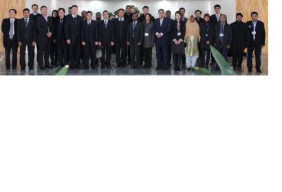
In cooperation with the Asia-Pacific Space Cooperation Organization (APSCO) and National Disaster Reduction Centre of China (NDRCC), UN-SPIDER jointly organized a training course on Remote Sensing Data Usage for Earthquake Monitoring and Evaluation. The training taking place at Beijing Normal University, China, started on 3 December and will continue until 13 December 2012.
The broad aim of the training is to offer more practical hands-on training for specific area of disaster management as mentioned above the ‘usage of remote sensing data for earthquake monitoring and evaluation’ for the participants from APSCO Member States. The training also includes a technical tour at “National Earthquake Response Support Service”. The principal objectives of the training program are as follows:
- i. To introduce space technology and its application in Earthquake losses monitoring and assessment, including work model and technical flow;
- ii. To introduce pre-process of high resolution satellite data, including geometric correction, mosaic, resizing, and stretching data etc.;
- iii. To introduce technical flow of assessment for damaged house, destroyed lifeline, resettle place and landslide;
- iv. To introduce technical flow of rapid mapping for earthquake monitoring and assessment.
- v. To promote an exchange of ideas and technical expertise between Member States towards for better collaboration on earthquake disaster monitoring and evaluation.
UN-SPIDER held the opening presentation on the use of space technology in the context of the Hyogo Framework for Action, especially regarding preparedness for earthquake disasters. A UN-SPIDER expert will furthermore elaborate on the experiences from recent Technical Advisory Missions focusing on challenges in using space-based information for disaster management.

