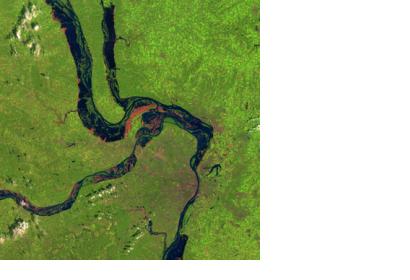
CGIAR Research Programs on Water, Land & Ecosystems (WLE) and Climate Change Agriculture and Food Security (CCAFS) are conducting a project focusing on flood impact mitigation using geospatial flood inundation mapping. The objective is to provide regional and national decision-makers with accurate information to understand the benefits of inundation as well as the need to provide protection from the damaging impacts of floods, to help farmers in selected areas to optimize the use of floodwaters for growing crops and to assist insurance companies to assess/monitor risks when floods damage agricultural land.
A number of products and services that are relevant to floods will be provided. Data provided by optical and radar satellites are used to generate maps of flood inundation in a short period of time. Optical satellites such as Moderate Resolution Imaging Spectroradiometer (MODIS), LANDSAT, Advanced Spaceborne Thermal Emission and Reflection Radiometer (ASTER), Indian Remote Sensing (IRS) satellite, etc., are easy to use and generally preferred to map floodrisk areas, damage and impact assessment. The advantage of radar images can be used in all weather conditions, and is highly suitable for flood mapping and ideal for flood monitoring, particularly in complex hydrologic.
| Attachment | Size |
|---|---|
| Mitigating impacts of floods.pdf (1.32 MB) | 1.32 MB |

