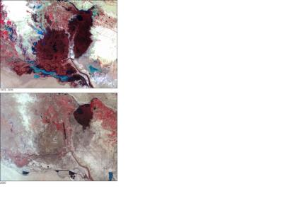
"The Arab Region: Atlas of Our Changing Environment" recently released by the United Nations Environment Programme (UNEP) and the Abu Dhabi Global Environmental Data Initiative (AGEDI) shows through satellite images the growing impact of Climate Change in the Arab region.
The comparative satellite images used in the atlas clearly show the changes caused by the growing population and environmental pressures that have been going on in the region – in land use, urban growth, degradation of marine and coastal areas, shrinking water bodies and loss of habitats. The atlas comes to show which challenges the region will be facing in the next years – limited freshwater resources, rapid urbanization, depletion of natural resources and increased vulnerability to environmental risks and natural disasters.
Furthermore, the satellite images shed light not just onto recent developments in the region and the role humans played in forming the environment, but they also offer an insight into the opportunities and the innovative responses that could be implemented in the region. Many of the countries established environmental agencies in order to mitigate the climate change impacts and their efforts in sustainable development can be seen in the atlas.
The main article published on the website of UNEP gives further information about some of the changes in the countries captured by satellites and gives a small introductory of the Abu Dhabi environmental agency.

