The mission was coordinated by UN-SPIDER with the support of 10 experts from UNOCHA ROWA (Senegal), the National Space Research and Development Agency of Nigeria (NASRDA), the Algerian Space Agency (ASAL), the Regional Centre for Training in Aerospace Surveys (RECTAS), Planet Action France and DMC & DMCii (Surrey Satellite Technology Ltd.) of United Kingdom.
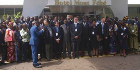
The Mission included institutional visits to Cameroon ministries, UN institutions involved with disaster management or space-based technologies. A stakeholder workshop was organized bringing together more than 70 experts of the Cameroon disaster management, geospatial and academic community.
- The mission and related workshop have highlighted the high levels of expertise available across all participating organizations in Cameroon, including in the academic environment;
- Educational capacities exist to train qualified professionals in various fields related to disaster management;
- Resources for telecommunications (including satellite-based) are available to support prevention, early-warning and response in case of disasters;
- Poor integration of information regarding natural hazards into environmental protection measures and a low level of awareness by the population regarding these hazards;
- A lack of a comprehensive regulation governing natural hazards.
The mission team recommends the incorporation of the use of space-based information in policies targeting civil protection and integrate the use of space based information in disaster-risk management and emergency response efforts carried out by the Civil Protection agency.
As the research and academic community is a major source of expertise for risk and disaster management, the country could benefit from mobilizing it better, in particular in the area of capacity building at the national level.
The Civil Protection agency would benefit from carrying out an awareness campaign targeting the national as well as the local levels on issues related to disaster-risk management, preparedness and emergency response.
The Civil Protection agency as well as other government agencies are recommended to offer trainings on the generation and use of space-based information in efforts related to disaster-risk management and emergency response.
Government agencies, including the Civil Protection agency, should establish a Geospatial Database Infrastructure as a way to share data more effectively.
UN-SPIDER could facilitate, on a periodic basis and at the request of all stakeholders, data and information to the National Observatory of Risks (ONR) established in 2003 and whose main mission is to centralize all available information on risks.
UN-SPIDER could also facilitate data and information to the Geological and Volcanological Research Station (ARGV) which monitors Lake Nyos, through the Director of Civil Protection.


