The team comprised nine experts: Dr. Shirish Ravan (UNOOSA, Beijing Office), David Stevens (UNOOSA, Vienna Office), Dr. Stefan Kienberger (University of Salzburg, Centre for Geoinformatics, Austria), Prof. Dr. Talbot Brooks (Delta State University, Center for Interdisciplinary Geospatial Information Technologies, USA), Alex Fortescue, (Southern Mapping, South Africa), Prof. Dr. Chris Hartnady (Umvoto, South Africa), Wolfram Lange (Center for Natural Resources and Development (CNRD), Cologne University of Applied Sciences, Germany), Dr. Kennedy Masamvu (Southern African Development Community – SADC) Botswana, Prof. Dr. Jackson Roehrig, (Cologne University of Applied Sciences, Institute for Technology and Resources Management in the Tropics and Subtropics, Germany).
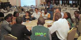
Meetings were held with key stakeholders within the government, associated departments/ agencies, and UN offices. In total, twelve different institutions were interviewed as part of a needs assessment process. The results of these meetings were augmented with information gained through a one day workshop organized by UN-SPIDER, INGC, and UNDP on 10 October 2012. The workshop brought together more than 45 representatives from various government/ United Nations and academic entities to discuss cross cutting issues related to use of geographic and space-based information for disaster risk reduction and emergency response.
The Mission Team observed the following:
- Disaster Management Plan and Contingency Plans are in place providing an opportunity for using geospatial information
- Coordination mechanism for disaster management is available (CTGC) which brings in different ministries/departments working with geospatial information
- A simulation exercise carried out annually provides an opportunity for the integration of geospatial products including satellite images
- Organizations expressed willingness to improve the coordination efforts
- Information sharing policy is not available which limits data sharing. No current discussion on the need to establish a National Spatial Data Infrastructure (NDSI)
- Different ministries and departments are involved in the mapping and maintenance of various thematic datasets
- Several institutions are involved in international projects involving space-based and geospatial information, which calls for stronger need for coordination and data sharing
- CENACARTA is mandated to provide baseline data (topographic maps, vector layers and satellite data) - baseline data needs to be updated. CENACARTA and INE are also obliged by existing policies to generate revenues
- Lack of awareness about the use and existence of geospatial data (need to improve dialogue)
- Capacities to use Remote Sensing and Geographic Information Systems exists within several organization
- INGC needs capacity to make use of the thematic data provided by different institutions
- Awareness and appreciation at decision-making level is required
Policy and Coordination
- Update Disaster Management Plan and Contingency Plans to make provisions to incorporate space-based and geospatial information
- Policy interventions to define clear cooperation and information sharing mechanism between data provider organisations and user organisation
- Establishment of a National Spatial Data Infrastructure should be taken up on top priority to ensure optimisation of use of existing resources. To share international NSDI best practices is seen as an important cornerstone to further build on
- Effort to have in place professional body bringing together geospatial experts
Data status and availability
- Creation and implementation of infrastructure for data sharing should be a top-priority for governmental institutions. NSDI should cover a road map for data creation, data management, metadata, standardization and quality
- Data creation needs to be streamlined to generate up-to-date geospatial information based on existing mandates of various organisations
- Data management needs to be reframed to provide uniform access to all humanitarian and developmental organisations. Metadata should be considered as an important component of the data management
- Awareness of the use of open-source software and open data should be strengthened
Capacity Building and Institutional Strengthening
- Enable stakeholders of INGC (members of CTGC) with on-the-job-training to impart specific skills
- Train-the-trainer in specific domains of risk, hazard and vulnerability mapping (Develop national capacity to generate critical mass of trained personnel)
- Forum to generate awareness (workshop, technical committee, associations) to engage various levels of decision makers
Other recommendations
- A Disaster Management Information System is needed to ensure integration of all information and providing meaningful inputs for decision making
- Ensure access by INGC to mechanisms that make space-based information available during emergency response: such as the International Charter Space and Major Disasters, SERVIR and GEO-EMS are the key mechanisms that need to be used effectively during emergencies