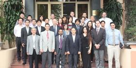
The mission included 12 experts from the following organizations:
- Shirish Ravan, UN-SPIDER/UNOOSA, Beijing
- Juanjuan Han, UN-SPIDER/UNOOSA, Beijing
- John Efstathiou Marinos, UN OCHA, Bangkok
- Christopher Clyde Chiesa, Pacific Disaster Center
- Milind Pimprikar, CANEUS (Canada-Europe-Americas-Africa-Asia-Oceania) International, and Centre for Large Space Structures & Systems, Canada
- Thuy Le Toan, CNES-CNRS-Université Paul Sabatier, France
- DanLing Tang, South China Sea Institute of Oceanology, Chinese Academy of Sciences
- Juan Barba Polo, GEREDIS, Spain
- Gliceto Olarte Dagondon, GREEN Mindanao, south of Philippines
- Norman Kerle, Faculty of Geo-Information Science and Earth Observation (ITC), University of Twente, Netherlands. Department of Earth Systems Analysis (ESA)
- Talbot John Brooks, Center for Interdisciplinary Geospatial Information Technologies, Delta State University
- LI Jing, Beijing Normal University & National Committee for Disaster Reduction of China
The expert team visited key stakeholders organizations involved in providing space-based and geospatial information for disaster management. A one-day workshop was conducted as a part of this mission, which was attended by about 60 officials from government departments, UN agencies and NGOs supporting disaster management in Vietnam. The team also met with the UN Resident Coordinator to brief him about the mission objectives. A final debriefing was provided to the Vice Minister of Agriculture. The debriefing focused on observations and recommendations related to the capacity building, data availability, data/information sharing, policy and coordination with respect to disaster risk management and emergency response.
Capacity building
- Several agencies using geospatial technologies understand the inter-disciplinary nature of crisis planning, mitigation, response, and recovery exist
- Tremendous technical capacity exists within Viet Nam to use spaced based technology (MONRE, MARD, VAST)
- The challenge is to leverage this capacity in support of disaster response and disaster risk reduction
- DMC/MARD needs ‘small’ core team of professionals trained in remote sensing and GIS, to be able to leverage on capacities of different institutions to effectively serve CCFSC and NCSR
- DMC mandate should be strengthened to be an effective focal agency for disaster risk management
Data availability and sharing
- Outstanding geospatial data sets, including a national topographic map accurate to a scale of 1:10,000.
- Remote Sensing data widely exist (SPOT, Sentinel Asia and soon from own satellite)
- Strong awareness about the diversity of data required to work in the crisis management arena.
- Little awareness between agencies on available data/information
- Very little sharing of data and information with high administrative hurdles, though willingness seems to be generally there
- Data policy, including Remote Sensing and Geospatial Data, is the most urgent need
- This is critical for CCFSC/MARD and VINASAROM to receive reliable and up-to-date information for decision making
Policy and coordination
- Mechanism should be revised or created to allow all data directly or potentially useful to disaster management to move freely through the Vietnamese Government as well as other local and international humanitarian actors.
- A Data and Information working group should be created which would allow technical focal points from key government agencies using data (i.e. DMC, DWR, Red Cross, CCFSC, etc.) to meet and discuss data-related issues (identifying user requirements, data standards, raising awareness of available data etc.) to facilitate data use in support of disaster management.
- A clearer and more pervasive role of geospatial data in the new Disaster Management law is recommended
Strengthening Disaster Risk Management
- DMC/MARD has critical role to play in establishing mechanism which allows for rapid data sharing with minimal administrative action, not only in times of crisis, but for planning, mitigation/risk reduction, and recovery activities.
- Leverage and expand capacities of MONRE, VAST and other organisations effectively to operationally derive products needed for Disaster Risk Management
- Specific programmes should be initiated through DMC to prepare nationwide hazard, vulnerability and risk mapping
- Projects should be coordinated by DMC with centres of excellence
- DMC to serve as Disaster Management Information System
Early warning
- Strong awareness at DMC of technical capacities of EW agencies (Center for Hydro-Meteorological Forecasting) and to embed those inputs in risk management
- Capacities to improve multi-hazard early warning
- Role of DMC in tailoring/downscaling early warning information to serve decision makers and population at stake (use CBDRM programme as a base)
- Integration of early warning information in Disaster Management Information System
Emergency Response
- Sentinel Asia and International Charter are operational
- VNREDSat-1 data will feed into this network
- Data from above sources need to make a way in decision making during emergencies
- Information sharing channel should be clear and calls for “Standing Orders during emergencies”
- Disaster response capabilities would be significantly enhanced through a mechanism which allowed for the temporarily re-assignment of appropriate staff from agencies
- DMC should evolve mechanism to engage all stakeholders on regular basis to practice in drills and simulation exercises.
- Make use of international support (UN-SPIDER, OCHA, UNOSAT)