![]()
United
Nations
Flood
, processed by ESA, CC BY-SA 3.0 IGO.")
Definition
Facts and figures
Further information
UN-SPIDER Regional Support Offices with hazard-specific expertise
Related content on the Knowledge Portal
The Sentinels are a fleet of satellites designed specifically to deliver the wealth of data and imagery that are central to the European Commission’s Copernicus programme.
read more
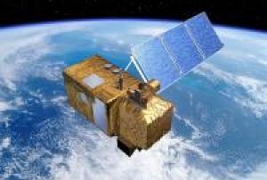
Sentinel-2 carries an innovative wide swath high-resolution multispectral imager with 13 spectral bands for a new perspective of our land and vegetation. The combination of high resolution, novel spectral capabilities, a swath width of 290 km and frequent revisit times provides unprecedented views of Earth.
The mission is based on a constellation of two identical satellites in the same orbit, 180° apart for optimal coverage and data delivery. Together they cover all Earth’s land surfaces, large islands, inland and coastal waters every five days at the equator. Sentinel-2B was launched on 7 March 2017.
As well as monitoring plant growth, Sentinel-2 can be used to map changes in land cover and to monitor the world’s forests. It also provides information on pollution in lakes and…07/03/2017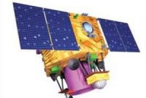 read more
Cartosat-2 is an advanced remote sensing satellite with a single panchromatic camera (PAN) capable of providing scene-specific spot imageries for cartographic applications. The camera is designed to provide imageries with better than one meter spatial resolution and a swath of 10 km. The satellite will have high agility with capability to steer along and across the track up to + 45 degrees. It will be placed in a sun-synchronous polar orbit at an altitude of 630 km. It will have a revisit period of four days. The re-…
15/02/2017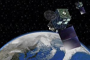
Himawari 9 is a Japanese weather satellite, the 9th of the Himawari geostationary weather satellite operated by the Japan Meteorological Agency.
02/11/2016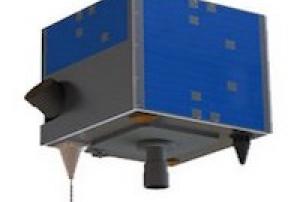
The AlSat-1B satellite was launched into orbit on September 26, 2016 from the Satish Dhawan Space Centre in Sriharikota, India. It was developed by the Algerian Space Agency (ASAL) in corporation with Surrey Satellite Technology Ltd (SSTL). The AlSat-1B satellite orbits at 670 km above the earth's surface and carries a 24m multispectral imager and a 12m panchromatic imager delivering images with a swath width of 140km. The satellite carries two High Speed Data Recorders and two Flash Mass Memory Units capable of recording, managing and storing image data for high speed downlink via S-Band and X-Band transmitters. The data collected by AlSat-1B helps monitor climatological disasters (forest fires, glacial lake outbursts, droughts) and hydrological disasters (landslides and floods).
read more26/09/2016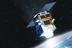
Peru’s first Earth Observation satellite was commissioned by the Peruvian government for its national space agency, CONIDA (Comisión Nacional de Investigación y Desarrollo Aeroespacial) in 2014, and constructed in a record time of less than 24 months. PerúSAT-1 features the very-high-resolution optical New AstroSat Optical Modular Instrument (NAOMI) imager designed and developed by Airbus Defence and Space. This silicon carbide optical instrument provides panchromatic images with 70 cm spatial resolution and multispectral images in up to 2 m spatial resolution. PerúSAT-1 is based on Airbus Defence and Space’s AstroBus-S platform, and captures up to 300 images covering an area of 63, 000 km2 per day.
16/09/2016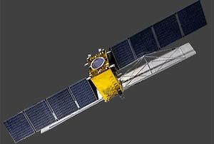
Gaofen-3 was launched into orbit on August 10, 2016 from Taiyuan Satellite Launch Center in China. It was developed by the China Center for Resources Satellite Data and Application (CRESDA). Gaofen-3 orbits at 755 km above the earth's surface and is fitted with a Synthetic Aperture Radar (SAR) sensor that makes use of microwaves in the electromagnetic C-band. The spatial resolution of its imagery ranges between 1 and 500 meters. The data collected by Gaofen-3 helps monitor climatological disasters (droughts) and hydrological disasters (landslides and floods).
read more10/08/2016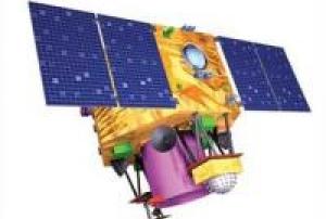
Cartosat-2 is an advanced remote sensing satellite with a single panchromatic camera (PAN) capable of providing scene-specific spot imageries for cartographic applications. The camera is designed to provide imageries with better than one meter spatial resolution and a swath of 10 km. The satellite will have high agility with capability to steer along and across the track up to + 45 degrees. It will be placed in a sun-synchronous polar orbit at an altitude of 630 km. It will have a revisit period of four days. The re-visit can be improved to one day with suitable orbit manoeuvres.
Several new technologies like two mirror on axis single camera, Carbon Fabric Reinforced Plastic based electro optic structure, lightweight, large size mirrors, JPEG like data compression, advanced solid state recorder, high-torque reaction wheels and high performance star sensors are being employed in Cartosat-2.
Beginning with Cartosat 2C, a Multi-spectral camera was added and…
read more22/06/2016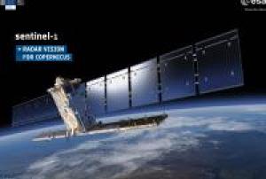 read more
Sentinel-1 is a two satellite constellation with the prime objectives of land and ocean monitoring. The goal of the mission is to provide C-Band Synthetic Aperture Radar (SAR) data continuity following the retirement of ERS-2 and the end of the Envisat mission.
To accomplish this the satellites carry a C-SAR sensor, which offers medium and high resolution imaging in all weather conditiions. The C-SAR is capable of obtaining night imagery and detecting small movement on the ground, which makes it useful for land and sea monitoring.
Sentinel-1 will work in a pre-programmed operation mode to avoid conflicts and to produce a consistent long-term data archive built for applications based on long time series.
The mission benefits numerous services. For example, services that relate to the monitoring of Arctic sea-ice extent, routine sea-ice mapping, surveillance of the marine environment, including oil-spill monitoring and ship detection for maritime security,…25/04/2016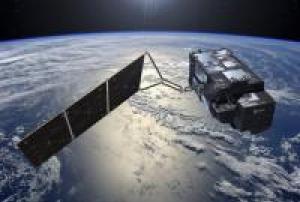
Carrying a suite of cutting-edge instruments, Sentinel-3 will measure systematically Earth’s oceans, land, ice and atmosphere to monitor and understand large-scale global dynamics. It will provide essential information in near-real time for ocean and weather forecasting.
read more
The mission is based on two identical satellites orbiting in constellation for optimum global coverage and data delivery. For example, with a swath width of 1270 km, the ocean and land colour instrument will provide global coverage every two days. Sentinel-3A was launched on 16 February 2016.
With a focus towards our oceans, Sentinel-3 measures the temperature, colour and height of the sea surface as well as the thickness of sea ice. These measurements will be used, for example, to monitor changes in sea level, marine pollution and biological productivity.
Over land, this innovative mission will provide a bigger picture by monitoring wildfires, mapping the way land is used, provide indices of…16/02/2016
Today, weather satellites scan the whole Earth, meaning not a single tropical storm or severe weather system goes undetected. The early detection and warnings they provide have saved thousands of lives.
Meteosat data is of unique value to nowcasting of high impact weather in support of safety of life and property.
It has been shown to improve weather forecasts and severe weather warnings which, in turn helps limit damage to property and benefits industry e.g. transport, agriculture and energy.
Meteosat-11 is the prime operational geostationary satellite, positioned at 0 degrees and providing full disc imagery every 15 minutes. It also provides Search and Rescue monitoring and Data Collection Platform relay service.Instruments:
read more
GERB (Geostationary Earth Radiation Budget)
MSG Comms (Communications Package for MSG)
SEVIRI (Spinning Enhanced Visible and Infra-Red Imager)
16/07/2015
Term Parents
UN-SPIDER Regional Support Offices with hazard-specific expertise
![]()