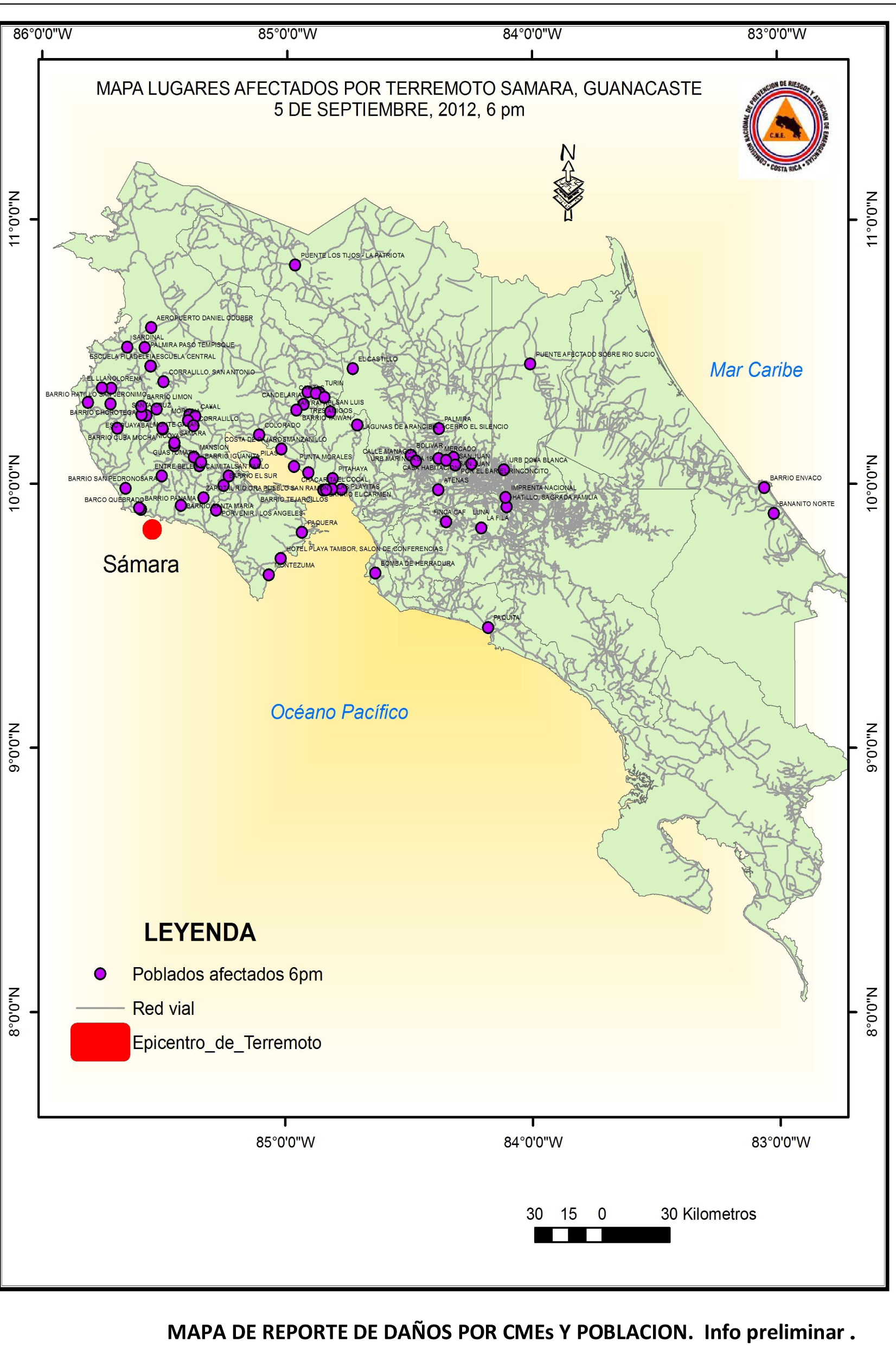
 The coast of Costa Rica was struck on 5 September 2012 at 08:42 a.m. local time by a major earthquake with the epicenter located in the Nicoya Península. The United States Geological Survey (USGS) indicated a magnitude of 7.6. on the Richter scale. The epicenter is located very close to the surface, approximately in a depth of 10 kilometres. A tsunami warning was in effect for Costa Rica, Panama and Nicaragua, issued by the Pacific Tsunami Warning Centre but it was cancelled two and a half hours later based on data gathered from tide gauges. A map displaying the epicenter was provided by Geographer Douglas Salgado from the National Risk Prevention and Emergency Response Commission of Costa Rica (CNE).
UN-SPIDER's Regional Support Office (RSO) in Panama has tasked NASA's EO-1 satellite to acquire satellite imagery of the areas affected by the earthquake. UN-SPIDER has additionally contacted its RSO in Colombia (IGAC) and CONAE in Argentina.
In its most recent impact assessment (6 Sept. 2012; 18:00 PM local time), CNE indicates that 163 communities were affected; mostly in terms of damage to public and private infrastructure including life-lines. Nine temporary shelters have been set up and are hosting 339 persons.
More information:
Pacific Tsunami Warning Centre
National Risk Prevention and Emergency Response Commission of Costa Rica (CNE)