Indonesia

country taxonomy block

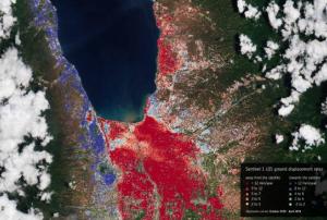
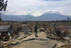
In September 2018, the Indonesian island of Sulawesi was hit by a 7.5 magnitude earthquake. The impact, combined with the tsunami, landslides, and soil liquefaction that followed, “... claimed well over 2000 lives, destroyed homes, buildings, infrastructure and farmland in several districts,” according to the European Space Agency (ESA)

Ten months later, response efforts are now moving into the recovery and rebuilding phase, with satellite information offering important insights to local officials. For example, through a collaboration with the Asian Development Bank, ESA is providing Indonesian officials with hazard-mapping tools derived from Earth observation data, and training in how to most effectively use these resources. “The main purpose of sharing these information products is to help the…

more
Publishing date 06/08/2019

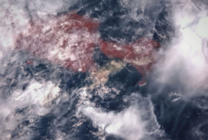
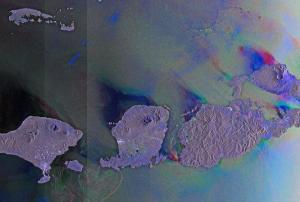
A team of scientists, led by the University of Bristol’s School of Earth Sciences, has used Sentinel-1 satellite imagery to analyze the ground deformation of the Agung volcano in Bali, Indonesia, and explain why it erupted in November 2017 after 50 years of dormancy.

The previous eruption of Agung in 1963 killed nearly 2,000 people and was followed by a small eruption of its neighbouring volcano, Batur. Because this past event was among the deadliest volcanic eruptions of the 20th century, the scientific community deployed a great effort into the monitoring and understanding of the re-awakening of Agung.

Two months before the eruption, a sudden increase in the number of small earthquakes occurred around the volcano. The researchers realized satellite images could reveal the volcanic ground deformation that occurred prior to the 2017 eruption. From satellite imagery and 3D numerical models…

more
Publishing date 06/03/2019

Following a tsunami that hit coastal areas around the Sunda strait between the Indonesian islands of Sumatra and Java on 22 December, the United Nations Office for Outer Space Affairs (UNOOSA) has requested the activation of the International Charter Space and Major Disasters on behalf of the National Institute of Aeronautics and Space (LAPAN) of Indonesia. LAPAN is a UN-SPIDER Regional Support Office (RSO).

According to the Indonesian National Disaster Management Agency (BNPB), 281 people have been killed, 1,016 people injured, and an estimated 11,700 people displaced as a result of the tsunami. The waves struck after volcanic activity from the Anak Krakatau volcano likely set off undersea landslides than in turn caused the surges.

more
Publishing date 24/12/2018
Regional Support Offices mentioned:

The International Charter “Space and Major Disasters” and the Copernicus Emergency Management Service Mapping have been activated on 29 September after a 7.5 magnitude earthquake in the central Indonesian Island of Sulawesi.

At least 844 people have been killed and 64,000 displaced according to reports.

The cities of Palu and Donggala are the worst affected areas by the earthquake and a tsunami with waves as high as six metres.

The International Charter was activated by the Asian Disaster Reduction Centre (ADRC) on behalf of the Indonesian National Institute of Aeronautics and Space (LAPAN). Both institutions are UN-SPIDER Regional Support Offices (RSO). Mapping products made available under the activation are available on the…

more
Publishing date 01/10/2018

The International Charter “Space and Major Disasters” has been activated on 6 August after a 6.9 magnitude earthquake struck the island of Lombok, Indonesia.

At least 98 people have been killed and 10,000 have been evacuated after a 6.9 magnitude earthquake struck off the coast of Lombok, destroying buildings and cutting power. The neighbouring islands of Bali and Gili Islands have also been affected. The quake struck at a depth of 13 km, according to GEOFON Program Potsdam, and tsunami warnings were triggered. Search and rescue efforts are also being affected by dangerous aftershocks, with over 130 having been recorded since the initial earthquake.

The International Charter activation was requested by the Asian Disaster Reduction Center (ADRC) on behalf of the Indonesian National Institute of Aeronautics and Space (…

more
Publishing date 07/08/2018

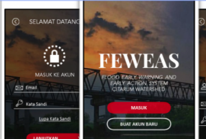
A new mobile phone application provides early warning and early action information related to the Citarum River Basin in Indonesia. FEWEAS Citarum can be downloaded for free on Android and iOS phones and is expected to help the authorities with the mitigation and disaster risk reduction around the area of the Citarum River Basin in Indonesia. The app is an initiative of the Bandung Institute of Technology (ITB) research team in collaboration with the International Federation of Red Cross and Red Crescent Societies (IFRC), the Indonesian Red Cross (PMI) and Zurich Insurance Indonesia (ZII).

Indonesia is known as one of the countries that is more prone to flooding disasters primarily due to factors such as the country’s topographic condition and geographical location, prolonged and intense rainfall, and human activities. In particular, the Citarum River Basin in Indonesia…

more
Publishing date 14/12/2017

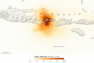
Authorities in Bali, Indonesia have ordered residents living near the Mount Agung volcano to evacuate the area amidst warnings from emergency agencies of a potential major eruption. Indonesia’s advanced hazard early warning and monitoring system, InAWARE, has helped officials anticipate impacts to populated areas and develop evacuation and response plans. However, for the most part, clear predictions for volcanic eruptions remain a difficult task.

Indonesia is located on the western rim of a seismically and volcanically active "Ring of Fire" that traces an outline around the Pacific Basin from New…

more
Publishing date 30/11/2017

The International Charter Space and Major Disasters was activated on 7 December 2016 due to a 6.5 earthquake in Indonesia. The Asian Disaster Reduction Center (ADRC) on behalf of LAPAN requested the activation. The most affected area was the Pidie Jaya district where damage was reported in approximately 250 buildings leaving several thousand people homeless. The number of victims is 102; however the Indonesia Disaster Agency said that the figure could increase as the recovery operations continue. The country’s president ordered the mobilization of troops, mechanical diggers and medical staff to support the rescue activities.

CNN reported that although no tsunami warning has been issued many people have left their homes in coastal areas because of the devastation left by the 2004 earthquake and tsunami. This is the second major tremor in Indonesia during 2016. The country suffers from strong quakes due to its position over the Ring of Fire. For more information from this…

more
Publishing date 09/12/2016
Regional Support Offices mentioned:

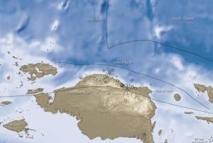
Geologist from the Australian National University (ANU) documented how the Banda Detachment fault in eastern Indonesia formed and works. This finding will help to evaluate the dangers of future tsunamis in the area that is part of the Pacific Ring of Fire, known for frequent earthquakes and volcanic eruptions.

Dr Jonathan Pownall, leader of the research, confirmed that “a 7km-deep abyss beneath the Banda Sea off eastern Indonesia was formed by extension along what might be Earth’s largest-identified exposed fault plane.”

ANU researchers worked together with Royal Holloway University of London experts analyzing high-resolution maps of the Banda Sea floor and found rocks flooring the seas are cut by hundreds of straight parallel scars. The marks show that the missing crust is bigger than a country like Tasmania or Belgium and it was torn apart by 120 km of extension along a detachment fault which formed the ocean-floor depression.

The findings will…

more
Publishing date 06/12/2016

So far, more than two million hectares of Indonesian forest area have been lost due to the forest fires that broke out on 21 June 2015. The National Space and Aviation Agency of Indonesia (LAPAN) expects losses to grow, as large forest areas and peat lands, especially in Kalimantan and Sumatra, are still affected by fires.   

Parwati Sofan, a senior official in LAPAN, stated at a press conference which was held at the Natural Disaster Mitigation Agency headquarters in Central Jakarta on 30 October 2015 that “Even though the satellite has helped us [collect the data], bear in mind that it cannot scan the forest areas that are covered in thick haze and clouds (…). We expect the size of burnt area to increase as the data collection is still underway. We will update the data on the burnt area every ten days."

Meanwhile, a German research…

more
Publishing date 09/11/2015
Regional Support Offices mentioned:

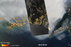
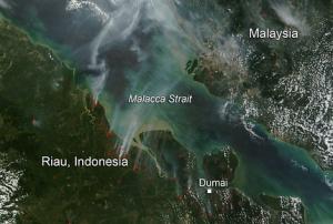
Since weeks Indonesia experiences severe forest fires in Sumatra and Kalimantan, Indonesia's half of Borneo island. Social Minister Khofifah Indar Parawansa officially confirmed the death of 19 people, as a cause of the effects of the fire haze. Due to heavy rainfall within the last days, the number of fire hot spots decreased from 1.578 to 291 on 28 October. 

Pollution levels advanced from "unhealthy" to "moderate" in Riau province on Sumatra island. Overall, more than half a million Indonesians suffer from the effects of the haze. This year’s fires had been worsened by El Niño, which further caused severe dryness in Indonesia. 

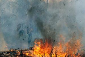
In the past, Indonesia had been impacted by several fires due to the common practice of "slash and burn agriculture", in which rainforest is burned to clear the ground for the growing of crops, like oil palm and acacia pulp, and the grazing of animals. Often fires smolder under the surface of Indonesia, continuing for a long time…

more
Publishing date 29/10/2015

The Indonesia Regional Support Office of UNSPIDER performed the following activities in September 2015:

1.  LAPAN support emergency quick response for land fires in Sumatera and Kalimantan. Since August 2015 land fires is occuring in Sumatera and Kalimantan. There are 6 provinces that have high density of hotspot analyzed from satellite remote sensing data i.e. Riau, Jambi, South of Sumatera, West Kalimantan, Central Kalimantan, and South Kalimantan. Using Terra/Aqua - MODIS and SNPP-VIIRS data that aquired from LAPAN's ground station in Pare-pare South Sulawesi and Rumpin West Java, we support distribution of hotspot and smoke haze daily, three times (morning, afternoon, night) for the 6 provinces. We also provide land/forest fire information using medium to high spasial resolution (Landsat-8, SPOT6/7) that also aquired from LAPAN ground station in Pare-pare. Dissemination of the land/forest fire information is done by email and group of…

more
Publishing date 13/10/2015
Regional Support Offices mentioned:

LAPAN, UN-SPIDER Regional Support Office, has been contributing to the mitigation process of the impact caused by the Mt. Sinabung and Mt. Raung volcanoes in Indonesia.

Mt. Sinabung, in North Sumatera, has been erupting since the middle-end of 2013 and Mt. Raung, in East Java, has been erupting since the end of June 2015. Until now, both volcanoes still show activity to the point of releasing volcanic ashes into the atmosphere that disrupt social-economic activities and interfere the air transportation.

In this incident, LAPAN contributed to the mitigation efforts which were coordinated by the Indonesian Board of Disaster Management (

more
Publishing date 06/08/2015
Regional Support Offices mentioned:

The Indonesian National Institute of Aeronautics and Space (LAPAN), UN-SPIDER’s Regional Support Office, has stated that Indonesia would face in 2015 the worst drought in the past five years, which would affect 80 per cent of the country’s territory, except for Kalimantan and Sumatra. 

This hazard is caused by the "El Niño" weather phenomenon, an anomaly in sea surface temperatures in the Pacific Ocean. It has served as basis for the scientists to determine the strength of the upcoming event.

This phenomenon will have a negative impact on agricultural activity, which is already being felt by farmers in the area of West Java, where almost 20 regencies are…

more
Publishing date 30/07/2015
Regional Support Offices mentioned:

On Monday, Fujitsu Limited and PT. Fujitsu Indonesia announced the completion of a participatory disaster information-sharing system, created for Jakarta’s Regional Disaster Management Agency, BPBD DKI. The smartphone application, which lets residents share disaster information, will be ready to go this month.

The app receives real time information from individuals as well as from BPBD DKI, Jakartas Disaster Information Management System, to which it is linked. People can upload pictures and comments, which the app will assign to their locations, using the associated GPS data. Consolidating all information, the application can plot a single map, showing rainfall amounts and river levels. In case of a disaster, it also sends out warnings to all smartphones that have the app installed.

Since this system doesn’t need an advanced network of monitoring equipment, it is relatively easy to deploy and therefore also of high interest for other concerned countries.…

more
Publishing date 25/03/2015

An early warning system for landslides will be installed in vulnerable areas in Indonesia, said the head of the Indonesian National Agency for Disaster Management (BNPB), Syamsul Maarif.

The installation of the system was ordered by Indonesian President Joko Widodo, following the landslide in Central Java that killed at least 82 people on Friday December 12, 2014.

In order to implement the early warning system for landslides, BNPB will cooperate with experts and officials from universities, the Ministry of Research, Technology and High Education, and the Agency for the Assessment and Application of Technology, said Maarif. Moreover, the government will also conduct trainings for those living in landslide-prone areas as well as prioritise the relocation of people living in the danger zone.

Publishing date 24/12/2014

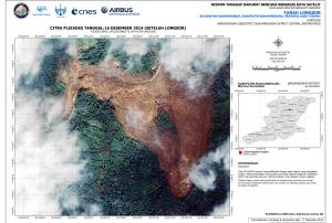
The International Charter: Space and Major Disasters was activated on 15 December 2014 by the Asia Disaster Reduction Center (ADRC) on behalf of Indonesian National Institute of Aeronautics and Space (LAPAN) in order to obtain satellite-based emergency maps. LAPAN will also serve as the project manager for this activation.

Heavy rain had caused a deadly landslide in Indonesia on 12 December 2014, which buried Jemblung Village. 64 people have died, and another forty more are unaccounted for and may still be buried. Currently over a thousand people are working to search for any other survivors.

The provided maps are available on the International Charter's website.

more
Publishing date 19/12/2014
Regional Support Offices mentioned:

Following a memorandum of understanding of 6 October, the China National Space Administration (CNSA) and the Indonesian Maritime Security Coordinating Board (IMSCB) have signed an agreement on the access to Chinese remote-sensing data.

The negotiated agreement allows the transmission of CNSA remote sensing information to IMSCB ground receiving stations, which are responsible for the Indonesian archipelago's security. The arrangement is intended to improve IMSCB's early-warning capacity and to enhance disaster relief and response and maritime law enforcement.

Chinese remote sensing technologies will deliver valuable data to Indonesia. In particular, space-based information will be useful for maritime surveillance, topography, marine resource management, and environmental monitoring.

more
Publishing date 20/10/2014

GFW-Fires is a new dynamic online platform for forest monitoring and fire alert system covering Southeast Asia by providing near-real time information and high-resolution satellite images. Thanks to this tool, fires can be precisely pinpointed in time and space and the impact of each one can be accurately measured and mapped, empowering people to better combat forest fires before they burn out of control.

Global Forest Watch Fires (GFW-Fires) was launched on 22 July in Jakarta, Indonesia, as the outcome of a partnership between World Resources Institute, DigitalGlobe, the Indonesian government, Google and Esri. GFW-Fires features near real-time satellite images from DigitalGlobe, fire alerts from NASA, a text messaging alert system, mapping of burn scars from Google Earth Engine, wind direction and air quality data, land-use and concession maps.

As a part of its Seeing a Better World™ Program, DigitalGlobe has tasked its five satellites to provide near real-time…

more
Publishing date 31/07/2014

Firefighters and field officers in Bekasi, Indonesia, can now collect first hand data and share real-time information by using the newly deployed GIS data capture application.

This application enhances the awareness of the firemen about the in-situ situation and facilitates the department heads’ decision making on deployment. As Futuregov Asia reports, it "also allows users to edit, measure, query and display spatial data."

"The Department is responsible for protecting and securing the safety of its citizens. Besides fire control missions, the Department also has to prevent any kind of disasters, maintain infrastructures and provide related counsels in a timely way," still according to Futuregov Asia.

more
Publishing date 22/05/2014

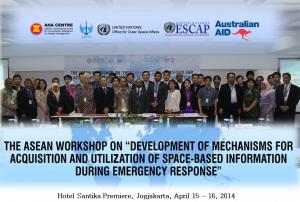
UN-SPIDER and its Regional Support Office in Indonesia, LAPAN, jointly conducted the ASEAN workshop "Development of mechanisms for acquisition and utilisation of space-based information during emergency response" from 15 to 16 April 2014 in Jogjakarta, Indonesia. The workshop was furthermore supported by the AHA Centre, ESCAP and Australian AID.

The workshop achieved the following four objectives

  • Identifying requirements and criteria to respond to major disasters by taking effective advantage of international mechanisms (mainly International Charter and Sentinel Asia) that provide space-based information during emergencies;
  • Leverage on UN and other…
more
Publishing date 16/04/2014

Indonesia recently launched InAWARE, an advanced hazard early warning and monitoring system in order to enhance its emergency response capacities. The system was developed by Indonesia’s national disaster management agency (BNPB) and supported by the United States Agency for International Development Office of Foreign Disaster Assistance.

The website FutureGov elaborates: "InAWARE is based on the Pacific Disaster Centre’s (PDC) DisasterAWARE platform which consolidates hazard information and alerts from various national and international sources. The system also facilitates information sharing within and between Indonesia’s national and provincial disaster management stakeholder agencies to help government authorities arrive at well-informed decisions during times of natural calamities."

more
Publishing date 01/04/2014

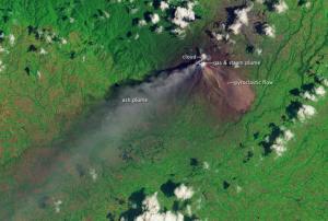
In January 2014, Mount Sinabung on Indonesia's Sumatra island has exploded intensively and repeatedly, forcing thousands of residents to vacate their houses. While eruptions have weakened and are less violent now, the volcanic activity of Mount Sinabung is ongoing.

NASA's Landsat satellite has captured the ash plume and pyroclastic flow from the volcano on 6 March 2014. The false-color image clearly shows the pyroclastic flow in red on the eastern flank of Sinabung.

Publishing date 12/03/2014

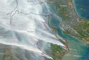
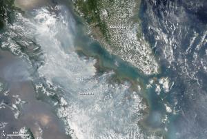
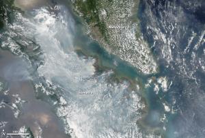
Since February, many fires have broken out on the Sumatra peninsula in Indonesia, as UN-SPIDER reported; many of them were deliberately set in order to clean the land. Although this is illegal, it is still a common practice in the region. NASA’s satellites Terra and Aqua monitor these fires from Space.

Since the fires have spread widely in peat forests, the produced smoke is denser than normal. Also at risk is the Giam Siak Kecil-Bukit Batu biosphere reserve that contains a wide range of animal and plant species.

Normally, fires occur in Indonesia during the dry season between April and October. This year the fire season started earlier and has already forced Indonesia to declare a state of emergency because of bad air conditions.

more
Publishing date 10/03/2014

NASA’s satellites detected over 500 hotspots of forest, plantation and peatland fires across the island of Sumatra, Indonesia. In Riau Province alone, the authorities located over 380 hotspots through satellite imagery from NASA's Terra and Aqua missions.

The scarcity of rainfall contributes to the wide spread of agricultural fires, once set by farmers to clear the land. On 15 February, the number of hotspots detected by the satellites doubled from 350 to 700 as compared to the day before.

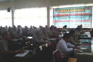
On February 11, the National Disaster Mitigation Agency (BNPB) organized a meeting in order to coordinate governmental activities to fight the fires, haze and drought in the region. The government agreed on taking ground-based and aerial measures, which include military forces on the land and even the implementation of cloud seeding technology. 

more
Publishing date 25/02/2014