South Africa

country taxonomy block

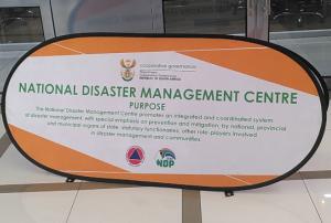
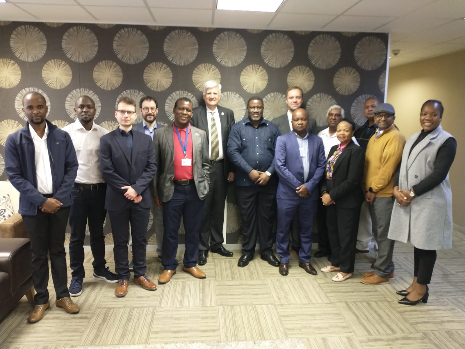
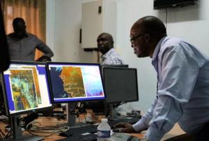
UN-SPIDER, the National Disaster Management Centre of South Africa (NDMC), and the Centre for Remote Sensing of Land Surfaces (ZFL) of the University of Bonn organized a three-day interinstitutional workshop in Pretoria, from 9 to 11 May 2023. The “Space-based Solutions for floods and droughts in Southern Africa" workshop was part of UN-SPIDER's mission to South Africa and contributes to the efforts conducted by the NDMC and UN-SPIDER in the topics of disaster risk reduction, preparedness, and early warning systems.

Workshop opening remarks
Workshop…
more
Publishing date 11/05/2023

Scientists have been awarded £2 million to develop ways of alerting communities in South Africa, Zambia, and Mozambique to extreme weather. The project, a collaboration between researchers at the University of Leeds and the National Centre for Atmospheric Science, will focus on providing effective warnings to vulnerable communities that are more likely to be impacted by extreme weather. This includes people living in informal settlements close to rivers and those with disabilities who require early warnings to protect themselves and their property.

Severe storms in Southern Africa pose a risk to hundreds of thousands of people every year. In 2022, it was estimated that over 15,000 people were affected by floods in Zambia, and in April of the same year, more than 400 people were killed by floods in Durban, South Africa. Furthermore, around 200,000 families were displaced during Mozambique's last rain season. Intense rainfall events are expected to increase in the coming…

more
Publishing date 01/04/2023

The National Centre for Space Studies (CNES) and the South African National Space Agency (SANSA) have signed an agreement that paths the way for future joint space projects between the two countries. The agreement was signed in the presence of France’s Minister of Europe and Foreign Affairs Jean-Yves Le Drian, and South Africa’s Minister of International Relations and Cooperation, Lindiwe Sisulu.

The agreement targets the following areas of cooperation: space operations, space science, Earth observation, telecommunications, applications, research and technology. The two agencies will also coordinate on international regulatory matters, the Space Climate Observatory (SCO), the International Charter “Space and Major Disasters” and the training of engineers.

more
Publishing date 26/04/2019

The United Nations Office for Outer Space Affairs, through its UN-SPIDER programme, has activated the International Charter "Space and Major Disasters" on behalf of the National Disaster Management Centre (NDC) of South Africa for the recent floods and mudslides in the country. The German Aerospace Centre (DLR) is acting as project manager for this activation.

Heavy rainfall has been affecting eastern South Africa over the past few days, causing floods and landslides in Durban and the surrounding KwaZulu-Natal province. According to media reports, around 70 people have been killed and some 1,000 displaced. Buildings were severely damaged as flood waters washed through areas at high speed, closing two universities, schools and wider…

more
Publishing date 26/04/2019
Participants at EvIDENz stakeholder workshop in Pretoria, South Africa. , Participants at EvIDENz stakeholder workshop in Pretoria, South Africa. , Participants at the technical training as part of the workshop.

Experts from the United Nations Platform for Space-based Information for Disaster Management and Emergency Response (UN-SPIDER), the United Nations University Institute for Environment and Human Security (UNU-EHS), the Centre for Remote Sensing of Land Surfaces (ZFL) of the University of Bonn and the Disaster Management Training and Education Centre for Africa (DiMTEC) at the University of the Free State (UFS) South Africa have met in South Africa as part of their joint project “Earth-observation-based Information Products for Drought Risk on a National Basis” (EvIDENz). The workshop, which takes place 4 to 8 June, brings together stakeholders, key decision makers, operational technical audiences from the rural development and agricultural sectors, space agencies, research and technology entities as well as members of water, sanitation, economic and disaster management communities.

The aim of the EvIDENz stakeholder workshop is to make decision makers…

more
Publishing date 04/06/2018

The project on Earth Observation Based Information Products for Drought Risk Reduction at the National Level (EvIDENz) conducted a workshop from 21 to 22 September at the United Nations Campus in Bonn to present its mid-term results. The event brought together project partners, scientists, policy-makers, practitioners and representatives of governmental institutions.

During the workshop, participants discussed information, knowledge and methods related to drought risk assessment and reduction strategies using the example of case studies in South Africa and Ukraine. More specifically, they focused on:

  • Assessing agricultural drought hazard and vulnerability to support the Sendai Framework for Disaster Risk Reduction 2015-2030 (Sendai Framework).
  • Quantifying drought risk to support assessment of the Sendai Framework targets “people affected” and “economic loss” and related indicators.

The workshop participants, which included experts from…

more
Publishing date 28/09/2017

Airbus Defence and Space (ADS) has signed an agreement with the South African National Space Agency’s (SANSA), which allows the African institution to access and download imagery captured by SPOT 6 and SPOT 7 satellites. Additionally, a Direct Receiving Station was installed at SANSA’s facilities in order to cover the entire country (1 221 000 km²) at a very high resolution.

SPOT (Satellite Pour l’Observation de la Terre) 6 and 7 satellites are 1.5-metre-resolution optical imaging Earth observation artifacts developed by EADS Astrium and launched in 2012 and 2014, respectively. They are capable of collecting up to three million km² per day and thus obtain the first coverage of South Africa in just 3 months. They can assist with environmental monitoring, weather forecasting or urban planning, and the aim of the contract is to enhance the livelihoods of communities across Africa. 

ADS’ and SANSA’s cooperation…

more
Publishing date 25/08/2015

Last 16 of July the UK Space Agency (UKSA) and the South African Space Agency (SANSA) signed a Memorandum of Understanding (MoU) to increase collaboration in scientific projects related to space.

Both institutions will share infrastructure and knowledge in fields including applications for weather monitoring, climate change and satellite information. Areas covered in this document include making UKSA satellite data accessible to SADC users and SANSA being access point for NovaSar data in South Africa.

"I am delighted to sign this MoU on behalf of the UK Space Agency, which reflects the growing strength in collaboration in cutting edge science between our two countries. South Africa, and in particular SANSA, are key partners for the UK, with a range of new activities linking the UK and South African space industry partners under the UK’s International Partnership Space Program", stated Sir Mark Walport, the UK Government Chief Scientific Adviser.…

more
Publishing date 28/07/2015

South Africa will launch an Earth observation satellite in 2019, as the head of the South African National Space Agency Sansa, Sandile Malinge, announced to a newspaper.

In doing so, South Africa would like to have their own data readily available instead of relying on international satellites. According to the newspaper Mail & Guardian, Sansa buys Spot-6 and Spot-7 data – used by entities such as the departments of human settlements, agriculture, forestry and fisheries and Statistics South Africa – for about R35 million a year - that is almost 3 million USD.

The new satellite, EO-Sat1, will be part of the African Resource Management Constellation, a network of African nations that plan on launching a common Earth observation satellite system. South Africa committed to contributing at least one satellite to the constellation in 2009.

more
Publishing date 07/04/2015

A UNOOSA/UN-SPIDER expert participated in the 4th meeting of the CEOS Working Group on Capacity Building and Data Democracy (WGCapD) from 18 to 20 March 2015 in Pretoria, South Africa. CEOS is the Commitee on Earth Observation Satellites. UNOOSA is an associate member of CEOS and an active participant in the Working Group.

The overall objective of the WGCapD is building capacity for the effective use of Earth Observation data as well as providing wider and easier access to those data. In its fourth meeting, the participants discussed issues such as the status of main projects and courses. A specific session was dedicated to the collaboration with GEO, the Group on Earth Observations. UNOOSA's Lorant Czaran presented the Offices's various capacity building activities including UN-SPIDER activities such as Technical Advisory Missions and training efforts. Find…

more
Publishing date 24/03/2015

On 27 January, the QuickBird Earth Observation satellite re-entered Earth’s atmosphere after 13 years in orbit. It was a satellite of the imagery provider DigitalGlobe and the company's oldest satellite.

DigitalGlobe stated in a press release: "QuickBird made more than 70,000 trips around the planet, capturing some 636 million square kilometers of high-resolution earth imagery that contributed to humanity’s understanding of our changing planet."

The last image captured by QuickBird was a shot of Port Elizabeth, South Africa, on 17 December 2014 right before its imager was turned off. The satellite’s orbit at that time was approximately 300 kilometers, resulting in an image with a ground resolution of 41 cm.

Publishing date 18/02/2015

The South African government has increased investing in space technology in order to build capacities within the country as well as to attract commercial space interests. As a result of this the South African National Space Agency SANSA has contracted Spaceteq, a division of the state run aerospace and defense company Denel Dynamics, to develop the new high resolution multispectral imaging earth observation satellite, EA-SAT-1.

Data from EA-SAT-1 will be used for resource management, urban planning, development, safety, security, and disaster risk management. Plans by the South African government are in place to increase access to this data.

Publishing date 16/07/2014

Supplier of innovative small and medium-sized satellite systems SunSpace says its Sumbandila satellite has paved the way for further research and development into the requirements of a future, locally built, communications satellite over which the South African National Defence Force (SANDF) could have total control. SunSpace executive director Ron Olivier says the Sumbandila satellite proves that a locally designed and built satellite can provide more up-to-date images on conflict and disaster than Google Earth, where images in lesser-known areas are up to 30 years old. Buying images from international suppliers also holds the disadvantages of price escalations and the unavailability of images of certain areas.

The SANDF would be able to use this satellite technology to obtain real-time terrain analysis for peace operations in unknown territories and spread spectrum analyses, as well as use the platform for intermittent highly secure communications in peace operations…

more
Publishing date 24/02/2012
South Africa’s second satellite, SumbandilaSat, is no longer fulfilling its main purpose due to technical problems and is essentially beyond repair, its maker SunSpace says. Ron Olivier, head of Business Development at SunSpace, told defenceWeb that although contact can still be made with the satellite, it cannot capture images and is thus “not fulfilling its main purpose”. He said that chances of repairing the satellite are virtually zero and that SunSpace has moved on to other projects. SumbandilaSat was damaged during a solar storm in the June last year. The power supply to SumbandilaSat’s onboard computer stopped working and the satellite stopped sending back images. SumbandilaSat has been damaged by solar radiation before. Shortly after its launch in September 2009, radiation caused a power distribution failure that rendered the Z-axis and Y-axis wheel permanently inoperable, meaning that the craft tumbles as it orbits. It also lost the ability to capture imagery from the green… more
Publishing date 31/01/2012

Malareo is focusing to develop technology and implement earth observation data that contributes to the fight against malaria in southern Africa. MALAREO compiles a mixed European-African consortium that combines years of experience in malaria control with GMES Earth Observation (EO) capacity.
The project aims to build the fundaments of a malaria EO monitoring cell that will support a more efficient, effective and wider malaria vector control programme in South-Africa, Swaziland and Mozambique and at the same time contributes to research on malaria and EO. The consortium is well-equipped and highly skilled to achieve the MALAREO project objectives. It is a good mixture of SME’s, universities and administrations uniting remote sensing experts with epidemiology experts and public health specialists from 3 European partners and three Southern African partners. Project partners are the Medical Research Council and the University of KwaZulu-Natal from S-Africa, the National…

more
Publishing date 15/04/2011

Fulfilling a mandate from the ENHANS International Workshop on Extreme Natural Hazards and Disaster Risk in Africa which was held in Pretoria, South Africa, in January 2011, a comprehensive recommendations document was prepared by a working group. Based on a summary of specific needs, challenges and achievements regarding natural hazards on the African continent, detailed recommendations are given in order to promote interdisciplinary science and education and to improve monitoring and prediction of extreme natural hazards for the benefit of society. In particular, it is proposed to set up the African Centre for Natural Hazards, Disaster Risk Analysis and Management (ACHADEME) as a network of existing research and educational centers, in cooperation with International Council of Scientific Unions (ICSU) bodies, United Nations agencies and other international organizations.

more
Publishing date 01/04/2011

South Africa was ill-prepared for the heavy summer rains that have caused flooding in eight of the country’s nine provinces since mid-December, according to disaster management experts and officials, who argue that much of the damage and loss of life could have been avoided by better planning and more investment in disaster management. With dams overflowing and rivers bursting their banks, the government declared a state of disaster in 33 municipalities on 21 January. By 26 January, as rain continued to fall in many parts of the country, the National Disaster Management Centre estimated that 85 lives had been lost and at least 13,000 houses damaged by the floods, while the Agricultural Ministry estimated the sector had suffered losses of over US$280 million. According to the director of the African Centre for Disaster Studies at North West University, Dewald van Niekerk, the flooding has highlighted weaknesses in South Africa’s disaster preparedness. "Our Disaster…

more
Publishing date 04/02/2011

The Extreme Natural Hazards And Societal Implications (ENHANS) International Workshop on Extreme Natural Hazards and Disaster Risk in Africa was held in Pretoria, South Africa, from 17 to 20 January 2011. The Workshop was hosted by the Aon Benfield Natural Hazard Centre, University of Pretoria, and sponsored by ENHANS/International Council for Science (ICSU), Global Ocean Observing System (GOOS), and the United Nations Educational, Scientific and Cultural Organization (UNESCO). Important goals of the ENHANS project are to improve the understanding of critical phenomena associated with extreme natural events and to analyze impacts of the natural hazards on sustainable development of society. Furthermore the project aims at establishing links and networks with the international organizations involved in research on extreme natural hazards and their societal implications by setting up a consortium of experts of ICSU Unions and several major intergovernmental and multi-national…

more
Publishing date 04/02/2011

South Africa's new national space agency will coordinate the country's major space projects, promote space science research, develop related engineering and technological capacity, and devise and implement a national space programme.

South Africa has some of the best space infrastructure in Africa, and is already heading some notable space projects, including Africa's bid to host the Square Kilometre Array, the Southern African Large Telescope, and the SumbandilaSat satellite.

The South African Space Agency (Sansa) will become the umbrella body that coordinates all these projects, while integrating the country's existing science and technology institutions, such as the Satellite Applications Centre run by the Council for Scientific and Industrial Research at Hartebeesthoek, west of Pretoria.


Source: http://www.southafrica.info/about/science/space-101210.htm…

more
Publishing date 23/12/2010

South Africa: SumbandilaSat was successfully launched on 17 September at 17:55:09 CAT (Central African Time) after the launch had to be postponed twice, once due to heavy winds and the second attempt due to the fuel pressure in the feed line which was four times too low and thus caused the fueling process to take too long to be completed in time for launch.

The satellite was released from the rocket while over the Antarctic and accessed by the ground station at the Stellenbosch University ten minutes later when the first command was sent to 'wake up' the satellites. Despite the low elevation orbit of less than 10 degrees SumbandilaSat responded well with its first telemetry. (Souce: GIS Development )

For further information please visit:
http://www.southgatearc.org/news/september2009/sumbandilasat_successfully_launched.htm
 

more
Publishing date 23/09/2009

Bidding for the construction of two ground receiver stations will be opened soon by Kamal Ewida Earth Observatory, quoted Mail & Guardian.

Kamal Ewida Earth Observatory, currently seeking a site in Egypt, is a joint project by South Africa's Council for Scientific and Industrial Research (CSIR) and Egypt's National Authority for Remote Sensing and Space Sciences.

The project will enable the rapid processing of information received from satellites monitoring Africa, in order to improve disaster relief response times to areas affected by floods, drought, and global warming.

The bulk of the project's funding is being provided by NATO's Science for Peace Programme, with the Egyptian government also providing contributions. (Source: GISDevelopment)

For further information, please visit:
http://www.africagoodnews.com/ict/egypt-sa-develop-supercomputers-to-respond-to-disasters.html

Publishing date 03/09/2009

The Advancing Information and Communication Technology for Disaster risk management in Africa (AÏDA) project aims at sharing knowledge about affordable ICT solutions in support of DRM in Africa.
In the framework of this project, the European Organisation for the Exploitation of Meteorological Satellites (EUMETSAT) is disseminating a series of products to mitigate the effects of the fire season which begins in June in South Africa. As part of the trial, the Forest Fire Association (FFA) in Nelspruit, South Africa, will use wildfire alarms developed by the South African Council for Scientific and Industrial Research (CSIR) in its operational activities to fight wildfires. If successful, this scheme could be extended to countries neighboring South Africa. (Source: EUMETSAT)

For more information visit:
http://www.eumetsat.int/Home/Main/Media/Features/711096
http://www.aidaonline.info/
 

more
Publishing date 31/07/2009

The Stakeholder Workshop on Earth observation-based information products for drought risk on a national basis (EviDENz) occurred from 4 to 8 June 2018 in Pretoria and Eastern Cape, South Africa.


Objectives and Expected Outcomes

The objective of the EvIDENz stakeholder workshop was to make decision makers and technical staff of several institutions of South Africa aware of the workflow developed by ZFL and UNU-EHS to contribute to the estimation of the impacts of droughts on crops and livestock, to understand drought risks and to discuss a methodological approach to implement the use of the workflow. In addition, the workshop was…

more
Regional Support Offices mentioned:

Space technology and its wide range of applications contribute essential information and services to many aspects of sustainable development, that is, economic and social development and environmental conservation and protection. Small satellite missions are becoming increasingly important in supporting these roles of space technology, as well as in the advancement of basic space science and technology, notably through capacity building. In 2009, the United Nations Programme on Space Applications, implemented by the Office for Outer Space Affairs, launched the Basic Space Technology Initiative (BSTI) in support of capacity-building for the development of basic space technology.

The present and fourth Symposium will be held as the United Nations/South Africa Symposium on Basic Space Technology in Stellenbosch and will focus on the African region. It is organized by the United Nations Office for Outer Space…

more
AfricaGEO Conference & Exhibition aims at facilitating interaction, discussion, collaboration and capacity building amongst participants. It will provide a platform to share the latest developments in the industry of surveying and geo-information (including remote sensing and aerial imagery) for a variety of applications in Africa, including disaster management and sustainable development. The Conference and Exhibition will include a variety of keynote talks, academic panels, workshops, tutorials and industry expos. Participants will receive academic talks about the use of geospatial data for early warning, risk management and resilience, sustainable development, remote sensing and other topics. Industry topics include disaster management, mitigation and early warning systems, smart cities and urban planning. Workshops and training sessions on the use of geospatial products are also available for participants.


more