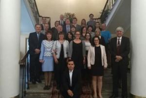
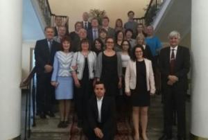
Experts from UN-SPIDER, the United Nations University Institute for Environment and Human Security (UNU-EHS), the Centre for Remote Sensing of Land Surfaces (ZFL) of the University of Bonn, and the Space Research Institute of the National Academy of Sciences of Ukraine and of the National Space Agency of Ukraine (SRI NASU-SSAU) have convened in Kiev for a stakeholder workshop in the context of their joint project “Earth-observation-based Information Products for Drought Risk on a National Basis” (EvIDENz). The event, which takes place form 14 to 16 May, brings together key decision-makers, operational technical audiences from the agricultural sector, the economic and the disaster risk reduction communities, space agencies, and research and technology entities.
The objective of the EviDENz stakeholder workshop is to introduce decision-makers and technical staff of several governmental and non-governmental institutions in Ukraine to the workflows developed by ZFL and UNU-EHS to… more
![]()
United
Nations
Ukraine
country taxonomy block
 ,
, 
Publishing date 14/05/2018
Regional Support Offices mentioned:

The project on Earth Observation Based Information Products for Drought Risk Reduction at the National Level (EvIDENz) conducted a workshop from 21 to 22 September at the United Nations Campus in Bonn to present its mid-term results. The event brought together project partners, scientists, policy-makers, practitioners and representatives of governmental institutions.
During the workshop, participants discussed information, knowledge and methods related to drought risk assessment and reduction strategies using the example of case studies in South Africa and Ukraine. More specifically, they focused on:
- Assessing agricultural drought hazard and vulnerability to support the Sendai Framework for Disaster Risk Reduction 2015-2030 (Sendai Framework).
- Quantifying drought risk to support assessment of the Sendai Framework targets “people affected” and “economic loss” and related indicators.
The workshop participants, which included experts from…
morePublishing date 28/09/2017

The partners of the EvIDENz project conducted the second stakeholder workshop entitled “Earth observation-based information products for drought risk on a national basis”. The workshop was conducted in Kyiv, Ukraine, on December 6, 2016. Partners involved in the organization of the workshop included the Space Research Institute (NASU-SSAU) of the Ukraine, the Remote Sensing Center (ZFL) of the University of Bonn, UNU-EHS, and UN-SPIDER. The workshop was attended by 15 key stakeholders of Ukraine involved in disaster risk reduction including the State Emergency Service, the Ukrainian Hydrometeorological Centre, the Institute of Agro-ecology and Environmental Management, the Ministry of Agrarian Policy and Food of Ukraine, the Institute of Agro-ecology and Natural Management, the National Centre of Management and Testing of Space Facilities, the State Water Resources Agency of Ukraine, the Ministry of Ecology and Natural Resources of Ukraine.
By bringing…
morePublishing date 13/12/2016
Regional Support Offices mentioned:
")
The Space Research Institute (SRI/NAS) in Ukraine and SSA Ukraine in cooperation with the UN-SPIDER Regional Support Office in Ukraine and Integration-Plus Ltd. have used satellite data to deliver geoinformation services for agriculture needs, including winter wheat yield preliminary forecast for 2015.
According to this preliminary yield forecast, based on satellite data as of 28 April 2015, significantly lower wheat yield compared to 2014 are expected in 2015. The yield reduction is expected to be in the range from 5% (Kyivska oblast) to 38% (Luhanska oblast). Wheat yield will be relatively low in regions that are the main wheat producers in Ukraine which can possibly lead to a significant yield reduction in wheat production on country level in 2015 compared to 2014.
For more detail, please refer to the…
morePublishing date 01/06/2015
Regional Support Offices mentioned:

When using Space technologies for disaster risk management and emergency response, it is not only important to have access to the right data and software, it is also crucial to be aware of methods that have proven to be good practices in a certain context.
UN-SPIDER's Regional Support Offices and other partners are currently working on the development of Recommended Practices on the use of space technologies for various hazards. The aim is to describe successful methods that our partners have used and refined during the work in their regions in order to make these practices available to a global audience. The practices include a descriptive part and hands-on, step-by-step instructions on how to use satellite information for various hazards, in various phases of the disaster management cycle.
While these Recommended…
morePublishing date 01/09/2014

Japan has launched two Earth Observation satellites last week to monitor environmental damage near the damaged nuclear plants in Fukushima and Chernobyl, officials said.
The two satellites, Hodoyoshi-3 and Hodoyoshi-4, have been developed by the University of Tokyo for around 300 million yen (about $2.9 million) each. They will take images of the two nuclear power plants and the surrounding environment to be combined with ground-based data including radiation levels.
"I hope that the data will help Japan and Ukraine correctly acknowledge the impact on the environment near the two plants," project leader Shinichi Nakasuka, from the University of Tokyo, said.
Publishing date 24/06/2014
 ,
, 
UN-SPIDER's network of Regional Support Offices is currently developing Recommended Practices on the use of space-based information for disaster risk management and emergency response. The practices deal with a variety of topics such as droughts, floods, agricultural monitoring or land degradation and include detailed information on the data and methodologies used as well as step-by-step instructions.
Six practices have already been submitted by Regional Support Office with others to follow. These practices will be discussed at the upcoming 5th UN-SPIDER RSO-Meeting on 13 and 14 February 2014 in Vienna, Austria, and will be disseminated through the UN-SPIDER Knowledge Portal once final.
Flood Mapping: This practice is devoted to the use of SAR satellite imagery for flood mapping. The practice shows the use of ESA NEST software for pre-processing and processing of SAR imagery using a threshold method for deriving the flood extent. QuantumGIS is used…
morePublishing date 03/02/2014
Regional Support Offices mentioned:

UN-SPIDER's Regional Support Office in the Russian Federation, EMERCOM, and the Ukrainian State Emergency Service signed on 17 December 2013 an agreement on cooperation in the area of prevention of industrial accidents, disasters and elimination of their aftermaths.
EMERCOM reported: "The Plan provides for participation of emergency rescue units of the Russian Emergencies Ministry and Ukrainian State Emergency Service in response operations in the Russian Federation and Ukraine, as well as exchange of experience in monitoring and forecasting natural and industrial emergency situations.
In addition, within the framework of the agreement the parties will work out organization of mutual notification if there is a risk of emergencies or in case of emergency."
morePublishing date 19/12/2013
Regional Support Offices mentioned:

Representatives of the UN-SPIDER Regional Support Office in Ukraine, hosted by SRI NASU-SSAU, took part in the International Meeting on Food Security, Earth Observations and Agricultural Monitoring. This workshop was held in Brussels on November 21, 2013 at the premise of the Secure World Foundation and was organized by Secure World Foundation (SWF), the European Commission (EC), and the Group of Earth Observations (GEO) Secretariat. The purpose of this meeting was to assess the situation regarding global observational facilities, models, and derived services needed to meet the demand in developed and developing countries regarding agricultural production.
One of the Ukrainian experts, Prof. Nataliia Kussul from Space Research Institute National Academy of Sciences of Ukraine and State Space Agency of Ukraine, delivered a presentation on national agricultural monitoring activities and took part in the discussion on the GEO-GLAM system implementation with other experts from…
morePublishing date 02/12/2013
Regional Support Offices mentioned:

Representatives of the UN-SPIDER Regional Support Office in Ukraine (SRI NASU-SSAU) took part in the United Nations/Belarus Workshop on Space Technology Applications for Socio-Economic Benefits. This workshop was jointly organized by UN Office for Outer Space Affairs (UNOOSA) and the Government of Belarus and took place from 11 to 15 November 2013, in Minsk (Belarus).
The workshop was hosted by the Belarusian State University on behalf of the Government of Belarus, and it was cosponsored by the Secure World Foundation (SWF). Ukrainian experts delivered presentations on “Flood Monitoring Activities in the UN-SPIDER RSO-Ukraine” (Prof. N. Kussul, Space Research Institute National Academy of Sciences of Ukraine and State Space Agency of Ukraine) and "Satellite Agricultural Monitoring in Ukraine" (Prof. A. Shelestov, National University of…
morePublishing date 02/12/2013
Regional Support Offices mentioned:

On 8 October 2013, the European Parliament ratified an agreement on jointly developing a civil global navigation satellite system (GNSS) with Ukraine, as the Ukraine News Agency Interfax announced.
Interfax reported: "The agreement envisages the creation of ground-based infrastructure - three ranging and integrity monitoring stations (RIMS) in Ukraine under the European Geostationary Navigation Overlay Service (EGNOS) project, which is the ground component of the Galileo European Global Navigation Satellite Systems. It is expected that the coverage of Ukraine with the EGNOS system will increase the accuracy of positioning and air navigation systems, which will help increase the safety of flights and airport operations."
morePublishing date 09/10/2013

On 26 August 2013, Ukraine and Japan agreed to launch a joint satellite project with the aim of monitoring the regions surrounding Chernobyl and Fukushima, sites of the world's greatest nuclear disasters. Japan's Foreign Minister Fumio Kishida declared that it will be a joint project of Tokyo University and the Ukrainian state space agency (host to a UN-SPIDER Regional Support Office) with launches of Japanese-developed satellites by Ukrainian carrier rockets.
The catastrophes that had occured in Chernobyl and Fukushima in 1986 and 2011, respectively, are the world's only nuclear disasters categorised as level seven on the United Nations' seven-point International Nuclear Event Scale (INES). According to official figures, more than 25,000 of the cleanup workers from then-Soviet Ukraine, Russia and Belarus died since the disaster in Chernobyl in 1986, while…
morePublishing date 05/09/2013
Regional Support Offices mentioned:

The Space Research Institute NASU-SSAU, UN-SPIDER's Regional Support Office in Ukraine, utilizes Earth observation (EO) data to support agriculture monitoring and operational forecasting of crop yield in Ukraine.
Every 16 days forecasts of winter wheat yield are provided upon arrival of new EO data and products. Due to the spring dry kill effects, many areas of winter wheat in southern regions of Ukraine were damaged in May of 2013. These regions could be identified from EO data.
Figures 1 and 2 show forecasts of winter wheat yield as of 8 May and 23 May 2013, respectively. Figure 3 shows changes in forecasts between 8 May and 23 May 2013. For southern regions, changes are of an order of 0.9 t/ha.
Other agriculture geo-information products provided by the Space Research Institute NASU-SSAU and UN-SPIDER Regional Support Office in Ukraine are…
morePublishing date 03/06/2013
Regional Support Offices mentioned:

Over the period March 22-24, 2013, northern and western regions of Ukraine experienced a snowfall equal to the monthly norm. The amount of snow and rising temperatures significantly increased the risk of potential floods. The state of emergency was declared in Kiev and its neighboring regions by local authorities due to the storm and high flood risk. According to the resolution no. 58922/59/1-11 from 12 February 2013, the Cabinet of Ministers of Ukraine requires all local authorities to take all measures to be prepared for the floods.
UN-SPIDER's Regional Support Office in Ukraine made a request to NASA to acquire images from the EO-1 satellite over the Kyiv region. The image was taken on March 29, 2013 at 07:59UTC, and was made available at about 11:25UTC, thus ensuring fast access and delivery of the satellite data. The image and products were delivered to the State Space Agency of Ukraine (SSAU) and local authorities responsible for dealing with the emergency.
Publishing date 03/04/2013
Regional Support Offices mentioned:

On March 4th, 2013 experts of the UN-SPIDER Regional Support Office in Ukraine took part in the regional workshop “Wild fires in Eastern Europe: science, politics and management” and the official opening of the Regional Eastern Europe Fire Monitoring Center (REEFMS) at the National University of Life and Environmental Sciences of Ukraine. Prof. N. Kussul and Dr. S. Skakun delivered a presentation on the “UN-SPIDER Regional Support Office in Ukraine: Fire Monitoring using Satellite Data”.
During the round table regional collaboration on the wild fire management in Eastern Europe was discussed (including collaboration between UN-SPIDER RSO in Ukraine and REEFMC), and a working plan was worked out that will be presented during the European Economic Commission Forum in Geneva in November 2013.
morePublishing date 02/04/2013
Regional Support Offices mentioned:

The 3rd Ukrainian Conference GEO-UA will be held in Evpatoria (Crimea, Ukraine) on September 3-7, 2012. The Conference is organized by the State Space Agency of Ukraine, the National Academy of Sciences of Ukraine and by the Space Research Institute of NASU-NSAU, UN-SPIDER's Regional Support Office (RSO) in Ukraine.
The Conference aims at discussing the prospects of aero- and space-born data utilization for natural resource management, sustainable development and security in the framework of the activities of the Global Earth Observation System of Systems (GEOSS), the European Programme Global Monitoring for Environment and Security (GMES), UN-SPIDER and the Infrastructure for Spatial Information in the European Community (INSPIRE). The Conference will further address the development of the Ukrainian segment of GEOSS - a GEO-UA system.
The Conference will feature a training session that will be conducted by experts of the UN-SPIDER RSO in Ukraine. The training will…
morePublishing date 31/08/2012
Regional Support Offices mentioned:

UN-SPIDER's Regional Support Office (RSO) in Ukraine, the Space Research Institute NASU-NSAU, has elaborated an operational forecast of the winter wheat yield in Ukraine for 2012 using Earth Observation Data. Due to the winter kill effect, many areas of winter wheat in southern regions of Ukraine have been damaged in the last year. These regions could be identified with satellite imagery. The obtained results were delivered the Department of Agriculture of the Ukrainian Hydrometeorological Center and Ministry of Agrarian Policy and Food of Ukraine.
Ukraine is one of the biggest crop producers in the world. According to the 2011 statistics provided by the U.S. Department of Agriculture (USDA) Foreign Agricultural Service (FAS), Ukraine was the 8th largest exporter and 10th largest producer of wheat in the world. Timely and accurate crop yield forecasts for Ukraine have become a key element in providing support to policy making in food security.
Publishing date 30/08/2012
Regional Support Offices mentioned:
NSAU experts and specialists of space industry enterprises of Ukraine paid a working visit to German Aerospace Centre (DLR), leading research institutes and companies of the space spectrum of Germany in the framework of Twinning Space project within Feb.1 – Feb.6, 2010 in order to define further perspectives of bilateral cooperation.
In course of the visit Ukrainian delegation became acquainted with activities of German leading space sector companies: OHB Technology, EADS Astrium, Kayser Threde GmbH, IABG.
The working meetings with representatives of the German Space Operations Center (GSOC), National Communication and Navigation Institute, Institute of Robotics and Mechatronics, Institute of Space Systems. NSAU delegation was also invited to German Remote Sensing Data Center and Galileo Control Center (European Global Satellite Navigation System).
The main topic of all working meetings was discussion of the present state and determining of cooperation…
morePublishing date 24/02/2010
Regional Support Offices mentioned:
On 22-23 of October in Kiev, Ukraine a Joint Workshop “Information Needs in Crop Monitoring” funded by European Commission’s Joint Research Centre and co-funded by the UN-SPIDER office of UNOOSA will be held.
Representatives from institutional users in Ukraine and neighboring countries, governmental representatives from the EU and technology experts from neighboring countries, international programmes and European institutions will be invited.
At the meeting of governmental representatives with Ukrainian and international experts in agricultural monitoring domain it will be discussed how actual requirements for information on agricultural statistics, crop monitoring and crop production can be threated with modern satellite based technologies.…
National Space Agency of Ukraine (NSAU)
Contact Person
Mr. Borys Atamanenko
Tel. +380 44 281 62 80
Email: atamanenko [at] nkau.gov.ua
About NSAU:
Main NSAU Tasks are:
Development of state policy concepts in the sphere of research and peaceful uses of space, as well as in the interests of national security;
Organization and development of space activities in Ukraine and under its jurisdiction abroad;
Contributing to state national security and defense capability;
Organization and development of Ukraine’s cooperation with other states and international space organizations.
![]()