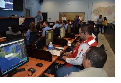
When a disaster strikes, situational awareness regarding impacts and needs is essential as a way to plan and carry out response efforts in areas affected by such a disaster. In recent years, advancements in the incorporation of satellite-assisted positioning and navigation services in smart telephones and other devices are contributing to enhance the capacity of responders on the ground to communicate critical information on such impacts and needs to Emergency Operations Centers.
Equally relevant are advances in the development of software applications such as GeoSHAPE, developed under the management of the United States Southern Command’s Science, Technology and Experimentation Division (USSOUTHCOM). GeoSHAPE stands for Geospatial Security Humanitarian Assistance and Partnership Engagement. It combines a web-based application that sits on a server and a portable application for the collection of data and images in the field. It has been developed to facilitate the combination of geo-spatial data emerging from the field with data provided by other stakeholders in the format of maps that assist those in charge of emergency operations to plan how best to respond in a timely and efficient way.
On 30 July 2014, USSOUTHCOM’s Science, Technology and Experimentation Division, the National Emergency Commission of the Dominican Republic (NEC) and the UN-SPIDER programme will conduct a simulation in Santo Domingo, Dominican Republic, as a way to demonstrate the usefulness of the GEOSHAPE application in emergency response efforts. The simulation will be conducted with the aim of integrating this application into the routine procedures employed by the Dominican Republic’s National Emergency Operations Center (EOC). The simulation will also involve the EIGEO technical team which has been established by the NEC at the recommendation of UN-SPIDER. EIGEO is an inter-institutional team of professionals from various ministries, government agencies and universities that focuses its efforts on the generation of space-based information to contribute to disaster-risk reduction efforts carried out by various government agencies and emergency response efforts coordinated through the EOC.
This simulation in Santo Domingo is a follow-up to a previous simulation conducted in Honduras by USSOUTHCOM and the Hondura’s Permanent Contingency Commission (COPECO) earlier this year. Both simulations focus on hurricanes and aim to promote the use of GeoSHAPE as a way to facilitate situational awareness regarding the impacts of such events in communities and cities, and to contribute to the coordination and conduction of response efforts in a more timely and efficient fashion through the visualization of impacts and needs and additional relevant information in the format of maps.
The simulation in Santo Domingo is an example of the joint efforts between civilian institutions and the Armed Forces that are contemplated in the HOPE FOR initiative that has been recently launched by the Dominican Republic, Qatar and Turkey as a way to improve capacities to respond to disasters.
USSOUTHCOM’s Science, Technology and Experimentation Division and UN-SPIDER are working together to promote the use of GeoSHAPE by civil protection organizations and in facilities such as the EOC as a way to improve the coordination and delivery of humanitarian assistance in areas affected by disasters.

