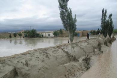
According to the International Disaster Database, floods and other hydrological hazards have claimed 15,000 lives and cost an estimated USD 396 million in Afghanistan between 1980 and 2015. Earlier this year, flash floods following heavy rains killed at least 60 people in the country's eastern province of Badakhshan.
Leveraging a new meteorological satellite data reception, visualization and processing station, the Afghanistan Meteorological Department (AMD) has now issued its first-ever flood early warning. Meteorological satellite images confirmed the accuracy of AMD's forecast, which is expected to contribute to reducing the loss of live and property as a result of floods and other extreme weather events in the country.
The station was installed in the context of a joint project between World Meteorological Organizaton (WMO) and the United States Agency for International Development/Office of U.S. Foreign Disaster Assistance (USAID/OFDA) that aims to build AMD's capacity in providing severe weather forecasts and early warnings. Through the station, AMD receives satellite images and products from Meteosat-8, a EUMETSAT operational geostationary satellite located over the Indian Ocean. Besides putting relevant infrastructure in place, the project also included extensive training on satellite meteorology.

