The Executive Secretariat of Guatemala’s National Coordinating Agency for Disaster Risk Reduction (SE-CONRED), the National Secretariat of Science and Technology (SENACYT), the National Authority for the Sustainable Management of Amatitlan Lake (AMSA) and the Institute of Environmental Studies of the Faculty of Agriculture of the San Carlos University of Guatemala (IAA-USAC) are joining forces to conduct a training course on the use of radar imagery to map the extent of floods. The training course is being conducted in the GIS Laboratory of IAA-USAC from 16 to 19 October 2017 by instructors from the Federal University of Santa Maria in Rio Grande do Sul, Brazil (UFSM), and from the Agustin Codazzi Geographic Institute of Colombia (IGAC).
The training course focuses on the use of the UN-SPIDER Recommended Practice that has been developed by the Ukrainian Space Agency in its role as one of the UN-SPIDER Regional Support Office. The step-by- step procedure makes use of ESA’s SNAP software to process SAR imagery to generate maps of the geographical extent of floods. More information on this Recommended Practice is available in the following link.
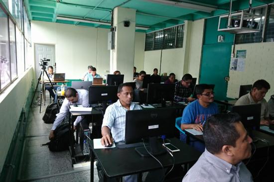
Twenty seven professionals from eleven government agencies, staff of IAA-USAC and from another university, and from an NGO dedicated to climate change research in Guatemala are taking part in this training course that is geared to contribute to the establishment of the technical, inter-institutional team all of these institutions are establishing as a way to contribute to the generation of space-based information to contribute to disaster risk reduction, preparedness and emergency response efforts in case of natural hazards.
This training course is a follow-up to a previous training course that UN-SPIDER, SE-CONRED, SENACYT and IAA-USAC organized from 31 July to 02 August 2017 that targeted the use of UN-SPIDER Recommended Practices on drought indices and forest fires.
UN-SPIDER is working with SE-CONRED in Guatemala to establish this technical, inter-institutional team and is providing additional technical advisory support to SE-CONRED to enhance its capacity to generate and make use of space-based information.