  • English
  • Español
  • Français

United
Nations


Office for Outer Space Affairs
UN-SPIDER Knowledge Portal

  • Home
  • About Us
    • What is UN-SPIDER?
    • About UNOOSA
    • Publications
    • Jobs
    • Meet the Team
    • Contact
  • Space Application
    • Satellite Technology
    • Emergency Mechanisms
    • Recovery Mechanisms
    • International Asteroid Warning Network
    • Space Mission Planning Advisory Group
    • International Space Weather Initiative
    • Space Technologies in the UN
    • User Stories
  • Links & Resources
    • Data Applications
      • Disaster Recovery
    • Data Sources
    • GIS and Remote Sensing Software
    • Online Learning Resources
    • Institutions
  • Risks & Disasters
    • Disaster Risk Management
    • Early Warning Systems
    • Emergency and Disaster Management
    • Natural Hazards
    • Sendai Framework
    • The UN and Disaster Risk Management
    • The UN and Early Warning
    • The UN and Disaster Management
  • Advisory Support
    • Advisory Missions
    • Emergency Support
    • Virtual Advisory Support
    • Recommended Practices
    • Training Activities
    • Practical Uses
  • Network
    • Regional Support Offices
    • GP-STAR
    • MHEWS
    • IWG-SEM
  • Projects
    • SPEAR
    • SEWS-D
    • EvIDENz
    • Flood GUIDE
  • News & Events
    • News
    • Events Calendar
    • UN-SPIDER Events Archive

Breadcrumb

  • Home
  • Modeled Tsunami Zones For Affected Areas of The Japan Earthquake
  • Modeled tsunami zones for affected areas of the Japan earthquake

Modeled tsunami zones for affected areas of the Japan earthquake

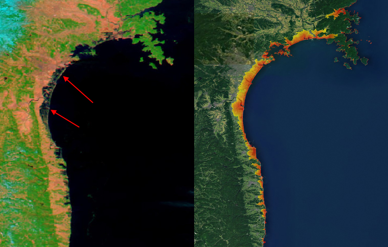
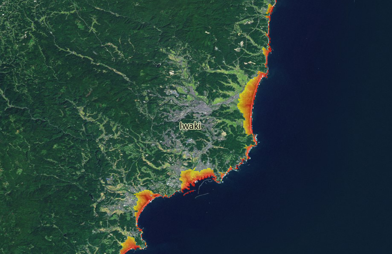
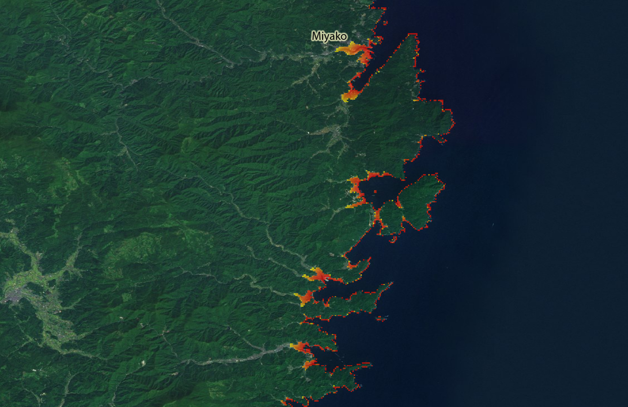
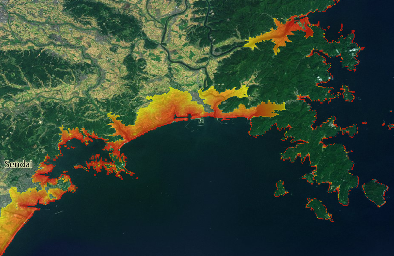
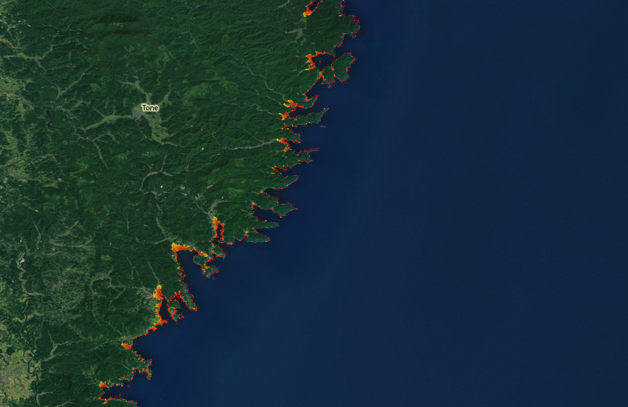
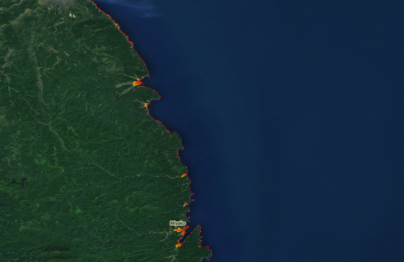
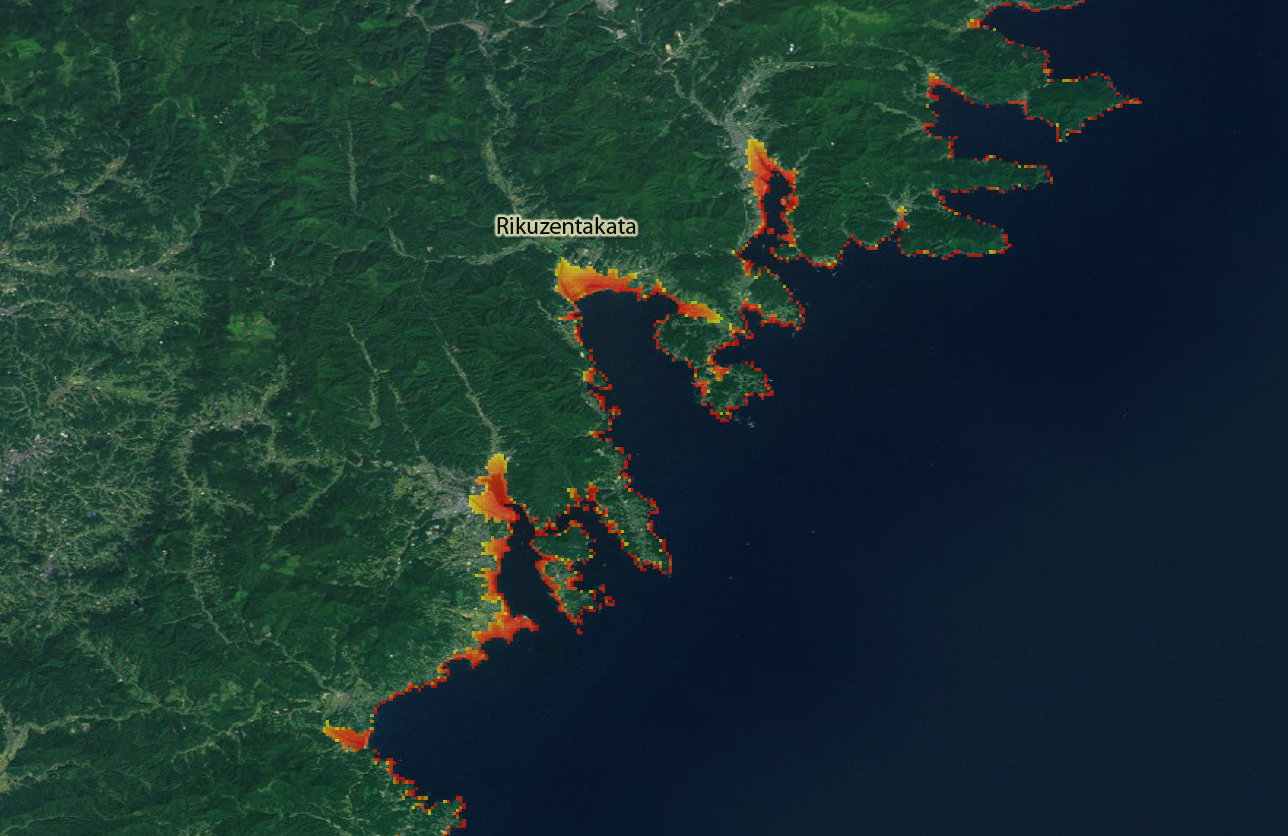
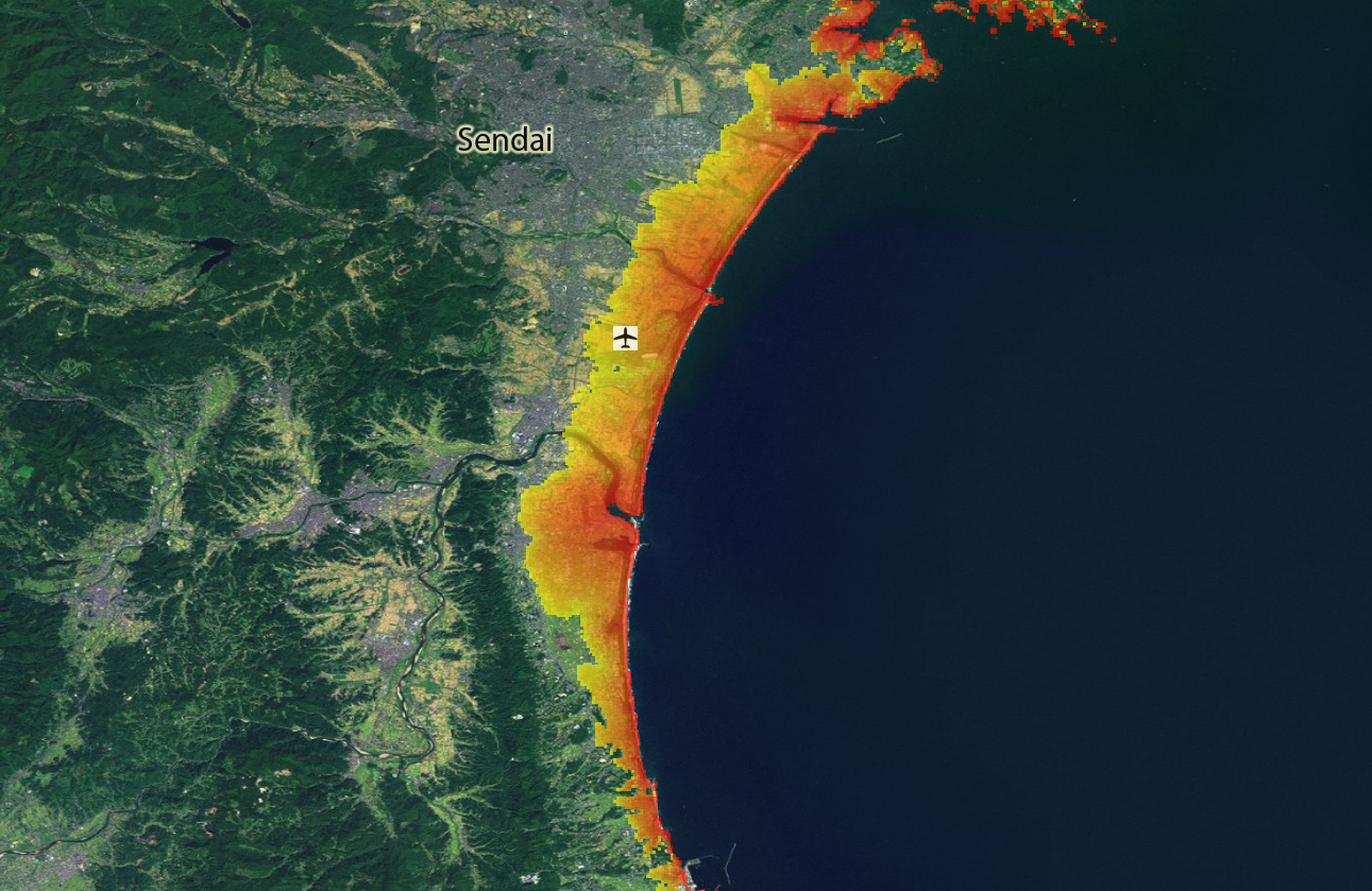
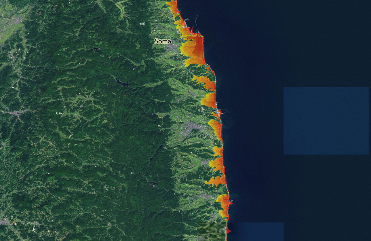
Modeled tsunami zones for affected areas of the Japan earthquake.

The model calculates inundation depths/areas according to a given tsunami wave height .
The model is based on topography only, using SRTM data with a horizontal resolution of approximately 90m.
Inundation zones were calculated for all coasts of the world (which are covered by SRTM data) independent from the actual tsunami probability 3 wave heights are pre-calculated 5m, 10m and 20m.
The inundation zones were calibrated to the Indian Ocean tsunami of 2004. It is accessible through the DVD Globe of Natural Hazards, by Munich Re.

 
Source:
Modeled Tsunami Zones: Lorenz Dolezalek (Munich RE), 2011
Esri Background: ESRI, I-cubed, USDA FSA, USGS, AEX, GeoEye, Getmapping, Aerogrid, IGP

Lorenz Dolezalek

LDolezalek@munichre.com


Attachment Size
Comparison.jpg (678.57 KB) 678.57 KB
Iwaki_detail.jpg (658.34 KB) 658.34 KB
Miyako_detail.jpg (646.95 KB) 646.95 KB
Sendai_detail_North.jpg (799.51 KB) 799.51 KB
Tone.jpg (546.03 KB) 546.03 KB
Miyako.jpg (486.58 KB) 486.58 KB
Rikuzentakata.jpg (634.14 KB) 634.14 KB
Sendai_detail.jpg (716.02 KB) 716.02 KB
Soma.jpg (716.31 KB) 716.31 KB

Footer menu

  • Contact
  • Terms of Use

User account menu

  • Log in