Europe

country taxonomy block

The coastlines of the world host a rich mix of dense populations, varying industries, and environmental characteristics that are collectively influenced by both land and sea. To facilitate the production of knowledge and data products regarding these complex coastal regions, the European Commission under the Copernicus program has developed a new online resource: The Copernicus Coastal Hub. The Coastal Hub offers a singular resource for data related to coastal regions including examples of use cases and an interactive data and map viewer.

The site provides a number of different use cases for the application of coastal focused datasets within the repository that could inform data-driven decision making within various sectors of research, government, and private industry. These uses are divided into three themes, water, pollution, and spatial planning, and include examples and case studies of the uses of coastal data in different parts of the world. For the disaster risk…

more
Publishing date 23/02/2024

This article is based on a news announcement by the JRC from 11 October 2023: "Drought Risk Atlas: heightened risk threatens the environment and the economy". Find the full article here.

The Joint Research Centre (JRC) of the European Commission published the first European Drought Risk Atlas, presenting a comprehensive assessment and mapping of drought risks and their impacts in the European Union (EU) under various climate change scenarios. Developed by the Joint Research Centre (JRC) and the European Drought Observatory for Resilience and Adaptation (EDORA) partners, this innovative Atlas is the first of its kind to offer a detailed view of the risks posed by…

more
Publishing date 25/10/2023

A recently published technical report by the Joint Research Centre (JRC) of the European Commission reveals that seasonal weather forecasts point to a warmer-than-average summer, higher-than-average precipitation levels in the Mediterranean, but lower than usual for central and northern Europe, particularly for the regions around the Baltic Sea. 

Link to publication announcement.

Link to publication repository.

Abstract (by JRC):

"A severe drought is affecting large parts of Europe. The severity and phases of its evolution differ across the continent: southern Europe already shows many impacts and is slowly moving into a drought recovery phase; northern Europe, on the other hand, is in an initial drought phase with a…

more
Publishing date 17/07/2023

A series of wildfires have been destroying forests and agricultural land near the abandoned Chernobyl nuclear power plant in Ukraine. Due to concerns about the spread of these fires and the potential dispersion of smoke plumes and radioactive chemicals to nearby inhabited areas, the European Union’s Emergency Response Coordinating Centre (ERCC) requested the activation of the Copernicus Emergency Management Service (EMS). Under the Copernicus EMS activation, satellites have mapped the actively burning fires, tracked the transport of smoke from fires, and assessed the damaged areas. These maps provide useful information for fire management and help authorities respond to the consequences of the wildfire.

Based on data from the Copernicus Sentinel-2 mission, using a wide-swath multispectral sensor that can…

more
Publishing date 21/04/2020

The National Aeronautics and Space Administration (NASA), the European Space Agency (ESA) and the Republic of Korea are working together on a global satellite constellation of three space-based instruments that could track global pollution on an hourly basis. These air quality satellites will measure pollutants, including ozone, nitrogen dioxide, formaldehyde and tiny atmospheric particles called aerosols in order to enhance our understanding of air quality and air pollution. To date, air quality satellites have collected data only once a day. These three new instruments will provide hourly, highly detailed and near-real-time data that will improve air quality science and forecasting around the world, in particular around the most densely populated areas of the Northern Hemisphere. 

Collecting data hourly will…

more
Publishing date 30/03/2020

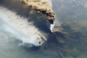
“More than half of the world’s active volcanoes are not monitored instrumentally,” according to GFZ Helmholtz Centre Potsdam. Yet eruptions occur quite frequently, with up to 85 of the 1500 active volcanoes erupting each year, and can cause significant damage. For example, the 2018 volcanic eruptions at Fuego (Guatemala) and Anak Krakatau (Indonesia) resulted in 430 dead and missing persons. This threat to human life makes improving the monitoring of volcanoes all the more important. 

A German research team, made up of scientists  from the Technical University of Berlin and the GFZ German Research Centre for Geosciences in…

more
Publishing date 06/08/2019

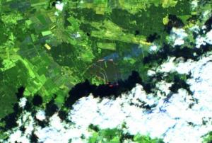
Satellite technology became an integral part of efforts to detect and contain forest fires in Mecklenburg Western Pomerania, Germany at the end of June and early July. The German Aerospace Center (DLR) used satellite information, along with images captured by the Modular Aerial Camera System (MACS), to create maps, which provided emergency services with up-to-date information about areas affected by the fires. 

When tracking the fires near Lübtheen, for example, the DLR Center for Satellite-Based Crisis Information (ZKI) used a freely available Sentinel-2 image, in which false-colour data offered valuable information about the status of the fires. Additionally, ZKI made use of data acquired by the Visible Infrared Imaging Radiometer Suite (VIIRS) and the Moderate Resolution Imaging Spectroradiometer (MODIS) to determine the locations of the fires.…

more
Publishing date 25/07/2019

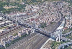
Evaluating the safety and integrity of infrastructure such as bridges, which is often done through hands-on inspections, may soon be possible with the help of information captured several kilometers above the Earth’s surface. According to a National Aeronautics and Space Administration (NASA) news article, scientists from NASA, the University of Bath, and the Italian Space Agency used historical synthetic aperture radar (SAR) satellite imagery to study the condition of the Morandi Bridge near Genoa, Italy, in the 15 years prior to its August 2018 collapse, which claimed the lives of dozens. 

Evaluating satellite data using the techniques of SAR multi-temporal interferometric analysis (MT-InSAR) and Markov Chain Monte Carlo…

more
Publishing date 08/07/2019

The importance of using space technologies in the disaster management process has received growing global recognition in recent years. For example, the African Union outlined in its 2017 African Space Policy that among other things, space represents a unique opportunity for cooperation in using and sharing infrastructure and data to proactively respond to and manage natural hazards and disasters. In addition, the potential of new technologies and techniques, such as machine learning, artificial intelligence, and big data, to improve the use of space-based data is receiving increased attention.

With a specific focus on Africa, the United Nations Office for Outer Space Affairs (UNOOSA), through its UN-SPIDER Bonn office, and the University of Bonn’s Centre for Remote Sensing of Land Surfaces (ZFL) are organizing the UN-SPIDER Bonn International Conference “Space-based Solutions…

more
Publishing date 18/06/2019
Regional Support Offices mentioned:

Data generated by Earth observation satellites can provide critical insights for disaster mitigation and management by revealing changes in the Earth’s surface over time. However, the great volume and different types of satellite data collected can pose challenges for evaluation. A new partnership between one of Europe’s largest supercomputing centres, the Leibniz Supercomputing Centre (LRZ), and the German Aerospace Center (DLR), aims to provide the necessary computing power to analyse vast quantities of Earth observation data, along with other global data sources that provide frequent updates about the Earth’s condition.

Better evaluation of Earth observation data improves knowledge and management of global environmental issues. This was reiterated by Hansjörg Dittus, DLR Executive Board…

more
Publishing date 31/05/2019

The lowering or sinking of the ground’s surface, referred to as land subsidence, can cause serious damage to infrastructure and private property, and in turn, have an adverse impact on communities, individuals, and the economy. The European Space Agency’s (ESA) Sentinel-1 satellite, part of the Copernicus programme, is being used to monitor cases of land subsidence and contribute to risk assessment and urban development efforts.

From Sentinel-1 radar data collected over time, ground deformation maps can be created, which provide important insights to local authorities charged with implementing hazard mitigation and management strategies. For example, such maps recently helped authorities in…

more
Publishing date 30/05/2019

Optical transmission techniques are considered to be the most effective way to transmit the significant amounts of data obtained day after day from Earth observation satellites to the ground for analysis. With a small test satellite, a corresponding data transmission via laser has now been successfully tested by the German Aerospace Center (DLR) and the University of Stuttgart.

Earth observation satellites  are used for many different tasks, which requires very large amounts of data to be transmitted from the satellite to the ground for evaluation. Today's radio systems are reaching their limits in this area. Optical transmission, however, provides the ability to send data at a much higher rate. The Optical Space Infrared Downlink System (OSIRIS), a laser communications terminal designed and tested by the German Aerospace Centre (DLR), is compact, power efficient and light, weighing only 1.3 kg. The terminal is located on board the “Flying…

more
Publishing date 23/04/2019

Sentinel Hub, together with the European Earth Observation programme Copernicus and the European Space Agency, are looking for new and innovative ideas and scripts for Sentinel data processing and visualization. The contest will run until 5 May 2019 and all the entries will be judged by a jury of experts on functionality and usefulness, as well as possible commercial value.

The EU Earth Observation Browser and similar services are made possible through open data policies, which allow everyone to access and use satellite data. Thanks to these policies a wide variety of fields are creating applications for satellite data, however, they need support to make use of the data for these applications. Custom scripts are an easy and quick way to add value to already available data and rapidly test new algorithms.

The Sentinel Hub Custom Script Contest is a remotely run hackathon engaging data…

more
Publishing date 23/04/2019

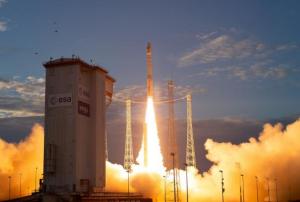
On 21 March in French Guiana, the Italian remote sensing satellite PRISMA launched aboard a Vega rocket of European launch provider Arianespace. Data from the satellite will be used for natural disaster prevention and disaster response, among other purposes.

The satellite was designed for Italian researchers and will serve as a prototype for future missions. With PRISMA’s images, scientist will study environmental behavior, including climate- and other human-influenced changes. Besides disaster management the data will be applicable for monitoring water pollution and agriculture, land use, soil mixtures as well as the carbon cycle.

PRISMA, or “Precursore Iperspettrale della Missione Applicativa”, which translates into “hyperspectral precursor of the application mission”, is a small hyperspectral imaging satellite.

It has been constructed by space company OHB Italia…

more
Publishing date 08/04/2019

A new project seeks to evaluate how satellite remote sensing and Copernicus satellite data can support reporting related to the Sendai Framework for Disaster Risk Reduction 2015-2030 (SFDRR). Cop4Sen will be implemented by the German National Coordination for the Copernicus Emergency Management Service (Copernicus EMS) under the auspice of the Federal Office of Civil Protection and Disaster Assistance (BKK) and in cooperation with the the National Contact Office for the Sendai Framework at BKK.

With the aim to support the national evaluation of the Sendai indicators, Cop4Sen assesses the potential of remote sensing and Copernicus data and services. Cop4Sen systematically analyzes the current state of science and technology, develops and enhances methods. On a long-term basis, the results of the project will support the National Contact Office for the Sendai Framework at BKK with consistent methods and…

more
Publishing date 21/03/2019

A consortium of Norwegian institutions has used Copernicus Sentinel-1 satellite data in combination with the Interferometric Synthetic Aperture Radar (InSAR) remote sensing technique to map ground movements in the country. The Geological Survey of Norway (NGU), the Norwegian Water Resources and Energy Directorate (NVE) and the Norwegian Space Centre (NSC) make results freely accessible through InSAR Norway, a service launched in November 2018. The service aims to produce ground deformation measurements in the country and improve accessibility of InSAR results for public and commercial users.

How does InSAR imagery work?

InSAR is used in remote sensing and geodesy, the science of measuring the geometric shape of the Earth. It compares two or more…

more
Publishing date 07/03/2019

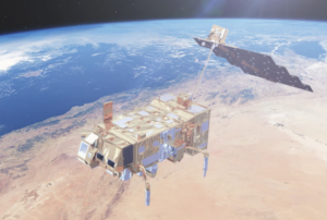
Europe’s newest weather satellite was launched into orbit on 7 November and is set to bring more accurate forecasts than ever.

The rocket was carrying the 4083 kg MetOp-C towards its destination of polar orbit. About 60 minutes after take-off, Soyuz’s upper stage delivered the satellite into orbit and contact was established through the Yatharagga ground station in Australia.

The new satellite is the third in the MetOp series as its name suggests and it was procured at the same time as MetOp-A and B, but has been sitting in storage until now. MetOp-A was in 2006 and MetOp-B in 2012.

How does it work?

Most surprisingly, one instrument on board the new…

more
Publishing date 23/11/2018

The European Space Agency (ESA) launched the much-awaited Aeolus satellite into orbit on 22 August. It will provide data expected to improve weather forecasting and contribute to better disaster management.

Aeolus - the “Keeper of Winds” in Greek mythology - aims to track and profile global wind better. Aeolus uses the Active Doppler Wind Lidar (DLR) method, which has the potential to provide global wind data - including about remote areas without ground-based weather stations. The Atmospheric Laser Doppler Instrument (ALADIN) uses a completely new method of observing the wind: it records the wind’s profile through pulses of ultraviolet light generated using by laser technology and beamed into the atmosphere.

Aeolus create a consistent series of about 120 constant wind profiles per hour to provide better and almost real-time information for meteorological predictions.

Upon launching the Aeolus…

more
Publishing date 28/08/2018

The summer of 2018 has seen several severe wildfires across Europe and the world. A number of space-based applications and data from the National Aeronautics and Space Administration (NASA), the European Union’s Copernicus programme, the European Forest Fire Information System (EFFIS) are supporting authorities in fighting the fires.

Both NASA GFWED, Copernicus’ EMS and EFFIS provide disaster management with free satellite data for accurate forecasting, monitoring, and recovery from fires. These services can be accessed at the NASA GFWED and Copernicus’ EMS, EFFIS websites.

UN-SPIDER has also developed a Burn Severity Mapping Recommended Practice to help…

more
Publishing date 30/07/2018

Atos activated its new Earth observation platform Mundi Web Services on 21 June 2018. The platform is already being used by several clients to evaluate and manage disaster risks.

On behalf of the European Commission and the European Space Agency (ESA), Atos created the Mundi platform to combine real-time geo data from Copernicus, the world’s largest single Earth observation program, with data from multiple sources and turn it into an information platform for companies in sectors such as manufacturing, insurance, utilities, agriculture, forestry, urbanism and emergency services.

Mundi is one of the five DIAS (Copernicus Data and Information Access Services) cloud-based platforms, which was officially launched by the European Commission in June.

Mundi will make the data from the European Union constellation of Sentinel satellites and other data providers more accessible. This will enable third parties as diverse as…

more
Publishing date 24/07/2018

The European Commission has launched an initiative to facilitate access to Copernicus data and information services. DIAS is designed to improve users’ ability to access as well as process Copernicus data and information by standardizing access to data through five cloud-based platforms: CREODIAS, MUNDI, ONDA, SOBLOO and WEKEO.

The European Union’s Copernicus programme produces up to 12 terabytes of data each day and Copernicus services, such as Copernicus Emergency Management Service (EMS), are provided free of charge to users. The extensive amount of data offers a wealth of opportunities in the fields of climate change, land monitoring, marine environment, atmosphere monitoring, security as well as emergency and disaster management. However, downloading…

more
Publishing date 20/07/2018

The Joint Research Centre (JRC) published a new edition of its World Atlas of Desertification (WAD3) on 21 June 2018. The publication and related website show that population growth and changes in consumption patterns put unprecedented pressure on the planet's natural resources. As a result, the WAD3 highlights the urgency to adopt corrective measures such as greater commitment and more effective cooperation at the local level to limit two of the main causes of land degradation: the consumption of animal proteins from unsustainable sources and agricultural expansion.

The Atlas provides a comprehensive and evidence-based assessment of land degradation at a global scale and thus offers a tool for decision makers to improve local responses to soil loss and land degradation, comprehend the causes of such issues and utilize potential remedies to tackle desertification and restore degraded land.

Land degradation and desertification are issues…

more
Publishing date 09/07/2018

Sentinel-5P is the latest satellite mission of the European Earth observation programme, Copernicus. The satellite was launched on 13 October to monitor the atmosphere and map gases and particles that pollute the air. Less than two months after its launch, the Sentinel-5P has already delivered its first images of air pollution thus marking an important milestone both for the mission and for atmospheric monitoring from space in general..

The images were presented on 1 December at the Earth Observation Center (EOC) of the German Aerospace Center (DLR) in Oberpfaffenhofen, where Sentinel-5P’s data is processed. Although the satellite is not yet ready for service, these first results show how this mission has the ability to deeply improve the task of monitoring air quality. All data provided by the Copernicus programme, including the data that will be provided by Sentinel-5P, is…

more
Publishing date 06/12/2017

The Copernicus Marine Environment Monitoring Service (CMEMS) has published a number of new free online tutorials on how to use the information services provided by it.

35 video tutorials covering a variety of topics from beginner to advanced level have been uploaded and can now be accessed by anyone interested in marine environment monitoring. Among them are videos on a range of satellite products with which it is, for instance, possible to learn more about sea surface temperature observation or ocean colour.

Furthermore, a new series of introductory videos on the Copernicus programme and its services is now available on YouTube. The…

more
Publishing date 17/10/2017

The Government of Turkey hosted the European Forum for Disaster Risk Reduction (EFDRR) Open Forum in Istanbul from 26 to 28 March 2017. EFDDR is Europe’s regional platform for disaster risk reduction and brings together multiple stakeholders across all sectors through its Open Forum meetings to discuss and advance on disaster risk reduction issues and to shape the implementation and monitoring of the Sendai Framework in Europe. In the form of the Istanbul Outcomes, it formulated a perspective on disaster risk reduction in Europe in preparation for and as a contribution to the 2017 Global Platform for Disaster Risk Reduction.

The Istanbul Outcomes call for an inclusive approach to disaster risk reduction which recognizes vulnerable people as vital participants in the formulation of national and local strategies. It recalls the severe earthquake in Central Italy in 2016 and commits national institutions to ensuring that strategies are implemented adequately through the…

more
Publishing date 01/04/2017