Pollution
UN-SPIDER Regional Support Offices with hazard-specific expertise
Related content on the Knowledge Portal
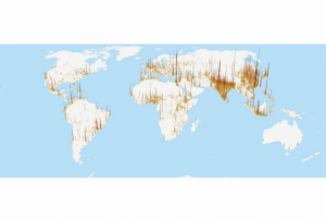
- The Hazards Mapper home page is a base map of the world with darker shaded areas indicating higher population densities. Custom population estimates generated by the Hazards Mapper are provided by SEDAC’s Population Estimation Service (PES). Population and settlement data are based on SEDAC’s Global Rural-Urban Mapping Project (GRUMP) and Gridded Population of the World, version 3 (GPWv3) data collections. GPWv3 provides a resolution of roughly 4 km (2.5 miles) at the equator. This population resolution will increase significantly when the updated version, GPWv4, is released in 2016. “Our new population layer will be at a resolution of 1 km (0.6 miles) at the equator, which will give higher precision for smaller areas,” says de Sherbinin.
Continuously updated data layers that can be overlaid on the base map are available from NASA’s EOSDIS, including data from SEDAC; NASA's Land, Atmosphere Near real-time Capability for EOS (LANCE); and Global Imagery Browse…, The default base map includes:
Red dots indicating fires and other hotspots detected over the past 48 hours by NASA’s Moderate Resolution Imaging Spectroradiometer (MODIS) instrument;
Colored circles indicating earthquakes over the past seven days from the USGS Earthquake Hazards Program;
Icons indicating the location of individual dams, dam clusters, and nuclear power plants from SEDAC’s Global Reservoir and Dam and Population Exposure Estimates in Proximity to Nuclear Power Plants, Locations databases; and,
Colored polygons indicating tornado and flood warnings issued by NOAA (U.S. locations only).
Publishing institution: - Hazards and Population Mapper (HazPop) is a free app that enables users to easily display recent natural hazard data in relationship to population, major infrastructure, and satellite imagery. Hazards data include the location of active fires over the past 48 hours; earthquake alerts over the past seven days; and yesterday′s air pollution data measured from space. The app shows the location of major dams and nuclear power plants and provides more detailed information and imagery for these facilities where available. By drawing a circle around a point or area of interest on the map, users can obtain an estimate of the total population and land area enclosed within., Developed by the NASA Socioeconomic Data and Applications Center (SEDAC) operated by the Center for International Earth Science Information Network (CIESIN) at Columbia University, HazPop combines data and map layers from various sources including NASA's Land, Atmosphere Near real-time Capability for EOS (LANCE) and Global Imagery Browse Services (GIBS), the U.S. Geological Survey (USGS), and others using a variety of open Web mapping services. The custom population estimates are provided by the SEDAC Population Estimation Service (PES) based on SEDAC′s Gridded Population of the World, version 4 (GPWv4) data for 2015.Publishing institution:
- Publishing institution:
- Publishing institution:
- Publishing institution:
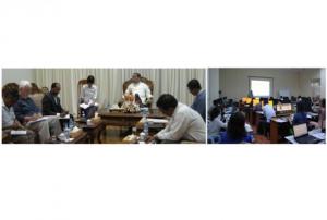
- After the TAM was conducted in Myanmar, innovative impacts were completed following a recommendation. “Emergency Operation Centre (EOC)”, which is comprised of four units including “Remote Sensing Unit” and “Risk Assessment and Emergency Response Unit” was established in the Ministry of Social Welfare, Relief & Resettlement (MSWRR). The capacity building of MSWRR and other related institutes in remote sensing and GIS were strengthened. The Disaster Management Training Centre now conducts courses in remote sensing/GIS. Myanmar has also become the first country in ASEAN to apply for universal access to the International Charter. Myanmar government is aware of the National Spatial Data Infrastructure (NSDI) and one map policy that has been initiated by the Ministry of Education is very crucial.read morePublishing institution:
In order to encourage the targeted retrieval of space-based information and data by disaster risk reduction practitioners, content on the Portal is systematically enriched with metadata. For instance, data sources are marked up with data about their file type, satellite/sensor and spatial coverage and whether they relate to the disaster risk management or emergency response phase. The tool features a range of filters that draw on the metadata, thereby allowing users to narrow down their search, for example, filtering available GIS software by hazard type. This ensures that users efficiently find the content that is most relevant to them. At the same time, the Portal encourages the discovery of resources related to those accessed by the user, by providing links to them on the same page. This allows for contextualisation and highlights links between resources…
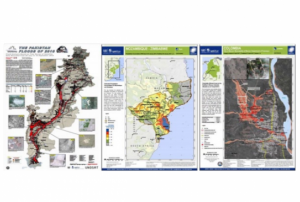
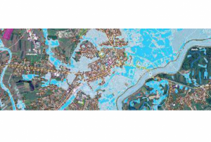
read morePublishing institution:Based on optical and radar images of different resolutions, UNOSAT products are also enriched with the available baseline GIS datasets and crowdsourcing data. Satellite-derived analysis performed by UNOSAT is delivered in the form of GIS Data, Static Maps, Live Web Maps, and Reports, and is then shared with a wide range of end-users such as UN Agencies, International Organizations, and Governments.
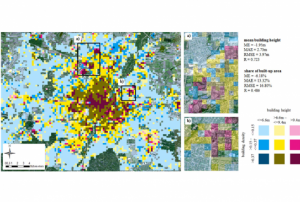
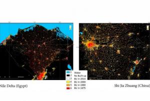
Publishing institution:The Global Human Settlement (GHS) framework produces global open source spatial information about the human presence on the planet over time. This is in the form of built up maps, population density maps and settlement maps. This information is generated with evidence-based analytics and knowledge using new spatial data mining technologies. The framework uses heterogeneous data including global archives of fine-scale satellite imagery, census data, and volunteered geographic information. The data is processed fully automatically and generates analytics and knowledge reporting objectively and systematically about the presence of population and built-up infrastructures.
The guidelines will be reviewed and updated periodically, in order to integrate new best practices and to be responsive to evolutions in technology and end-user needs. The IWG-SEM chair has the responsibility to initiate the review, by agreement of the Working Group.
The production and the maintenance of the guidelines are based on a joint effort by the members of the International Working Group on Satellite-based Emergency Mapping (IWG- SEM), a voluntary group of organizations involved in satellite-based emergency mapping. It was founded to improve cooperation, communication and professional standards among the global network of satellite-based emergency mapping providers. The chairperson of the group is nominated for a term of one year and is responsible for organizing the monthly telecons and bi-annual meetings. The current chair is from the Department of Geoinformatics, Z_GIS University of Salzburg / Spatial Services Ltd, Austria…
Publishing institution:
