![]()
United
Nations
Inundación
, processed by ESA, CC BY-SA 3.0 IGO.")
Definition
Facts and figures
Further information
UN-SPIDER Regional Support Offices with hazard-specific expertise
Related content on the Knowledge Portal

") Publishing institution:
Publishing institution:
The Asia and Oceania regions are frequently affected by severe natural phenomena such as tropical cyclones, torrential monsoons, volcanic eruptions, yellow sandstorms, floods, sea ice, and wildfires. The importance of monitoring the climate and the environment is also increasing, which has prompted enhanced global interest in the field.
In this area, the new generation of meteorological and earth observation satellites provide frequent and extensive observational information for use in disaster prevention and climate monitoring/diagnostics; they are indispensable in today’s world. The Asia/Oceania Meteorological Satellite Users’ Conferences provide an excellent forum for satellite operators and users within the Asia/Oceania community to meet and enhance their joint efforts in the utilization of satellite data and products for better weather, climate, and disaster mitigation services.Objectives- Promoting satellite...

The government of Niger, in partnership with the World Bank and a team of local volunteers, steps up the gathering of data on Niamey’s exposure to floods using drone and open source data to support disaster preparedness.
The initiative started with a team of volunteers, students and young professionals who used an open source mobile application to build a database on exposed people and assets in Niamey, the capital city.
The team has so far gathered about 15,000 data point on household and infrastructure in the region. Drone African Service, a Nigerien startup has been providing training on the use of drones to acquire high-resolution images of exposed people and facilities. This is further analyzed and modelled for flood risk of the most vulnerable communities, which will be further shared with Nigerien government authorities on the risk data portal.
Drone Africa Services trained the team on digital cartography using OpenStreetMaps and a mobile...
read more26/09/2018 of 2.7 m (i.e., less than one floor) and the share of built-up area could be estimated with a MAE of 13.3 %, when compared to a reference data set.") Publishing institution:
Publishing institution: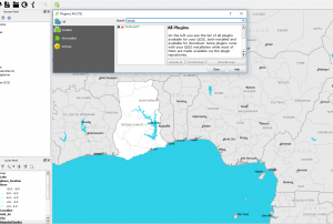
 ,
, 
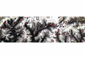
The identification of critical glacial lakes is based on remote sensing method in which several criteria related to glacial lakes, glaciers and physical condition of surrounding area is considered to assess potential for future outburst and possible glacial lake outburst flood (GLOF).
read morePublishing institution: Satellite based flood mapsPublishing institution:
 Derived products from various satellites processed by agencies in the field of disaster mapping.Publishing institution:
-
Derived products from various satellites processed by agencies in the field of disaster mapping.Publishing institution:
Term Parents
UN-SPIDER Regional Support Offices with hazard-specific expertise
![]()