Inundación
Definition
Facts and figures
Further information
UN-SPIDER Regional Support Offices with hazard-specific expertise
Related content on the Knowledge Portal
Introduction
Space-based applications related to Earth Observation and geospatial data play an important role in supporting disaster risk reduction, response, and recovery efforts through providing accurate and timely information for decision-makers. Monitoring floods, drought conditions and water resource environments using satellite remote sensing (RS) technologies have become more essential recently in particular for developing countries.
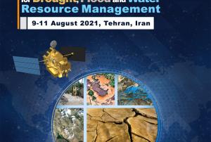
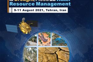
This workshop will address the use of space technologies (remote sensing, telecommunication and global navigation satellite systems) for various applications in natural disaster managements that can provide sustainable social and economic benefits. Current and planned projects/research that use space-based technologies for both practical applications and scientific explorations will be presented. Cooperative efforts and international partnerships for capacity-building, training and research will be discussed....
read moreSpace-based applications related to Earth Observation and geospatial data play an important role in supporting disaster risk reduction, response and recovery efforts through providing accurate and timely information for decision-makers. Monitoring floods, drought conditions and water resource environments using satellite remote sensing (RS) technologies have become more essential recently, in particular for developing countries.
The workshop will be held in Tehran, Iran, from 9 to 11 August 2021, in a virtual format, and will be hosted by the Iranian Space Agency (ISA). The workshop will explore how current space technologies help identify and monitor the effects of a changing climate – including the onset of drought, flash floods, and general water resources conditions as a result of global climate change, in particular on an international and regional scale. The discussions at the workshop will also be linked to the 2030 Agenda for...
read moreRegional Support Offices mentioned:14/06/2021- Publishing institution:
- Publishing institution:
Like many countries in Latin America, Peru is exposed to a variety of natural hazards that have triggered disasters in previous decades. Disaster preparedness, response and recovery efforts are coordinated by the National Civil Defense Institute (INDECI). In recent years, INDECI has benefited from the advisory support provided by Peru’s National Commission for Aerospace Research and Development (CONIDA). Taking advantage of this advisory support, INDECI developed and launched at the end of 2018 its Agenda for Applied Research for the period between 2018 and 2021, addressing the preparedness, risk, and recovery phases of...
read moreRegional Support Offices mentioned:03/05/2021- Publishing institution:
The European Space Agency is organising the 10th International Workshop on Science and Applications of SAR Polarimetry and Polarimetric Interferometry, POLINSAR 2021.
Date(s)
The workshop will take place online from 26 to 30 April 2021.
Objectives
- Provide a forum for scientific exchange
- Present the latest exploitation results from full-pol airborne and spaceborne systems and assess the state-of-the-art
- Review retrieved bio-geophysical parameters and their accuracy
- Make recommendations for algorithm development and new products
- Support the preparation for ESA and Third Parties full-pol missions exploitation (BIOMASS, NOVASAR-S, RCM, SAOCOM, TerraSAR-L etc.)
- Present innovative polarimetric applications and ideas for future polarimetric mission concepts Report on the status of POLinSAR 2019 recommendations
Sessions...
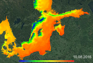
read moreRUS Copernicus organises a full day hands-on training session focussing on the processing of Sentinel-3 data to monitor an upwelling event in the ocean.
The Sentinel-3 constellation is composed of two identical satellites, which aim at quantifying large-scale surface (both ocean and land) colour and temperature phenomena, as well as at measuring accurately the oceans and inland water bodies elevation.
After an introduction to the Sentinel-3 mission and associated products, participants will learn to retrieve manually and automatically these products from different data hubs. Then, the course will demonstrate the extensive applications and advantages of combining Sentinel-3 OLCI and SLSTR ...
read moreThis introductory webinar will cover the fundamentals of Solar Induced Fluorescence (SIF) and LIDAR, their applications, and an overview of different satellite data sources that are openly available. In addition, it will also include a step-by-step guide on how to access, open, and interpret SIF and LIDAR data.
SIF is a relatively new satellite retrieval, providing a direct measurement related to plant photosynthetic activity. It serves as a strong proxy to gross primary production (GPP), capturing dynamic responses of vegetation to stressors such as drought and temperature.
LIDAR is a system that illuminates a target and measures distance through the time taken for a pulse to reflect back to the sensor. LIDAR can be used to generate topography and vegetation height maps and retrieve digital elevation data necessary for flood modeling and vulnerability, along with risk analysis. They are valuable datasets for post-disaster assessment of debris deposition,...
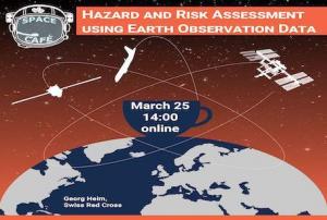
read moreThe village of Avispa was hit by a flood event in 2008. 8 people died and various houses were destroyed. The high disposition for flooding still exists today. The Red Cross supports the community of Avispa in planning of protective measures. This requires a reliable hazard and risk analysis that takes into account the individuality of future events. For this purpose, the Red Cross combines qualitative and technical methods of analysis. In the presentation, these methods will be presented with a special focus on EO methods. In particular, reference is made to the use of GEE, where historical precipitation data are retrieved retrospectively for the last 40 years and can be used to calculate flood peaks. The benefits and limitations in practical application are demonstrated using Avispa as an example.
In addition, a new method for testing the cost-effectiveness of protective measures will be presented.
Speaker at the event will be Georg Heim, technical expert in...
read more

