![]()
United
Nations
Tormenta severa

Definition
Facts and figures
Further information
UN-SPIDER Regional Support Offices with hazard-specific expertise
Related content on the Knowledge Portal
") Publishing institution:
Publishing institution:
The Asia and Oceania regions are frequently affected by severe natural phenomena such as tropical cyclones, torrential monsoons, volcanic eruptions, yellow sandstorms, floods, sea ice, and wildfires. The importance of monitoring the climate and the environment is also increasing, which has prompted enhanced global interest in the field.
In this area, the new generation of meteorological and earth observation satellites provide frequent and extensive observational information for use in disaster prevention and climate monitoring/diagnostics; they are indispensable in today’s world. The Asia/Oceania Meteorological Satellite Users’ Conferences provide an excellent forum for satellite operators and users within the Asia/Oceania community to meet and enhance their joint efforts in the utilization of satellite data and products for better weather, climate, and disaster mitigation services.Objectives- Promoting satellite...
 Publishing institution:
The International Charter “Space and Major Disasters” has been activated on 18 September after Typhoon Manghut hit the northern coast of Luzon in the Philippines with winds of up to 180mph. This has made Manghut one of the strongest storms in decades.
The high winds also churned rough seas as it moved across Luzon, producing 30 feet-high waves, damaging forest, dragging electricity supplies and harming a farmland in Cagayan.
Mass evacuations, restricted travel and school closures have helped to manage the situation across the Philippines, with the army on standby to assist relief efforts.
On 16 September, Manghut was making its way to southeastern China after moving all across the Phillippines.
read more19/09/2018 of 2.7 m (i.e., less than one floor) and the share of built-up area could be estimated with a MAE of 13.3 %, when compared to a reference data set.") Publishing institution:
Publishing institution: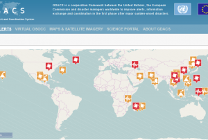 Derived products from various satellites processed by agencies in the field of disaster mapping.Publishing institution:
-
Derived products from various satellites processed by agencies in the field of disaster mapping.Publishing institution:
-
Derived products from various satellites processed by agencies in the field of disaster mapping.Publishing institution:
 After the TAM was conducted in Myanmar, innovative impacts were completed following a recommendation. “Emergency Operation Centre (EOC)”, which is comprised of four units including “Remote Sensing Unit” and “Risk Assessment and Emergency Response Unit” was established in the Ministry of Social Welfare, Relief & Resettlement (MSWRR). The capacity building of MSWRR and other related institutes in remote sensing and GIS were strengthened. The Disaster Management Training Centre now conducts courses in remote sensing/GIS. Myanmar has also become the first country in ASEAN to apply for universal access to the International Charter. Myanmar government is aware of the National Spatial Data Infrastructure (NSDI) and one map policy that has been initiated by the Ministry of Education is very crucial.read morePublishing institution:
 ,
, 
In order to encourage the targeted retrieval of space-based information and data by disaster risk reduction practitioners, content on the Portal is systematically enriched with metadata. For instance, data sources are marked up with data about their file type, satellite/sensor and spatial coverage and whether they relate to the disaster risk management or emergency response phase. The tool features a range of filters that draw on the metadata, thereby allowing users to narrow down their search, for example, filtering available GIS software by hazard type. This ensures that users efficiently find the content that is most relevant to them. At the same time, the Portal encourages the discovery of resources related to those accessed by the user, by providing links to them on the same page. This allows for contextualisation and highlights links between resources...
read morePublishing institution:
Term Parents
UN-SPIDER Regional Support Offices with hazard-specific expertise
![]()