Since two years ago, the Research and Investigation Centre Remote Sensing Group and Geographic Applications (CIAF) of the Agustin Codazzi Geographic Institute (IGAC) has been conducting efforts in the area of remote sensing applications using unmanned platforms (UAV-DRONES) with the support of German Aerospace Agency "DLR". These efforts are conducted under the umbrella of a tripartite agreement among DLR, IGAC, and the Institute of Hydrology, Meteorology and Environmental Studies of Colombia(IDEAM), which aims to support technology transfer and scientific field remote sensors.
While there have been enormous advances in remote sensing in recent years, a vast majority of applications still rely on basic image processing concepts developed in the early 70s: classification of single pixels in a multi-dimensional feature space. Although the techniques are well developed and sophisticated variations include soft classifiers, sub-pixel classifiers and spectral un-mixing techniques, it is argued that they do not make use of spatial concepts. Looking at high-resolution images it is very likely that a neighbouring pixel belongs to the same land cover class as the pixel under consideration.
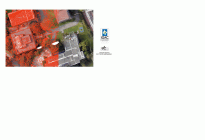
For this reason, IGAC scheduled on 3 and 4 February, a training course on the topic of "Sorting images of high resolution based on objects." Such techniques allow users to extract thematic vectors with different approaches (features basic mapping, surveying, coverage and use soil, etc...) from satellite imagery, airborne cameras or remotely manned platforms (UAV-Drones).