Europe
Noticias
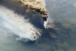
“More than half of the world’s active volcanoes are not monitored instrumentally,” according to GFZ Helmholtz Centre Potsdam. Yet eruptions occur quite frequently, with up to 85 of the 1500 active volcanoes erupting each year, and can cause significant damage. For example, the 2018 volcanic eruptions at Fuego (Guatemala) and Anak Krakatau (Indonesia) resulted in 430 dead and missing persons. This threat to human life makes improving the monitoring of volcanoes all the more important.
A German research team, made up of scientists from the Technical University of Berlin and the GFZ German Research Centre for Geosciences in Potsdam,... read more
Publishing Date: 06/08/2019
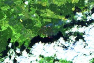
Satellite technology became an integral part of efforts to detect and contain forest fires in Mecklenburg Western Pomerania, Germany at the end of June and early July. The German Aerospace Center (DLR) used satellite information, along with images captured by the Modular Aerial Camera System (MACS), to create maps, which provided emergency services with up-... read more
Publishing Date: 25/07/2019
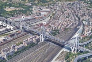
Evaluating the safety and integrity of infrastructure such as bridges, which is often done through hands-on inspections, may soon be possible with the help of information captured several kilometers above the Earth’s surface. According to a National Aeronautics and Space Administration (NASA) news article, scientists from NASA, the University of Bath, and the Italian Space Agency used historical synthetic aperture radar (... read more
Publishing Date: 08/07/2019
The importance of using space technologies in the disaster management process has received growing global recognition in recent years. For example, the African Union outlined in its 2017 African Space Policy that among other things, space represents a unique opportunity for cooperation in using and sharing infrastructure and data to proactively respond to and manage natural hazards and... read more
Publishing Date: 18/06/2019
Regional Support Offices mentioned:
The lowering or sinking of the ground’s surface, referred to as land subsidence, can cause serious damage to infrastructure and private property, and in turn, have an adverse impact on communities, individuals, and the economy. The European Space Agency’s (ESA) Sentinel-1 satellite, part of the Copernicus programme, is being used to monitor cases of land subsidence and contribute to risk assessment and urban development efforts.
From... read more
Publishing Date: 30/05/2019
Optical transmission techniques are considered to be the most effective way to transmit the significant amounts of data obtained day after day from Earth observation satellites to the ground for analysis. With a small test satellite, a corresponding data transmission via laser has now been successfully tested by the German Aerospace Center (DLR) and the University of Stuttgart.
Earth observation satellites are used... read more
Publishing Date: 23/04/2019
Sentinel Hub, together with the European Earth Observation programme Copernicus and the European Space Agency, are looking for new and innovative ideas and scripts for Sentinel data processing and visualization. The contest will run until 5 May 2019 and all the entries will be judged by a jury of experts on functionality and usefulness, as well as possible commercial value.
The EU Earth Observation Browser and similar services are made possible through open data policies, which allow everyone to access and use satellite data. Thanks to... read more
Publishing Date: 23/04/2019
On 21 March in French Guiana, the Italian... read more
Publishing Date: 08/04/2019
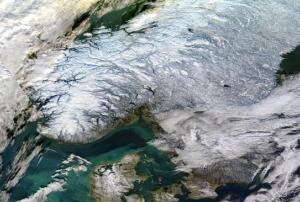
A consortium of Norwegian institutions has used Copernicus Sentinel-1 satellite data in combination with the Interferometric Synthetic Aperture Radar (InSAR) remote sensing technique to map ground movements in the country. The Geological Survey of Norway (NGU), the Norwegian Water Resources and Energy Directorate (NVE) and the Norwegian Space Centre (NSC) make results freely accessible through InSAR Norway, a service launched in November 2018. The service aims to produce ground deformation measurements in the country and improve accessibility of InSAR results for public and... read more
Publishing Date: 07/03/2019
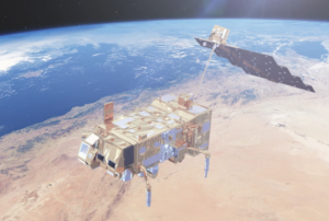
Europe’s newest weather satellite was launched into orbit on 7 November and is set to bring more accurate forecasts than ever.
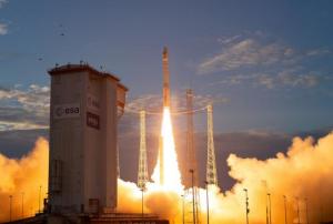
The rocket was carrying the 4083 kg MetOp-C towards its destination of polar orbit. About 60 minutes after take-off, Soyuz’s upper stage delivered the satellite into orbit and contact was established through the Yatharagga ground station in Australia.
The new satellite is the third in the... read more
Publishing Date: 23/11/2018
The European Space Agency (ESA) launched the much-awaited Aeolus satellite into orbit on 22 August. It will provide data expected to improve weather forecasting and contribute to better disaster management.
Aeolus - the “Keeper of Winds” in Greek mythology - aims to track and profile global wind better. Aeolus uses the Active Doppler Wind Lidar (... read more
Publishing Date: 28/08/2018
The summer of 2018 has seen several severe wildfires across Europe and the world. A number of space-based applications and data from the National Aeronautics and Space Administration (NASA), the European Union’s Copernicus programme, the European Forest Fire Information System (EFFIS) are supporting authorities in fighting the fires.
Both NASA GFWED, Copernicus’ EMS and EFFIS provide disaster management with free satellite data for accurate forecasting, monitoring, and... read more
Publishing Date: 30/07/2018
Atos activated its new Earth observation platform Mundi Web Services on 21 June 2018. The platform is already being used by several clients to evaluate and manage disaster risks.
On behalf of the European Commission and the European Space Agency (ESA), Atos created the Mundi platform to combine real-time geo data from Copernicus, the world’s largest single Earth observation program, with data from... read more
Publishing Date: 24/07/2018
The European Commission has launched an initiative to facilitate access to Copernicus data and information services. DIAS is designed to improve users’ ability to access as well as process Copernicus data and information by standardizing access to data through five cloud-based platforms: CREODIAS, MUNDI, ONDA, SOBLOO and WEKEO.
The European Union’s Copernicus programme produces up to 12 terabytes of data each day and Copernicus services, such as Copernicus... read more
Publishing Date: 20/07/2018
The Joint Research Centre (JRC) published a new edition of its World Atlas of Desertification (WAD3) on 21 June 2018. The publication and related website show that population growth and changes in consumption patterns put unprecedented pressure on the planet's natural resources. As a result, the WAD3 highlights the urgency to adopt corrective measures such as greater commitment and more effective cooperation at the local level to limit two of the main causes of land degradation: the consumption of animal proteins from unsustainable sources and agricultural expansion.
The Atlas provides a comprehensive and evidence-based assessment of land degradation at a global scale and thus offers a tool for decision makers to improve local responses to soil loss and land degradation, comprehend... read more
Publishing Date: 09/07/2018
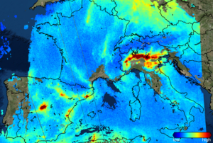
Sentinel-5P is the latest satellite mission of the European Earth observation programme, Copernicus. The satellite was launched on 13 October to monitor the... read more
Publishing Date: 06/12/2017
The Government of Turkey hosted the European Forum for Disaster Risk Reduction (EFDRR) Open Forum in Istanbul from 26 to 28 March 2017. EFDDR is Europe’s regional platform for disaster risk reduction and brings together multiple stakeholders across all sectors through its Open Forum meetings to discuss and advance on disaster risk reduction issues and to shape the implementation and monitoring of the Sendai Framework in Europe. In the form of the Istanbul Outcomes, it formulated a perspective on disaster risk reduction in Europe in preparation for and as a contribution to the 2017 Global Platform for Disaster Risk Reduction.
The Istanbul Outcomes call for an inclusive approach to disaster risk reduction which recognizes vulnerable people as vital participants in the formulation of national and local strategies. It recalls the severe earthquake in Central... read more
Publishing Date: 01/04/2017
ESA’s Earth observation satellite Sentinel-3A has on its board a new instrument measuring sea surface height and wave height. The Synthetic Aperture Radar Altimeter (SRAL) delivers accurate measurements and provides the Copernicus ocean forecasting systems with data for monitoring the sea level change. The data come with two different time stamps-Near real... read more
Publishing Date: 02/03/2017
The Sentinel-3A, one of the most complete Copernicus missions, has advanced instruments to measure the temperature on oceans, land, ice and atmosphere. After going through testing and improvements since its launch on February 2016, it has released high quality information from the Ocean and Land Colour Instrument in October this year.
This satellite is currently offering information from its Sea and Land Surface Temperature Radiometer. This data can be used for ocean and weather forecasting activities by helping... read more
Publishing Date: 01/12/2016
The United Nations commemorated its 20th anniversary since its establishment in Bonn, Germany in June 1996. Taking into consideration the recent launch of the Sustainable Development Goals, the theme for this anniversary celebration was “Shaping a Sustainable Future”. UN-SPIDER joined the festivities on 28 and 29 October 2016. During the UN Talks held in the evening of 28 October, the Head of the UN-SPIDER Bonn Office focused his remarks on the role of space-based information in
disaster risk reduction as essential when addressing sustainable development. His comments were rooted on the fact that disasters are eroding hard-won development gains in developing countries. At the UN fair on 29 October 2016, UN-SPIDER’s stand offered visitors more information on the work carried out by this programme of the United Nations Office for Outer Space Affairs (UNOOSA) and...
read more
Publishing Date: 03/11/2016
The COPERNICUS Emergency Management Service Mapping was activated on 26 October 2016 due to a 5.4 earthquake affecting Italy's central region. Although there are no fatalities the tremor has left destruction and people sleeping on the street or improvised shelters, reported RT. For more RT information, click here.
The Guardian informed that approximately 200 replicas were felt during the night. The epicenter was close to Visso, a town in central Marche. More details from this daily, click here.
Publishing Date: 27/10/2016
Radar Satellite images offer precise 3D pictures of earth. The Crises Control Team of the German Aerospace Center puts together radar imagery on natural disasters like floods or earthquakes. This information is essential for emergency services to know where people are in danger or where help is required. To watch the complete video click here.
Publishing Date: 19/10/2016
Pages
Zircon - This is a contributing Drupal Theme
Design by
WeebPal.