")
UNOOSA/UN-SPIDER is supporting two summer courses at the Central European University in Budapest, Hungary this July. The application deadline for both courses is 15 March 2015.
Bridging ICTs and Environment - Making Information Talk and Technologies Work will take place from 6 to 10 July 2015 and is co-sponsored by UNOOSA's Programme for Space Applications. The course is furthermore supported by Esri, with support from the Eye on Earth Initiative and United Nations Environment Programme’s (UNEP) Global Universities Partnership for Environment and Sustainability ( GUPES). It aims to bridge the gap between decision- and policy-makers and ICT technologies (e.g. GIS, remote sensing), making data and emerging technologies more accessible, usable, and relevant for decision-making. It is focused on the application of ICTs in water management and security and is a preparatory activity for the Eye on Earth...
more")
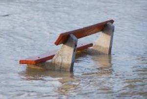
 keep from leakage. (Credits: Károly Róbert College)")