![]()
United
Nations
Tremblement de terre
 Earth Observation Center (EOC) using data acquired by Sentinel-1A before and after the earthquake event. Image: DLR/EOC")
Definition
Facts and figures
Further information
UN-SPIDER Regional Support Offices with hazard-specific expertise
Related content on the Knowledge Portal
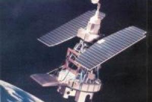
Landsat 1 was launched on July 23, 1972; at that time the satellite was known as the Earth Resources Technology Satellite (ERTS). It was the first Earth-observing satellite to be launched with the express intent to study and monitor our planet’s landmasses. To perform the monitoring, Landsat 1 carried two instruments: a camera system built by the Radio Corporation of America (RCA) called the Return Beam Vidicon (RBV), and the Multispectral Scanner (MSS) built by the Hughes Aircraft Company. The RBV was supposed to be the prime instrument, but the MSS data were found to be superior. In addition, the RBV instrument was the source of an electrical transient that caused the satellite to briefly lose altitude control, according to the Landsat 1 Program Manager, Stan Weiland.
read more
To help understand the data and to explore the potential applications of this new technology, NASA oversaw 300 private research investigators. Nearly one third of these were international scientists…23/07/1972
The Asia-Pacific Space Cooperation Organization (APSCO) organized from 23 to 25 October 2023 the International Workshop on Aerospace Application of Earthquake Early Warning and Quick Response in Istanbul, Türkiye. The workshop brought together around 110 participants from Bangladesh, Belgium, the People’s Republic of China, Cuba, the Islamic Republic of Iran, Italy, Mongolia, Pakistan, Peru, the Russian Federation, Thailand, the Republic of Türkiye, and the United States. In addition, experts from the Copernicus programme and UN-SPIDER were invited to participate in the workshop.
Experts from several organizations and national institutions made presentations on the use of space and in-situ technologies to monitor earthquake precursors, space technologies for disaster management, and aerial technologies for quick response in case of earthquakes. Participants took note of on-going research to detect precursors using in-situ measurements of radon activity, dedicated satellites…
read more30/10/2023.")
In the early hours of 6 February 2023, a major earthquake of magnitude 7.8 struck the sourthern region of Türkiye. The epicentre was located 23 kilometres east of Nurdagi (Gaziantep Province). The earthquake also affected neighbouring Syria and was followed by very strong aftershocks.
The space community is contributing to provide critical information and support disaster response efforts. Through the activation of the International Charter on Space and Major Disasters, and the Copernicus Emergency Management Service, the space community is playing an important role in the response and recovery efforts. Other space agencies are also contributing to map the areas affected by the earthquake.
One of the products that can be elaborated processing radar imagery before and after an earthquake is an interferogram that depicts the displacement of the surface triggered by such an earthquake. The European Space Agency carried out an analysis of satellite imagery to…
read more
The Space and Upper Atmosphere Research Commission (SUPARCO) of Pakistan and the United Nations Office of Outer space Affairs (UNOOSA) signed the cooperation agreement on the establishment of a UN-SPIDER Regional Support Office (RSO) on the occasion of the 47th Scientific and Technical Subcommittee sessions on 12 February 2010.
SUPARCO, the national space agency, was established in 1961 as a Committee and was granted the status of a Commission in 1981. SUPARCO is mandated to conduct R&D in space science, space technology, and their peaceful applications in the country. It works towards developing indigenous capabilities in space technology and promoting space applications for socio-economic uplift of the country.
Address:
Pakistan Space and Upper Atmosphere Research Commission (SUPARCO)
Islamabad Highway,
Islamabad-44000 PakistanMission/Objective:
To…
read more

Le Centre Asiatique pour la Prévention des Catastrophes (ADRC) et le Bureau des Affaires Spatiales des Nations Unies (UNOOSA) ont signé l'accord de coopération sur l'établissement du Bureau Régional d'Appui (BRA) ONU-SPIDER de l'ADRC à l'occasion de la 52ème session du Comité des Utilisations Pacifiques de l'Espace Extérieur (COPUOS) le 4 juin 2009.

Term Parents
UN-SPIDER Regional Support Offices with hazard-specific expertise
![]()