Global

country taxonomy block

The US National Geospatial-Intelligence Agency (NGA) and DigitalGlobe have jointly released Hootenanny, a new open source project to enhance the way crowdsourced mapping influence geospatial big data analytics.

Through GitHub, a web-based Git repository hosting service, Hootenanny provides a scalable processing engine and interactive editing interface to help users rapidly conflate, or reconcile, map features generated from satellite imagery, unmanned aerial vehicles and mobile devices, as NGA explained.

“The commercialization of GEOINT [GEOspatial INTelligence] is leading to exponential growth of publicly available geospatial information. Hootenanny as an open source project will enable new levels of data sharing across the community that will increase our nation’s ability to quickly respond to emerging…

more
Publishing date 20/07/2015

The company of recent creation CartoFusion Technologies has developed a mapping application called SituMap that allows first responders to effectively detect an emergency situation.

SituMap is an app created by Dr. Richard Smith, Assistant Professor of Geographic Information Science and Geospatial Surveying Engineering at Texas A&M University-Corpus Christi. By acting as a tablet-like digital command center, it enables first responders to see real-time information through maps of crisis areas and therefore to plan and respond faster in emergency situations.

In Sensors & Systems website the functioning of the app is explained as follows: “With the touch of a finger, the table-size display can be zoomed, rotated, and drawn on. Like a personalized version of…

more
Publishing date 14/07/2015

The proceedings of the Third United Nations World Conference on Disaster Risk Reduction (WCDRR) are now available in English and will be translated and made available in the other five UN languages in the next few weeks.

The document includes all the issues addressed during the five days of deliberations, discussions and presentations at Sendai City, Japan, with the occasion of the Third United Nations World Conference on Disaster Risk Reduction (WCDRR) in March 2015.

Within the proceedings, the Sendai Declaration and the Sendai Framework for Disaster Risk Reduction 2015-2030, as well as a chart of the Framework, stand out. Among the additional information integrated in the document are: opening ceremony statements,…

more
Publishing date 10/07/2015

ETSI, producer of globally applicable standards for Information and Communications Technologies, through its Technical Committee for Satellite Earth Systems (TC SES) has published new specifications on scenarios for emergency communications during disasters, including the use of satellite networks.

These reports cover two different scenarios: a major earthquake in an urban area and a train crash in the countryside. In the first case emergency responders are spread across a wide area and may use satellite imagery to replace damaged infrastructures. In the second case, responders are more concentrated in a small area, response activities are more homogenous and satellite data is capable of offering a hub to supplement the minimal existing infrastructures.

These disaster management guidelines offer standardized “user” guidelines by using additional communication networks such as satellites and enhance coordination between several agents in charge of disaster…

more
Publishing date 08/07/2015

The Millennium Development Goals (MDGs) Report 2015 was released yesterday, 6 June. The results presented serve as the basis for the upcoming sustainable development agenda that will be adopted this year.

Geospatial information and natural disasters have found their place among the lines of the report. Location-based information is mentioned as a tool to help governments and stakeholders improving their decision-making process and setting priorities. The access to geospatial data helps dealing with social, economic and environmental challenges such as health care during virus outbreaks or global climate changes, from sea level rise to unexpected natural disasters.

“Geospatial data can support monitoring in many aspects of development, from health care to natural resource management,” can be read within the report to highlight the need of access to better data for the post-2015 development agenda.

As an example, the new Millennium Development Goals (…

more
Publishing date 07/07/2015

A new report by the international consulting firm Northern Sky Research (NSR) forecasts a boom for nano and microsatellites by 2024, which would lead to a significant diversification of the satellite industry. The report, entitled “Nano and Microsatellite Markets, 2nd Edition”, states that the market for sub-100 kg space artifacts has nearly doubled between 2013 and 2014, and operators have multiplied by three in just five years.

The developers of these nano and microsatellites are mainly universities, start-ups, small government agencies and military forces with low budget and limited time and expertise but who also participate in Earth Observation, science and risk awareness.

However, this sector also faces challenges, as the shortage of affordable launch vehicles, more efficient rideshares and limited orbital diversity. Therefore, the availability of venture capital and support from national agencies will be crucial for securing investment.

more
Publishing date 25/06/2015

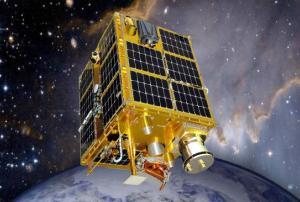
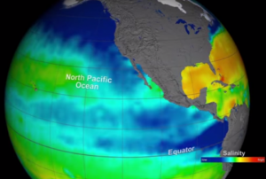
The Aquarius/Satélite de Aplicaciones Científicas (SAC)-D satellite observatory, a joint project between NASA and Argentina’s Space Agency (CONAE), with participation from Brazil, Canada, France and Italy, has ended its activity after nearly four years.

The international Earth-observing mission, launched in 2011 to study the salinity of the ocean surface, has been brought to an end due to the shut down of an essential part of the power and attitude control system for the SAC-D spacecraft.

Despite this recent loss of onboard power regulation and spacecraft attitude stabilization, the Aquarius instrument had already successfully achieved its science objectives and completed its primary three-year mission in November 2014.

“The Aquarius sensor collected three years and nine months of valuable data. It was truly a pioneering effort to determine how accurately we could measure ocean salinity from space and for the first time study large and small-scale…

more
Publishing date 24/06/2015
Regional Support Offices mentioned:

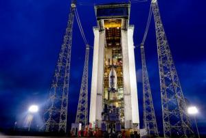
Sentinel 2A, the new satellite developed by the European Space Agency (ESA) and Airbus, was successfully launched from the European Spaceport in Kourou (French Guiana) on 23 June 2015 at 01:52 GMT. It separated from the stage into flight 54 minutes after the launch, its solar panel has already been deployed but it will only begin its missions in three or four months.

Sentinel 2A is the second satellite of the European Union’s Copernicus programme, weights 1.1 tonnes and was developed with a budget of 7.500 million euros, the highest for a civil Earth Observation satellite. It is specifically designed for environmental monitoring and will provide colourful high resolution imagery in 13 spectral bands.

It will allow displaying new land cover and change detection maps, disaster maps and leaf area index to chlorophyll content and other biogeophysical data. This would facilitate locating sites for refugee camps in humanitarian crises, monitoring the destruction or…

more
Publishing date 23/06/2015

UNOOSA and NASA have launched a global social media campaign to raise awareness about the impact of the outer space on our daily lives and its importance for a sustainable development on Earth.

The #whyspacematters photography contest aims to collect pictures showing why outer space matters to our everyday life. Astronaut Scott Kelly, stationed on the International Space Station for a one-year mission, will be posting the winning photo through his Instagram account every month.

“This campaign will help to promote the use of space science and technologies in such areas as disaster risk reduction, tracking the effects of climate change and in the equality of access to education and telemedicine," stated Simonetta Di Pippo, UNOOSA Director.

To illustrate the influence of outer space for a sustainable development, UNOOSA has made available a dedicated webpage with some examples…

more
Publishing date 18/06/2015

At the ongoing Paris Airshow European spacecraft company Airbus Defence and Space announced that they will produce a fleet of 900 satellites for OneWeb, a project carried out by British Channel Islands in order to enable internet access in remote areas. It will be made up of 900 small, low orbit satellites which are cheaper and faster to mass produce and have shorten latency periods than those circling further away from Earth.

The first satellites will be manufactured in the Airbus facilities in Toulouse, but full production will take place in the US. To put the constellation in orbit, Richard Branson’s Virgin Group will likely be involved. Initially only 600 out of 900 will be launched, the rest would be kept as spares.

The expected launch of the OneWeb satellite network is scheduled for 2018 and it will presumably be operational around 2020 and would need hundreds of millions of dollars to maintain in venture. The objective is to connect these satellites to…

more
Publishing date 16/06/2015

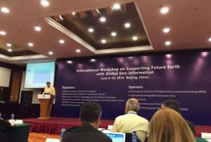
The UN-SPIDER Beijing Office in cooperation with the National Geomatics Center of China (NGCC), the Chinese National Committee for Future Earth (CNC-FE), the UN Project Management Office (National Administration of Surveying, Mapping and Geoinformation - NASG) and LIESMARS - Wuhan University co-organized the "International Workshop on Supporting Future Earth with Global Geo-information" from 9 to 10 June, Beijing, China.

UN-SPIDER contributed to the session "Disaster Risk Reduction and Global Geo-information" to support sustainable development and Future Earth initiative with the effort of establishing reliable global geo-information. The session also aimed to promote integration of Earth observation and geo-information technologies in implementing the Sendai Framework for Disaster Risk Reduction: 2015-2030, which is the theme of upcoming UN-SPIDER Conference in Beijing to take place in…

more
Publishing date 15/06/2015

On the sidelines of the 58th session of the Committee on the Peaceful Uses of Outer Space (COPUOS) in Vienna, the United Nations Office for Outer Space Affairs (UNOOSA) and Israel signed an agreement on cooperation in space-related issues on Friday, 12 June 2015. The Israel Space Agency will implement the agreement on behalf of the Israeli Government.

The agreement includes the contribution to the advancement of space-related research within the international community recognizing that space has become a dominant factor in technological, economic and cultural development, holding great potential to improve the lives of mankind globally, in such fields as medicine, disaster management, satellite technology, environment, geographical navigation and much more.

The two parties confirmed that they aim at further consolidating and developing their cooperation in order to effectively achieve their common objectives, including for the purpose of establishing mechanisms to…

more
Publishing date 15/06/2015

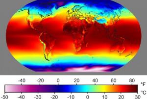
NASA has released a dataset displaying how temperatures and precipitations might change by the year 2100 taking into account various greenhouse gas emission scenarios. This 25-km high resolution data is of free access to the public and shows estimated maximum and minimum temperatures as well as precipitations on a daily basis and at a local and global scale from 1950 to 2100 under two different greenhouse gas emission scenarios: a “business as usual” scenario based on current trends and an “extreme case” with huge carbon dioxide increases. These simulations were carried out by the international Fifth Coupled Model Intercomparison Project.

These maps could contribute to the improvement of climate risk evaluations to get a better knowledge of local and global impacts and risks, such as severe drought, floods, heat waves and losses in agriculture productivity.

This dataset is the newest product by the big-data platform NASA Earth Exchange (NEX),…

more
Publishing date 11/06/2015

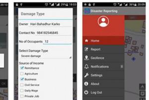
“Disaster Reporting” is a new android application launched by UN-SPIDER's Nepal Regional Support Office ICIMOD and Kathmandu University, Nepal, with the aim of easing relief processes of disaster events through contributive reports of the users.

The users can select the type of disaster event and inform about the impact and damages caused, the number of people injured or the relief requirements on the field, among others. Users’ reports allow creating and updating an interactive and freely accessible map, which helps better understanding and assessing the situation.

“The app can be used by government and nongovernmental organizations for field data collection for long-term planning for rebuilding and reconstruction, disaster assessment, relief distribution and overall disaster management,” said Shashish Maharjan, the main coordinator of the application development.

The application was developed by the Geospatial Lab, Department of…

more
Publishing date 10/06/2015

The first harmonized and high-resolution monitoring service for inland and coastal waters has been launched providing water quality information directly accessible online through the eoApp web application.

This new service is offered by the provider of aquatic remote sensing solutions EOMAP GmbH & Co. KG, which is easing, among others, the identification of long-term trends and the understanding of emerging problems in near real time over large areas containing numerous water bodies.

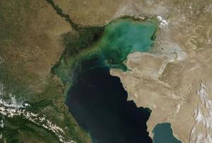
Turbidity, chlorophyll concentrations and organic/inorganic components are some of the water quality parameters that can be generated for any location worldwide and presented in digital map form. The satellites used are already operating with global coverage allowing the new EOMAP service to implement the inland water quality monitoring for the whole globe, covering from local to continental scales.  

"Our remote sensing-based service sets the new standard for monitoring…

more
Publishing date 09/06/2015

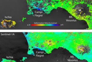
The remote sensing technique to map ground deformation is being improved thanks to scientific work based on frequent observations from the Sentinel-1A radar satellite data.

The one-year old satellite data has been compared with those from the ERS and Envisat, former satellite radar missions. This work has enabled researchers of Italy’s Institute for Electromagnetic Sensing of the Environment (IREA-CNR) to show a drastic improvement in mapping surface deformation and to draw a new path for earthquake and volcano monitoring.

“To achieve this, the scientists used the Interferometric Synthetic Aperture Radar, or InSAR, technique. This involves combining two or more radar images acquired at different times. If something on the ground has changed between the acquisitions, the terrain deformation is displayed as a continuous sequence of coloured stripes called interference fringes, or an ‘interferogram’,” explains the European Space Agency on…

more
Publishing date 09/06/2015

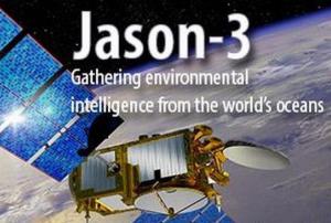
The launch of the Jason 3, a U.S.-French oceanography satellite, has been postponed due to a discovered contamination in one of the spacecraft’s thrusters at its factory in France.

The mission was scheduled to be launched July 22 from California but NOAA announced the slip on Tuesday, June 2, and for the moment officials did not set a new launch date. They are waiting for the outcome of the thruster review taking place at its Thales Alenia Space factory in Cannes, France.

NOAA announced in a statement: “The launch of the Jason 3 mission will not occur July 22, as announced previously. During spacecraft testing, engineers located contamination in one of the four thrusters on the spacecraft. The problem thruster has been replaced. An investigation into the contamination will continue during the next two weeks, as the new thruster is tested.”

Through extend space-based measurements of sea levels and wave height, Jason 3 will be used to monitor…

more
Publishing date 08/06/2015

The satellite developer PlanetiQ introduced its new GPS technology called Pyxis which will make predictions better than before. The satellite-based weather instrument includes sensors that are designed to penetrate storm clouds and generate data that will significantly improve weather forecasting.

Pyxis will monitor GPS signals in the atmosphere and then translate them in precise measurements of global temperature, pressure and weather vapor. With this mode of operation the new instrument may also improve climate monitoring, and does it all at less cost than existing satellite weather systems, as PlanetiQ announced.

According to the satellite developer, Pyxis will be incorporated…

more
Publishing date 05/06/2015

A new UN-SPIDER newsletter is now available. The latest issue focuses on the use of Earth observation for the post-2015 sustainable development agenda. 2015 is a milestone year for the United Nations. Not only is the organization celebrating its 70 years of existence, the year is also the starting point for major agreements and frameworks that will shape global sustainable development in the years to come. Nations worldwide will jointly embark on new paths to end poverty, promote prosperity and well-being for all, protect the environment, address climate change and reduce disaster risks.

More specifically, the newsletter looks at space technologies for the Sendai Framework for Disaster Risk Reduction, the new Paris climate change agreement and the Sustainable Development Goals to be launched in September of this year.

Furthermore, this issue…

more
Publishing date 04/06/2015

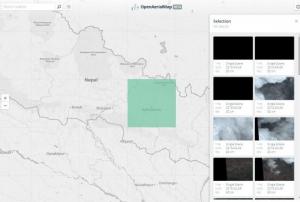
The OpenAerialMap project was started by Humanitarian Open Street Map earlier this year with the goal to improve rapid access to aerial imagery for disaster mapping and humanitarian response. Now, a beta version was released.

Delivering useful imagery to decision makers, mappers and responders still needs its time, like it was illustrated during the recent Nepal earthquake. Now, the OpenAerialMap offers users a simple interface to find, browse, filter and review available data.

Additional components that will allow users to upload and share image data are being designed and will be released soon. This means that anyone from traditional satellite image providers to individual drone mappers will be able to easily share imagery for humanitarian mapping.

The entire system is built using open source software and designed to dynamically scale in performance as the catalog grows with millions of images.

The current image catalog is still in beta but gives an…

more
Publishing date 03/06/2015

UNOOSA took up the annually rotating position of official Chair of the International Working Group on Satellite based Emergency Mapping (IWG-SEM) at the Group's meeting today in Bonn, Germany.

The IWG-SEM is a voluntary group of organizations involved in satellite based emergency mapping which supports disaster response by improving international cooperation in such mapping activities. The group was founded to improve cooperation, communication and professional standards among the global network of satellite based emergency mapping providers. This becomes especially important for the large-scale response in the aftermath of devastating earthquakes such as in Haiti in 2010 or last month in Nepal.

UNOOSA will take over as Chair from the German Aerospace Center (DLR). In this role, UNOOSA is aiming to promote further collaboration among the Group's members, and is looking to broaden its membership. In the coming year UNOOSA also wants to continue working on the…

more
Publishing date 29/05/2015

On 28 May 2015, UNOOSA and its co-organizers, the German Aerospace Center (DLR) and the German Federal Ministry for Economic Affairs and Energy (BMWi), successfully concluded the three day United Nations/Germany International Conference on Earth observation in Bonn, Germany. The conference was kindly supported by Secure World Foundation, the City of Bonn and Digital Globe.

Under the theme of "Global Solutions for the Challenges of Sustainable Development in Societies at Risk", approximately 120 experts and participants from more than 35 countries in Africa, Asia, Europe, Latin America and the Caribbean convened in Bonn to discuss the benefits of Earth observation for sustainable development, including climate change and disaster risk reduction. Specifically, the participants discussed how Earth observation can feed into the Sendai Framework for Disaster Risk Reduction, the Sustainable Development Goals and the 2015 climate change agreement. The overall aim is to…

more
Publishing date 29/05/2015

The United Nations/Germany International Conference on Earth Observation: Global Solutions for the Challenges of Sustainable Development in Societies at Risk was opening today in Bonn, Germany. The three-day event is bringing together 130 experts and participants from more than 30 countries in Africa, Asia, Europe, Latin America and the Caribbean to discuss the benefits of Earth Observation for sustainable development. The issues discussed include the Sendai Framework for Disaster Risk Reduction, the Sustainable Development Goals and the 2015 climate change agreement. The conference is organized jointly by UNOOSA, the German Aerospace Center (DLR) and the German Federal Ministry for Economic Affairs and Energy (BMWi).

The conference was opened by Juan Carlos Villagran, Head of Office of the UNOOSA/UN-SPIDER Bonn Office, Margitta Wülker-Mirbach, Head of Division at BMWi, and Lord Mayor of the City of Bonn, Jürgen Nimptsch.

In her keynote speech, UNOOSA's director…

more
Publishing date 26/05/2015

The need of a close relation between disaster risk reduction and the health sector has been highlighted at the 68th World Health Assembly on the basis of the Sendai Framework for Disaster Risk Reduction 2015-2030.

“The Sendai Framework is an opportunity for countries to shift their focus from managing disasters to managing risks which requires a better understanding of risk in all its dimensions of vulnerability and exposure, a key priority for disaster risk reduction over the next fifteen years. […] The health status of disaster-exposed populations is central to the achievement of the overall goal of the Framework of achieving a substantial reduction of disaster risk and losses in lives, livelihoods and health,” stated Ms. Chadia Wannous, UNISDR’s health focal point.

She stressed the importance of building stronger cooperation between health authorities and relevant stakeholders to improve the capacity for disaster risk…

more
Publishing date 22/05/2015

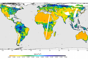
NASA's new Soil Moisture Active Passive (SMAP) mission has begun science operations. SMAP investigates global soil moisture and detect whether soils are frozen or thawed. This information help scientist understand links among Earth’s water, energy and carbon cycles. In addition, map global soil moisture can help to monitor and predict natural hazards like floods and droughts.

"Fourteen years after the concept for a NASA mission to map global soil moisture was first proposed, SMAP now has formally transitioned to routine science operations," said Kent Kellogg, SMAP project manager at Jet Propulsion Laboratory (JPL). "SMAP's science team can now begin the important task of calibrating the observatory's science data products to ensure SMAP is meeting its requirements for measurement accuracy."

SMAP was launched on 31 January this year…

more
Publishing date 20/05/2015