
Cette base de données fournit des descriptions d'une grande variété de logiciels pour le traitement et l'analyse des informations spatiales. Vous pouvez effectuer des recherches dans la base de données en fonction de critères tels que le type de logiciel, le format des données et le système d'exploitation. Comme la base de données comprend des applications d'une complexité technique variable, il est également possible de ne sélectionner que celles qui ne nécessitent pas de compétences en programmation et qui ont une interface utilisateur graphique.
Software type:
Tool/Converter
Costs:
Free
Operating System:
Windows, Linux

Software type:
Tool/Converter
Costs:
Free
Operating System:
Online
Software type:
Database/Library
Costs:
Free
Operating System:
Windows, MacOSX, Linux, Solaris

Software type:
Desktop image processing (remote sensing software - raster data)
Costs:
Free to try
Operating System:
Windows
Software type:
Database/Library
Costs:
Free
Operating System:
Windows, MacOSX, Linux
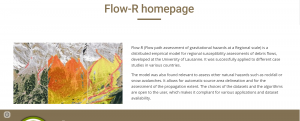
Software type:
Web processing (cloud computing)
Costs:
Free
Operating System:
Online
Software type:
Tool/Converter
Costs:
Free
Operating System:
Windows
Software type:
Tool/Converter
Costs:
Free
Operating System:
Windows, MacOSX, Linux
Software type:
Crowdsourcing/VGI
Costs:
Free
Operating System:
Online
Software type:
Web processing (cloud computing)
Costs:
Free
Operating System:
Online
Software type:
Web processing (cloud computing)
Costs:
Free
Operating System:
Online
Software type:
Desktop GIS
Costs:
Free
Operating System:
Windows, Linux