Cyprus

country taxonomy block

The subject of the 10th EARSeL Forest Fire Special Interest Group Workshop will be "Sensors, Multi-sensor integration, large volumes: New opportunities and challenges in Forest Fire Research".  The workshop will focus on the use of multi-scale sensors, including UAV, drone, aircraft, helicopter, Landsat/Sentinel, MODIS/PROBA and systematic observations through Landsat WELD and Sentinel 1/2/3 to conduct research in forest fires.  

The EARSeL Special Interest Group on Forest Fires (FF-SIG) was created in 1995, following the initiative of several researchers studying fires in Mediterranean Europe. The FF-SIG which currently represents one of the most active groups within EARSeL promotes the integration of advanced technologies and the production of satellite-derived products for the benefit of forest managers, researchers, local governments and global…

more
Abstract Submission
Papers can be presented orally and by poster. Both are considered of equal standing. Kindly indicate your preference for oral or poster presentation when submitting your abstract. Please note that both oral and poster presentations require a full paper to be submitted in order to be published in the SPIE conference proceedings.  All abstracts will be published in the RSCy2016 abstract proceedings that will be distributed at the conference.
 
Topics
Authors are requested to submit their abstracts in the following areas:
 
- Remote Sensing Applications, Geo-information, Geophysics
- Remote sensing & geo-information in education
- Oil exploration, Oil and Gas – Hydrocarbons
- Marine Spatial Planning, Coastal Zone Management
- Geoinformation for…
more

The Copernicus Training and Information Session will be held on 27 March 2018, in Paphos, Cyprus. This is the 13th Copernicus Training and Information Session in a series of national Copernicus events. The European Commission is organising these sessions at the request of, and in collaboration with Member States.

The event aims to promote awareness of the many uses of Copernicus data and information, while providing the opportunity for hands on demonstrations and basic training regarding:

  • Access to Copernicus satellite data;
  • Copernicus Land Monitoring Service (CLMS);
  • Copernicus Marine Environment Monitoring Service (CMEMS)
  • Copernicus Climate Change Service (C3S).

The event is open and free of charge but registration is required.

Register Now

On 18 to 21 March 2019, the Seventh International Conference on Remote Sensing and Geoinformation of Environment will be held on Cyprus. Participants can network with leading experts in the field of Remote Sensing and Geo-information.

The Technical Program is open to all topics in Remote Sensing and Geo-information of Environment and related techniques and applications. Workshops will include a variety of topics. The RSCy2019 will include ESA, NASA and Copernicus workshops. Additional workshops will be announced.

The agenda can be accessed here. Find the event on Twitter.

 

The Keynote Speakers and thought-provoking technical program will encourage the exchange of ideas and provide the foundation for future collaboration and innovation. The Technical Program is open to all topics in Earth Obersvation, Remote Sensing, Geo-information of Environment and related techniques and applications.

The RSCY2020 scientific program will accommodate sessions and workshops on a wide range of themes, including:

  • Earth Observation research projects, applications and emerging technologies
  • Environment & climate (atmosphere, agriculture, water, land)
  • Resilient society (disasters risk reduction, cultural heritage, marine safety and security, energy)
  • Big Earth data analytics (information extraction, visual exploration and visualisation, crowd-sourcing and data fusion, geo-informatics)
  • Remote Sensing Applications, Geo-information, Geophysics Environmental Monitoring and Protection, Risk Assessment Land use and land cover,…
more

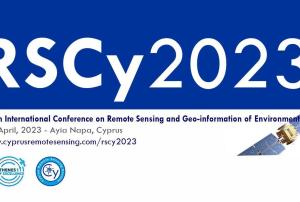
The 9th International Conference on Remote Sensing and Geoinformation of Environment (RSCy2023) will be held in Cyprus on 3-5 April, 2023.

The RSCy2023 is organized by the Cyprus Remote Sensing Society and ERATOSTHENES Centre of Excellence, in cooperation with ESA, NASA, Copernicus, DLR, Group On Earth Observations, the Department of Electronic Communications of the Ministry of Communications and Works, the Technical Chamber of Cyprus, the Cyprus Department of Meteorology and the Agricultural Research Institute.

The Technical Programme is open to diverse topics in remote sensing and geoinformation, as well as related techniques and applications. Presentations and workshops will include a variety of topics, such as:

  • Environment & climate (atmosphere, agriculture, water, land)
  • Resilient society (disasters risk reduction, cultural heritage, marine safety and security, energy)
  • Big Earth data analytics (information extraction,…
more