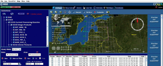
EOLi (Earth Observation Link ) i

| Description: | EOLi (Earth Observation Link ) is the European Space Agency's client for Earth Observation Catalogue Service. Using EOLi, you can browse the metadata and preview images of Earth Observation data acquired by the satellites ERS and Envisat, ALOS, SMOS, GOSAT and download products of various processing levels |
||||||||||||
| Software type: | Desktop GIS | ||||||||||||
| Accessibility: | Install only | ||||||||||||
| Requirements: |
|
||||||||||||
| Computer System: | Windows, MacOSX, Linux, UNIX | ||||||||||||
| Scope: | Image processing, Visualisation | ||||||||||||
| Vector/Raster: | Raster | ||||||||||||
| Optical data or radar data format: | Radar | ||||||||||||
| Graphical user interface: | Yes | ||||||||||||
| Costs: | Free | ||||||||||||
| Tutorials: |


