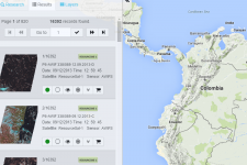
The partnership between Brazil and China has their own image catalog of remotely-sensed data which lets you download free satellite imagery using the INPE Image Catalog.
The catalog includes satellite imagery from their own China–Brazil Earth Resources Satellite 2 and 2b (CBERS-2, CBERS-2b). It includes satellites from the United States, the United Kingdom and the India from Aqua, CBERS, Landsat, ResourceSat, S-NPP, Terra & UK-DMC 2.
The one caveat is that the data is specific to South America and Africa. You’ll have to create an account because each request you make will be sent to your email. You can use your English translation to translate from Portuguese.
Select your satellite and sensor. Choose a country in South America and Africa. Add it to your cart, and click “Go Ahead”. From there you can download your chosen free satellite imagery from the INPE FTP site.
