United
Nations
Office for Outer Space Affairs
UN-SPIDER Knowledge Portal
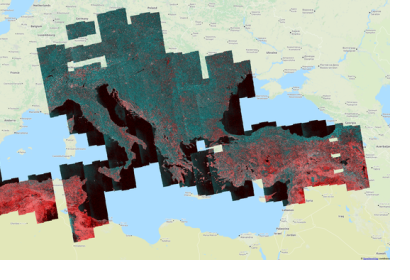
Monitoring the soil after seismic activity is fundamental to understand the small but significant modifications on the soil. Thanks to the merge of satellite imagery and computing is possible to do it automatically nowadays. The Copernicus Sentinel-1 twin radar satellite takes consecutive pictures of the same place and the imagery is then combined with cloud computing to unveil millimeter variations.
This well-known practice was developed in the 80’s using GPS centimeter measurements.
The on-line and cloud-based Geohazards Exploitation Platform allows the processing of large amount of satellite information covering vast geographic regions, showing the benefits of ICT when applied to earth observation.
In the nearest future the plan is to cover all tectonic plates in the world contributing to the preparedness and risk reduction in case of volcanic hazards or tremors.
