  • English
  • Español
  • Français

United
Nations


Office for Outer Space Affairs
UN-SPIDER Knowledge Portal

  • Accueil
  • À propos
    • Qu'est-ce que l'ONU-SPIDER?
    • À propos d’UNOOSA
    • Publications
    • Offres d'emploi
    • Rencontrez l'équipe
    • Contact
  • Applications spatiales
    • Technologie satellitaire
    • Mécanismes d’urgence
    • Recovery Mechanisms
    • Réseau international d'alerte aux astéroïdes
    • Space Mission Planning Advisory Group
    • Initiative internationale sur la météorologie spatiale
    • Les technologies spatiales à l'ONU
    • Comptes-rendus d'utilisateurs
  • Liens & ressources
    • Application de données du mois
      • Disaster Recovery
    • Sources de données
    • SIG et logiciels de télédétection
    • Online Learning Resources
    • Institutions
  • Risques & catastrophes
    • Prévention des risques de catastrophe
    • Systèmes d'alerte précoce
    • Gestion des catastrophes et des interventions d'urgence
    • Aléas naturels
    • Cadre d'action de Sendai
    • L'ONU et la prévention des risques de catastrophe
    • L'ONU et les alertes précoces
    • L'ONU et la gestion des catastrophes
  • Appui technique
    • Missions Conseil
    • Appui d’urgence
    • Appui à distance
    • Pratiques recommandées
    • Activités de formation
    • Utilisations pratiques
  • Réseaux
    • Bureaux régionaux d’appui
    • GP-STAR
    • MHEWS
    • IWG-SEM
  • Projets
    • SPEAR
    • SEWS-D
    • EvIDENz
    • Flood GUIDE
  • Actualités
    • Actualités
    • Événements
    • Événements passés

Breadcrumb

  • Home
  • Post Disaster (Earthquake) Rapid Damage Assessment Training In Myanmar
  • Post Disaster (Earthquake) Rapid Damage Assessment training in Myanmar

Post Disaster (Earthquake) Rapid Damage Assessment training in Myanmar

Centre for Space Science Technology and Education for Asia and the Pacific

UN-HABITAT and UNOOSA/UN-SPIDER.

Tue, 28 Mar - Sun, 2 Apr 2017
Thu 6 Apr 2017

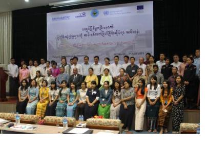
A training programme named ‘Post Disaster (Earthquake) Rapid Damage Assessment’ was held at Yangon, Myanmar on 28 March – 2 April 2017. Its objective was to build capacity for rapid damage assessment using geospatial and earth observation technologies.

It was hosted by Yangon Technological University in collaboration with Ministry of Social Welfare, Relief and Resettlement, Myanmar Engineering Society and Myanmar Earthquake Committee. It was organised as a recall of the Chuak earthquake in August 2016 that severely damaged some of the religious structures in the heritage site of Bagan, with the purpose of developing capacities in use of earth observation and geospatial technologies for post-disaster rapid damage assessment. 

The course included theory and hands-on sessions focused on the use of earth observation in providing critical information and rapid mapping during earthquakes. The participants learned about the role of International Charter, Sentinel Asia etc. and about the use of FOSS4G (Free and Open source software’s for Geoinformatics) and latest trends of digital image processing.

Disaster risk management stakeholders: governmental institutions, members of civil society, disaster risk management experts.
Yangon Technological University
Yangon
Myanmar
English

Footer menu

  • Contact
  • Terms of Use

User account menu

  • Log in