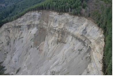
Landslides claim many lives and cause economic loss every year. According to one database recording occurrences of landslides, there were 444 landslides leading to 2,250 fatalities in 2016. Five of these landslides were triggered by earthquakes, one of the many natural and human causes for landslides.
Traditional detection and monitoring techniques are based on in-situ data from sensors measuring, for instance, ground movement and seismic activity. As landslide activity affects the ground surface, satellite information can provide insights about both surface changes and factors that may affect the susceptibility of landslides such as steep slopes and deforestation.
Based on before and after images of a recent landslides in China’s Sichuan Province obtained from the European Space Agency’s Sentinel-1 satellite radar mission, a team of scientists from the United Kingdom and China was able to detect and map the active landslides, including their sources and boundaries. They also found that in the case of one of the landslides, the ground had been moving for six months before eventually failing and hitting Shidaguan Town in Sichuan Province. Bearing in mind this timescale, early warning systems drawing on this type of space-based information about active ground movement could help saves lives, besides supporting damage and risk assessments in the affected areas.
