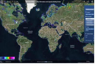
Water quality is essential when it comes to health, food production, ecosystem functions, poverty reduction, gender equality, and socio-economic development. Poor water quality leads to environmental, social and economic problems. The condition of the water, including its chemical, physical and biological characteristics, defines water quality, which could be affected by substances such as pesticides or fertilizers. Through UNESCO’s new World Water Quality Portal, satellite-derived water quality information for all inland and coastal water is now freely available and can be browsed and visualized online.
One of the main challenges that societies face is water quality improvement, which plays an important role for sustainable development. Water quality has been monitored conventionally by taking samples of water for laboratory analysis. However, this process is time-consuming and cannot capture the temporal and spatial differences within a water body. Through satellite data water bodies can be analyzed effectively and provide significant information for early interventions.
The portal is part of the International Initiative of Water Quality (IIWQ) under UNESCO’s International Hydrological Programme (IHP). It provides direct access to spatial and time series information, and allows retrieving and exporting water quality and statistical measures easily. Users can also access digital maps displaying turbidity, chlorophyll, absorption parameters and harmful algae bloom indicators for a specific period of time. Thanks to the increased availability of space-derived data, improved sensors and evaluation methods, space-based information services can be suitable for operational use.
The portal is designed to be user-friendly and help developing countries build capacity to obtain valuable water quality information, especially in remote areas where there is a lack of water monitoring networks. Environmental managers, decision makers and scientists can incorporate the service directly to their geospatial information systems for analysis and assessments.
The platform was developed by EOMAP GmbH, a company founded in 2006 as a spin-off from the German Aerospace Center’s (DLR) Remote Sensing Technology Institute.

