![]()
United
Nations
Delft3D
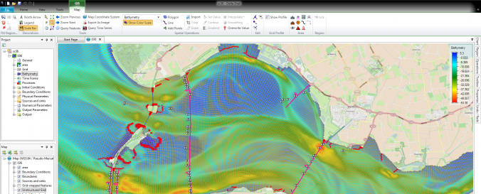
| Description: | Delft3D is a world leading 3D modeling suite to investigate hydrodynamics, sediment transport and morphology and water quality for fluvial, estuarine and coastal environments. The software is used and has proven his capabilities on many places around the world, like the Netherlands, USA, Hong Kong, Singapore, Australia, Venice, etc. The software is continuously improved and developed with innovating advanced modelling techniques as consequence of the research work of our institute and to stay world leading. The FLOW module is the heart of Delft3D and is a multi-dimensional (2D or 3D) hydrodynamic (and transport) simulation programme which calculates non-steady flow and transport phenomena resulting from tidal and meteorological forcing on a curvilinear, boundary fitted grid or sperical coordinates. In 3D simulations, the vertical grid is defined following the so-called sigma coordinate approach or Z-layer approach. The MOR module computes sediment transport (both suspended and bed total load) and morphological changes for an arbitrary number of cohesive and non-cohesive fractions. Both currents and waves act as driving forces and a wide variety of transport formulae have been incorporated. For the suspended load this module connects to the 2D or 3D advection-diffusion solver of the FLOW module; density effects may be taken into account. An essential feature of the MOR module is the dynamic feedback with the FLOW and WAVE modules, which allow the flows and waves to adjust themselves to the local bathymetry and allows for simulations on any time scale from days (storm impact) to centuries (system dynamics). It can keep track of the bed composition to build up a stratigraphic record. The MOR module may be extended to include extensive features to simulate dredging and dumping scenarios. |
| Software type: | Tool/Converter |
| Accessibility: | Install only |
| Computer System: | Windows, Linux |
| Scope: | Modelling |
| Graphical user interface: | Yes |
| Costs: | Free |
| Tutorials: |
![]()