When disaster looms, early warning about potentially affected areas and the extent of the event are critical for disaster management efforts. Using in situ and satellite-based observations, two web-based systems provide critical information to support flood early warning efforts worldwide, for instance in the context of the current record-setting Atlantic hurricane season, which has brought widespread damage to countries in Central America. The GEOGloWS ECMWF Streamflow Hydroviewer and the Global Flood Awareness System (GloFAS) are easily accessible and free-to-use online tools that present information resulting from complex hydrological modelling in an accessible manner to support disaster management authorities and other stakeholders in preparing for floods. Both systems feature world map viewers that provide an overview of the local as well as the global hydro-meteorological situation. Outlooks from such systems are also increasingly used to take anticipatory humanitarian action, such as allocating resources to the affected areas, supported through forecast-based financing mechanisms. This minimizes potential disaster losses.
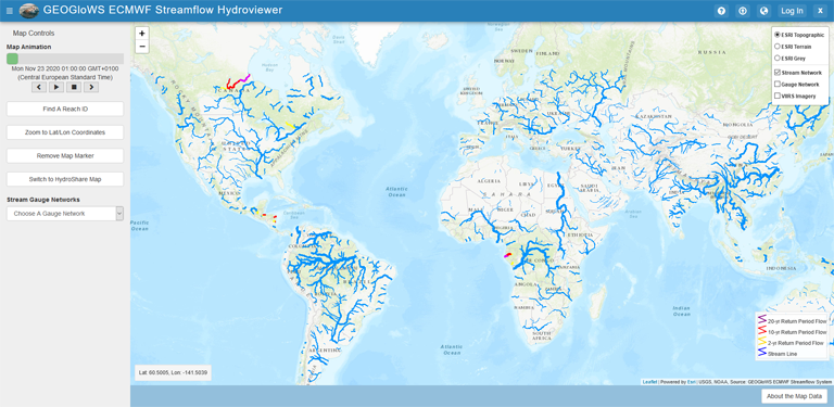
Both services work with the data from ECMWF (European Centre for Medium-range Weather forecasting) ensemble streamflow forecast. The GEOGloWS Streamflow Forecasting represents a daily 51-member ensemble streamflow forecast for over 1 million reaches across the globe and uses a downscaled gridded surface runoff routed to the streams, using Routing Application for Parallel computation of Discharge (RAPID). The forecast can be viewed sequentially by using the time slider. The animation layer displays the first 6-days of a 15-day forecast at 3-hr intervals. Additionally, a 35-streamflow history has also been computed for each stream. From this historical simulation, return periods for each stream are calculated and can be used for medium to long time forecasts.
Image: Screenshow of the GEOGloWS ECMWF Streamflow Hydroviewer.
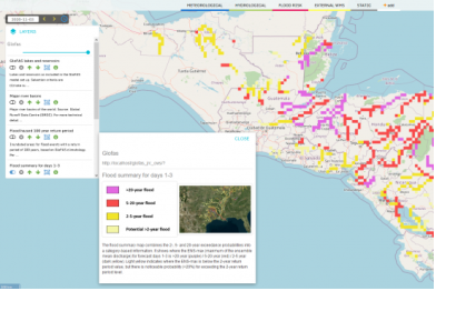
GloFAS is part of the Copernicus Emergency Management Service (EMS), which provides information for disaster emergency response as well as information for prevention, preparedness, response and recovery activities. GloFAS is composed of two complementary systems. One being the GloFAS 30-day, a daily hydrological forecast which provides a quick overview of upcoming flood events for the next 30 days. And the other one is the GloFAS Seasonal, giving a monthly hydrological forecast which provides river flow outlooks highlighting unusually high or low river flow up to 16 weeks ahead. Access to the GloFAS map viewer can be obtained by creating a free account. The GloFAS system is composed of an integrated hydro-meteorological forecasting chain and of a monitoring system, which analyses and updates results on a daily basis. Additional information including detailed evolution of streamflow forecasts is provided for over 2000 static reporting points, complemented with dynamically defined points in areas at risk of flooding.
Both GloFAS as well as the GEOGloWS ECMWF Streamflow Hydroviewer are important tools for mapping efforts and for supporting early flood warning. They are freely accessible without charges and can be used as an operational tool for decision makers, including national and regional water authorities, water resources managers, hydropower companies, civil protection and first line responders, and international humanitarian aid. An introduction and explanation of the tools can be found on the individual websites and on the associated YouTube Channels. In the case of the hurricanes in the Caribbean, these two tools can provide essential help for the risk and disaster management by helping to identify possible affected areas as well as the potential impact and therefore giving more time to prepare disaster relief efforts and to allocate resources.
As a bridge between the space and disaster management communities, UN-SPIDER regularly raises awareness about such tools so that civil protection agencies and other stakeholders become aware of the benefits of using space-based information products in their disaster risk and emergency response efforts.
Helpful Links
GloFAS
Website: https://www.globalfloods.eu/glofas-forecasting/
YouTube: https://www.youtube.com/channel/UCV76vM-bU2cksErBz8D1vRw
GEOGloWS ECMWF Streamflow Hydroviewer
Website: https://www.geoglows.org/pages/geoglows-streamflow-forecasting
Hydroviewer: https://tethys-staging.byu.edu/apps/geoglows-hydroviewer/


