Satellite Monitoring and the Xe Pian–Xe Namnoy Dam Collapse
A new UN-SPIDER user story highlights the critical role of space-based technologies in preventing dam failures and enhancing disaster preparedness.
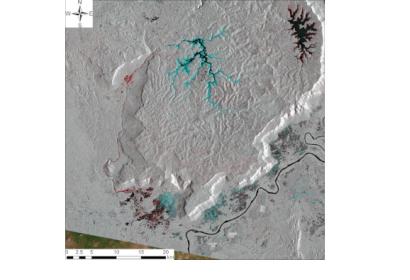
On 23 July 2018, Saddle Dam D, part of the Xe Pian–Xe Namnoy hydropower project in southern Laos, collapsed, releasing 350 million cubic meters of water. The resulting flood devastated 46 km² of land, destroyed infrastructure, and displaced thousands of people. The incident revealed significant vulnerabilities in dam safety, monitoring, and early warning systems in the region.
The user story demonstrates how Sentinel-1 Synthetic Aperture Radar (SAR) data and Time-Series Interferometric SAR (TS-InSAR) analysis could have identified early signs of deformation weeks before the collapse. These advanced remote sensing techniques enable continuous, high-precision monitoring of infrastructure, even under cloud cover, and can serve as an early warning tool to mitigate similar disasters in the future.
Read the full story here: Dam Monitoring for Saddle Dam D in Laos by Time-series InSAR Analysis | UN-SPIDER Knowledge Portal

