Disaster Overview
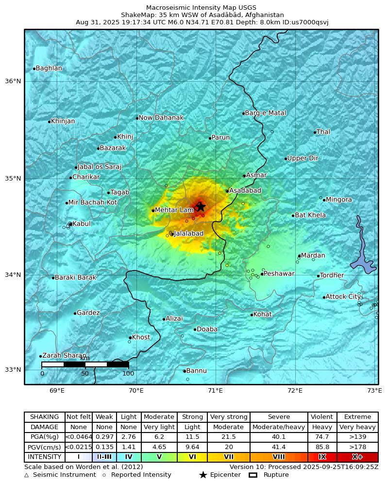
A magnitude 6.0 earthquake struck eastern Afghanistan near the Pakistan border on 31 August 2025, with its epicentre in Kuz Kunar District, Kunar Province, at a shallow depth of about 8–10 km. The quake killed at least 800 people and injured over 2,800, mainly in Kunar and Nangarhar, destroying many villages. Landslides and blocked roads hindered rescue operations, though helicopters evacuated hundreds of victims. Aftershocks, including two of magnitude 5.2, further complicated recovery. Local volunteers and government forces joined rescue efforts, while the UN, Iran, and China pledged aid. The disaster highlights Afghanistan’s extreme vulnerability due to fragile housing, mountainous terrain, and poor infrastructure, marking one of the deadliest quakes since Herat 2023 and Paktika 2022.
Reference: https://earthquake.usgs.gov/earthquakes/eventpage/us7000qsvj/executive
Satellite Data and Analytical Method
In close collaboration with the China Regional Support Office (RSO) of UN-SPIDER, the RSIDEA team at Wuhan University, and the National Earth Observation Data Center, UN-SPIDER facilitated the acquisition and analysis of post-disaster satellite imagery for rapid building damage assessment.
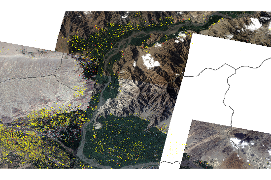
The post-disaster imagery was acquired by the Jilin-1 satellite constellation, captured on 2 September 2025, featuring a swath width of 17 km and a ground resolution of 0.6 m. The imagery was provided by the National Earth Observation Data Center, whose contribution is gratefully acknowledged.
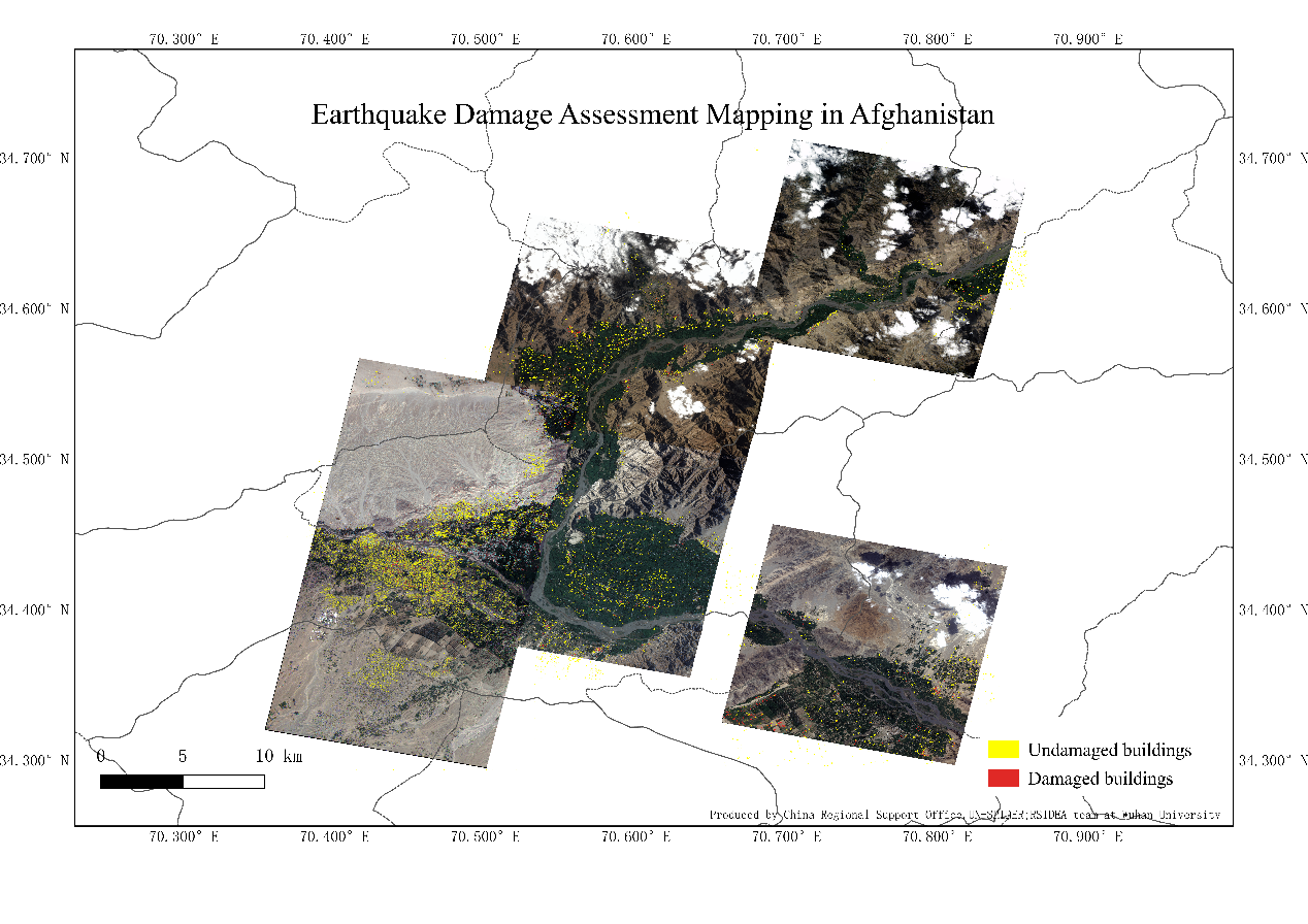
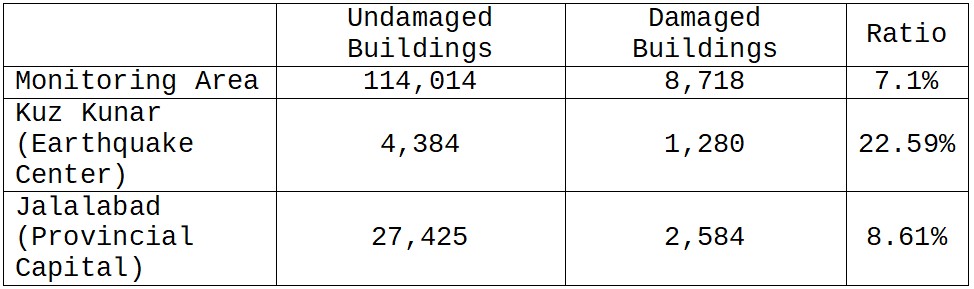
To identify structural damage, Professor. Ailong Ma from the RSIDEA research group applied their deep-learning semantic change detection method, a state-of-the-art approach specifically designed for building damage assessment mapping in disaster scenarios. This method integrates a deep object localization network and a deep damage classification network into a unified end-to-end architecture, allowing direct classification of damaged and undamaged buildings without manual threshold adjustment. The model was trained using a custom-built dataset comprising approximately 10,000 images (1024×1024 pixels, 0.3 m resolution), enabling precise discrimination between intact and collapsed structures in complex urban environments. The analysis focused on Kuz Kunar District (epicentral area) and Jalalabad City (provincial capital).
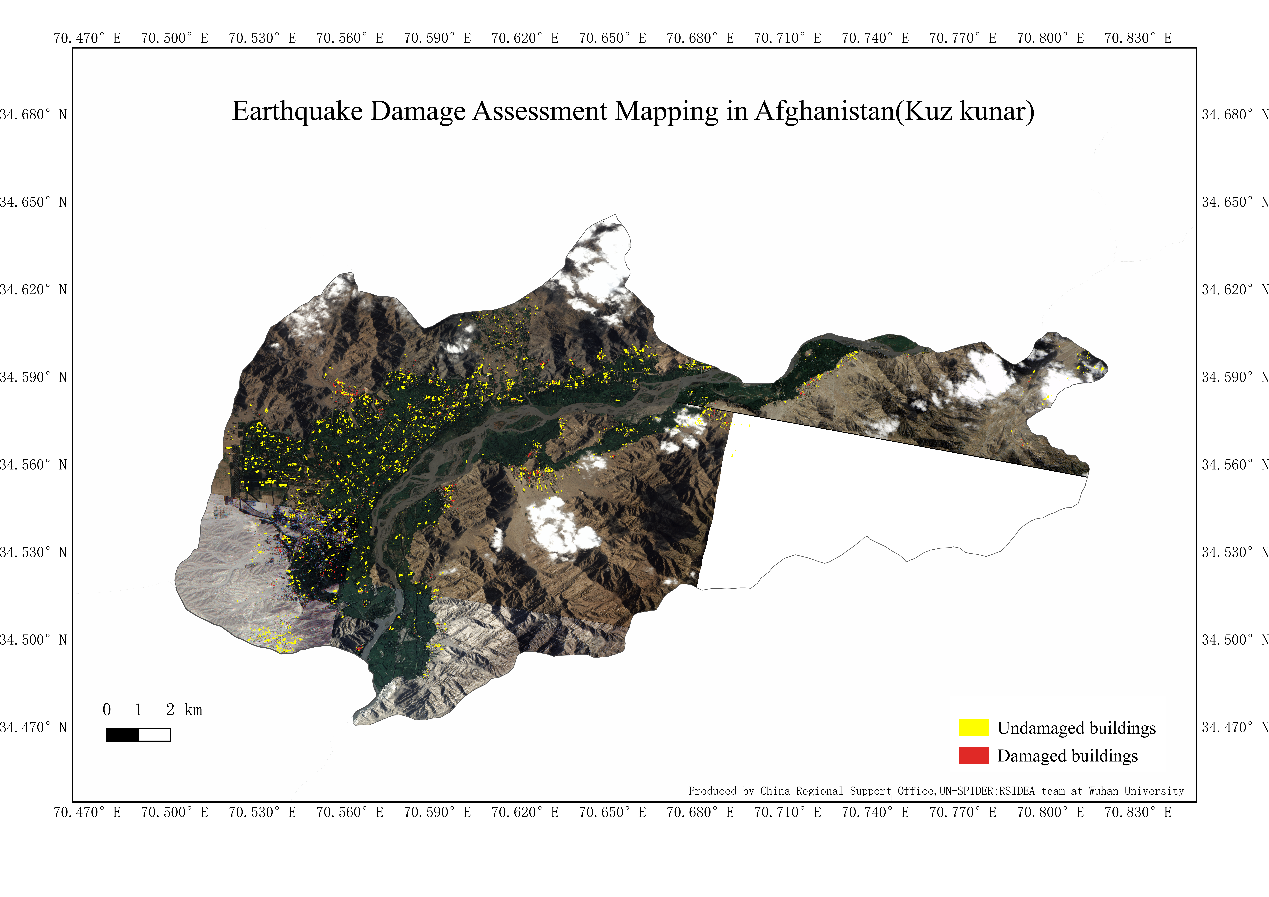
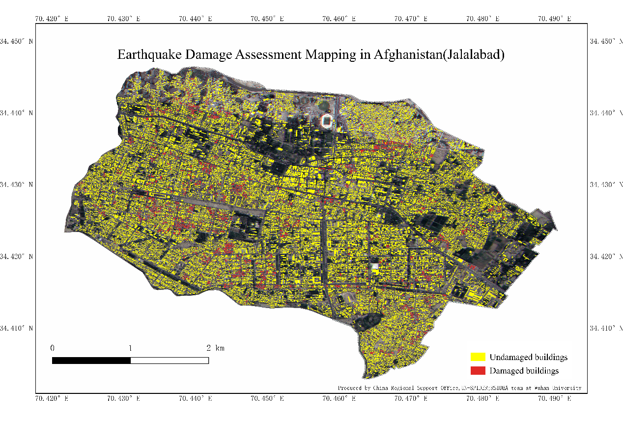
Results indicated that 22.6 % of buildings in Kuz Kunar and 8.6 % in Jalalabad sustained visible damage, corresponding to 1,280 and 2,584 affected structures respectively. In total, 8,718 damaged buildings were detected across the broader monitoring area.
Technical Notes
The Jilin-1 constellation, operated by Chang Guang Satellite Technology Co., Ltd., provides high-revisit, sub-meter imagery suitable for rapid post-disaster observation. Data were pre-processed using radiometric calibration, orthorectification, and cloud masking before feeding into the deep-learning model.
Acknowledgments
UN-SPIDER expresses its sincere appreciation to:
- China RSO (Regional Support Office) for coordination and data management;
- RSIDEA Laboratory, Wuhan University, for implementing the AI-based analysis;
- National Earth Observation Data Center, for providing the Jilin-1 imagery; and
- Chang Guang Satellite Technology Co., Ltd., for maintaining the satellite operations.
This collaborative effort showcases the potential of AI-driven Earth observation and UN–academia partnerships in enabling fast and accurate disaster assessments. UN-SPIDER will continue to work with these institutions to promote open, science-based use of satellite data for disaster resilience and sustainable development.