

Background
Timely access to Earth Observation data plays an important role in disaster preparedness, response and recovery. Recent developments in commercial small satellite constellations offer new opportunities to complement existing satellite systems through more flexible data acquisition, advanced sensors and faster information delivery.
This technical article takes a closer look at Open Cosmos' OpenConstellation 1.0 and Hyper-500 hyperspectral payload, examining their technological capabilities and potential applications across the disaster risk management cycle under the UN-SPIDER mandate. It explores how these emerging technologies could support disaster risk reduction and emergency response, while also considering their operational capabilities and limitations.
Traditional flagship Earth Observation (EO) missions provide foundational geospatial layers, but emergency response and risk management workflows are often constrained by fixed orbital revisit intervals, rigid tasking protocols, and latency in ground-station downlink pipelines. Agile small-satellite constellations operated by the commercial space sector represent a complementary architectural framework in space-based disaster risk management (DRM). By integrating multi-sensor payloads (visible-to-near-infrared, shortwave infrared, and narrow-band hyperspectral) across distributed orbital planes with edge computing and intersatellite connectivity, commercial smallsat systems—such as those developed by Open Cosmos—introduce flexible tasking-to-delivery workflows.
Sensor Specifications & Physical Measurement Capabilities
The OpenConstellation 1.0 architecture comprises a planned 15-satellite portfolio designed for diverse spatial, spectral, and temporal resolution trade-offs. The constellation to operate via a hybrid orbital setup:
• 3 Very High Resolution (VHR) platforms designed for daily revisit capabilities, and
• 12 High Resolution (HR) platforms configured for sub-daily revisits.
Payload / Product | Spatial Resolution (GSD) | Swath Width | Spectral Coverage / Bands | Radiometric Quantization |
VHR (VNIR-100) | 1.0 m PAN / 4 m Multispectral @ Nadir | 12 km | 4x VNIR + Panchromatic | 12-bit |
HR Multispectral (Multi-150) | 1.5 m PAN / 3.0 m Multispectral @ Nadir | 30 km | 7x VNIR + PAN (incl. 3 Red Edge bands) | 12-bit |
SWIR (SWIR-2000) | 20.0 m @ Nadir | 23 km | 4x SWIR (947nm, 1375nm, 1607nm, 1213nm) | 10-bit |
Hyperspectral VNIR (Hyper-1800) | 18.0 m @ Nadir | 35 km | Up to 150 native bands (470–900 nm) | 10-bit |
Hyperspectral HR VNIR (Hyper-500) | 4.75 m @ Nadir | 19 km | 32 narrow VNIR channels (440–900 nm) | 12-bit |
Physical Phenomena & Spectral Dynamics
• Red Edge Bands (705 nm, 740 nm, 783 nm): The inclusion of three narrow Red Edge bands within the HR Multi-150 sensor isolates sudden chlorophyll breakdown and vegetation stress prior to structural canopy collapse, providing early indicators during drought or ecological degradation.
• Shortwave Infrared (SWIR-1600): Centered at 1607 nm, SWIR wavelengths penetrate light smoke hazes and thin atmospheric aerosol layers. SWIR displays high sensitivity to soil moisture changes, leaf tissue water content, structural mineral absorption features and fire front active mapping, as flames emit intense thermal radiation at shorter wavelengths. A 1600 nm sensor provides early detection and penetrates dense smoke clouds without needing the longer, more complex 2000 nm spectral region that involves payload refrigeration. The 1375 nm channel specifically targets upper-atmosphere cirrus cloud screening.
• Continuous Hyperspectral Sampling (Hyper-500): Utilizing a wedge filter in line-scan mode across 32 narrow channels (Full Width at Half Maximum [FWHM] ranging between 15–31 nm), the Hyper-500 payload captures distinct spectral absorption features and chemical emission spectra that are typically unresolvable via broad multispectral channels.
On-Board Processing & Near Real-Time Latency
In conventional satellite workflows, data availability is governed by ground station passes, downlink scheduling, and centralized cloud preprocessing (Level-0 to Level-2A conversion). To mitigate latency during fast-evolving crises, modern smallsat platforms pair on-board edge computing with space-to-space connectivity.

Hardware Architecture: Each satellite platform hosts an on-board computing setup featuring dual-board processors delivering 100 TOPS (Tera Operations Per Second) of processing capacity paired with FPGA accelerators and 640 GB of local storage.
1. Processing algorithms can execute directly on raw sensor streams in orbit. The software pipeline converts raw telemetry into geo-referenced Top-Of-Atmosphere (TOA) radiance (Level-1B lite) or extracts low-bandwidth vector masks (e.g., active fire boundaries, flooded road networks, or ship coordinates).
2. Extracted analytical vectors or small image thumbnails are routed across an L-Band ISL (128 kbps) constellation network to the nearest node with ground station visibility.
3. This edge processing configuration allows commercial providers to offer tiered delivery windows based on operational urgency:
o ~30-minute delivery for direct near-real-time insights via ISL.
o 4-hour tasking-to-delivery turnaround.
o 24- to 48-hour delivery windows for routine baseline mapping.
Multi-Hazard Applications in Disaster Risk Management
Wildfires (Preparedness, Response & Recovery)
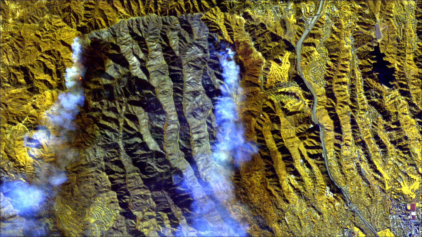
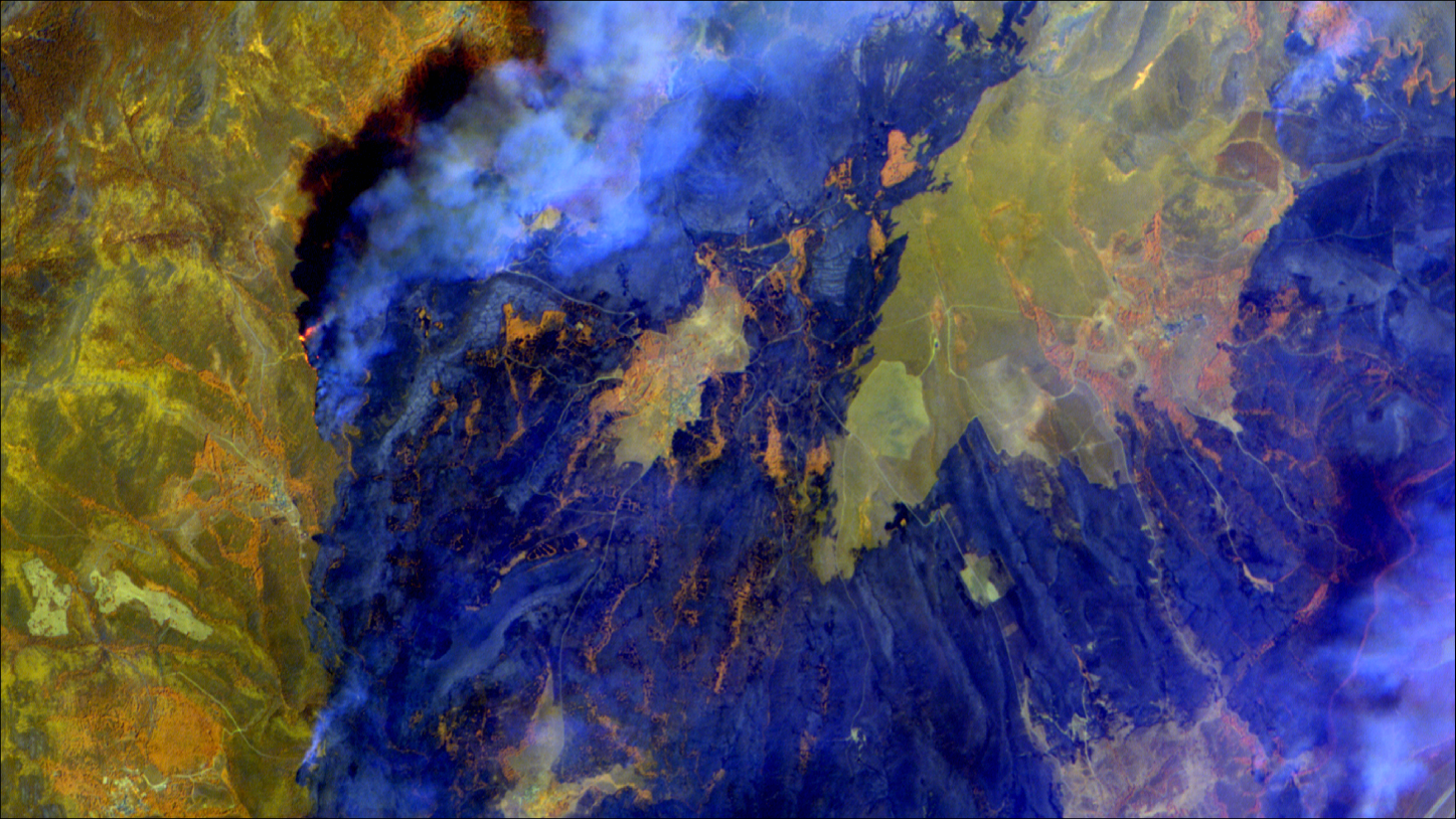
• Hyper-500's narrow-band VNIR observations may improve the discrimination of active burning areas, smoke-affected regions, burned surfaces, and healthy vegetation compared with conventional multispectral imagery. When combined with temporal analysis and complementary datasets, these observations can support situational awareness during wildfire response and recovery.
• Post-fire assessments can utilize Normalized Burn Ratio (NBR) and related indices derived from NIR and SWIR observations to characterize burn severity, delineate charred surfaces, and monitor vegetation recovery. These products can support damage assessment and post-disaster restoration planning.
Floods & Hydrological Hazards (Rapid Response)
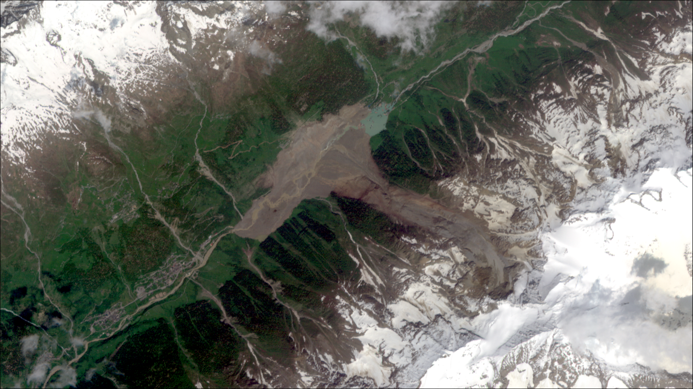
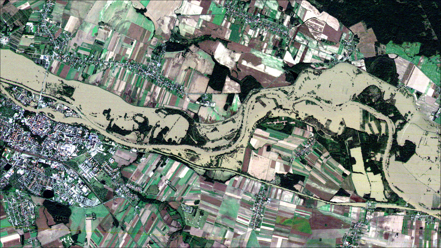
• Multi-150 multispectral imagery (1.5 m GSD) combined with SWIR-1600 observations provides strong spectral contrast between water and terrestrial land cover. This capability supports the delineation of inundated areas, including sediment-laden floodwaters, facilitating rapid flood mapping and impact assessment.
• The constellation incorporates NB-IoT and LoRa communication capabilities that can support the collection of environmental measurements from distributed ground sensors. In flood-monitoring applications, data from river gauges, weather stations, or soil-moisture sensors may complement satellite observations by providing additional situational awareness and supporting validation of flood extent products.
Drought & Agricultural Crises (Early Warning & Mitigation)
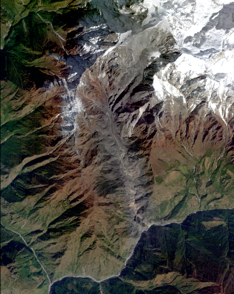
• Traditional vegetation indices such as NDVI can become less sensitive within dense vegetation canopies. Hyper-500's 32 narrow VNIR channels provide enhanced sensitivity to subtle spectral variations associated with chlorophyll content, canopy condition, and vegetation stress. When integrated with calibrated biophysical models and field observations, these data may improve the monitoring of crop health, drought impacts, and agricultural productivity.
Technological, Maritime & Environmental Incidents
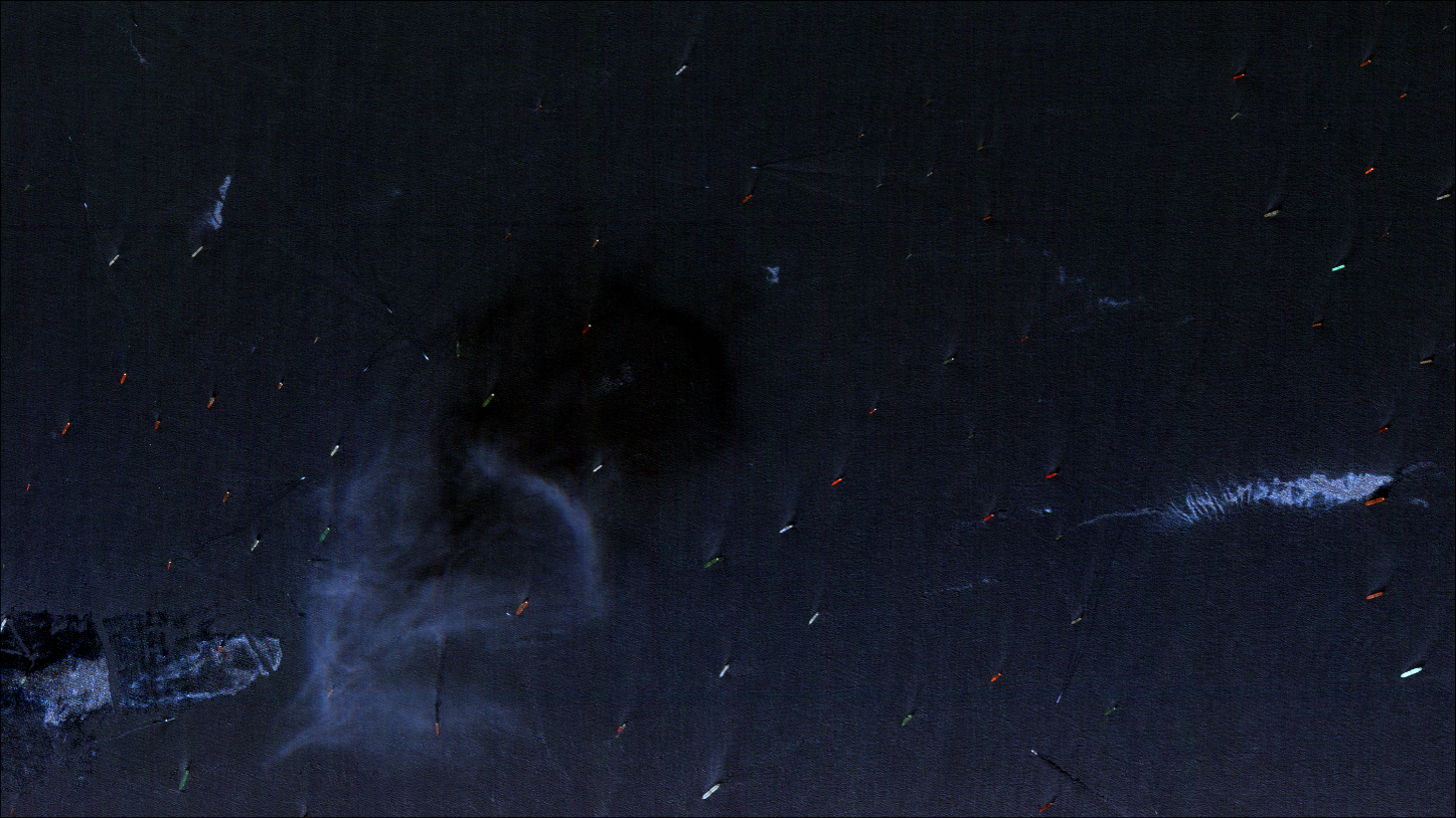
• By combining AIS transmissions with coincident VHR and HR optical observations, onboard analytics can support the identification of vessels whose reported locations do not correspond to observed vessel activity. This capability may assist maritime authorities in monitoring fishing activity, shipping operations, and maritime security incidents.
• Hyperspectral observations can reveal spectral anomalies associated with minerals, suspended materials, vegetation stress, and changes in water quality. These capabilities may support the monitoring of mine tailings ponds, acid mine drainage, dam seepage, industrial runoff, and other environmental hazards when interpreted alongside ancillary datasets and field observations.
Earthquakes & Urban Structural Damage (Rapid Damage Assessment)
• 1.0 m Panchromatic and VNIR and 1.5 m Multispectral VHR products provide imagery suitable for post-event change detection, debris mapping, transportation network assessment, and identification of potentially damaged infrastructure. These observations can support rapid damage assessment workflows following earthquakes and other urban disasters.
Data Access & Operational Considerations
Workflow Architecture
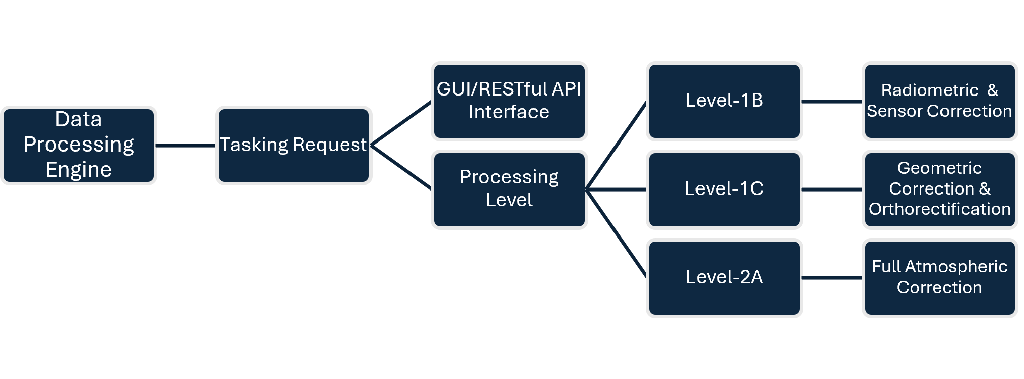
Data access and satellite management within commercial constellations are typically governed via Graphical User Interfaces (GUI) and RESTful Application Programming Interfaces (APIs). Commercial offerings commonly structure access through three operational models:
• On-demand access to tasking capacity without direct ground infrastructure ownership.
• Direct orbital tasking controls over specific Areas of Interest (AOIs) utilizing either shared or dedicated ground segment infrastructure.
• Dedicated payload or satellite allocation within the broader constellation framework.
Technical Limitations & Complementarity
• As optical, shortwave, and hyperspectral payloads operate in the solar-reflected electromagnetic spectrum (440–2000 nm), the acquisition pipeline remains susceptible to cloud cover obscuration. While SWIR bands mitigate thin cirrus and smoke, heavy overcast conditions require integration with Synthetic Aperture Radar (SAR) constellations, such as Sentinel-1.
• High-resolution VHR imaging operates on a narrow 12 km swath. Regional multi-hazard mapping mandates combining wide-swath payloads (Hyper-1800 @ 35 km swath, Multi-150 @ 30 km swath) with targeted VHR acquisitions to balance spatial coverage with detail.
• While private sector satellite constellations offer advanced tasking agility and rapid turnaround times, public disaster management agencies must consider data licensing costs, data-sharing protocols during international activations, and long-term sustainability compared to open-data initiatives (e.g., Copernicus or USGS/NASA Landsat).
Conclusion & Alignment with International Frameworks
The UN-SPIDER mandate focuses on promoting universal access to space-based information across all phases of the disaster management cycle.
Advanced small-satellite architectures demonstrate how commercial space capabilities can complement public Earth observation missions in supporting international frameworks such as the Sendai Framework for Disaster Risk Reduction 2015-2030.
• Sendai Priority 1 (Understanding Disaster Risk): Hyperspectral and multispectral observations can provide enhanced environmental characterization by capturing spectral information related to vegetation condition, surface materials, moisture dynamics, and land-cover change. When integrated with complementary geospatial datasets and field observations, these capabilities can support hazard assessment, vulnerability analysis, and environmental risk mapping.
• Sendai Priority 4 (Enhancing Disaster Preparedness and Effective Response): The integration of on-board edge processing, AI-enabled analytics, and intersatellite communications has the potential to reduce traditional tasking-to-delivery timelines. Near real-time information products may support decisionmakers during emergency response, early warning activities, and rapidly evolving disaster situations.
By combining multi-sensor Earth observation, on-board analytics, IoT connectivity, and flexible tasking architectures, commercial small-satellite constellations offer an additional source of geospatial information for National Disaster Management Agencies (NDMAs), humanitarian organizations, civil protection authorities, and technical advisory networks. These capabilities can complement existing public Earth observation programs by providing increased revisit opportunities, operational flexibility, and rapid information delivery across the disaster risk management cycle.
